

184
7: Hua-mei Chen, Pramod K. Varshney
Similarly, the three-date registration consistency can be defined as
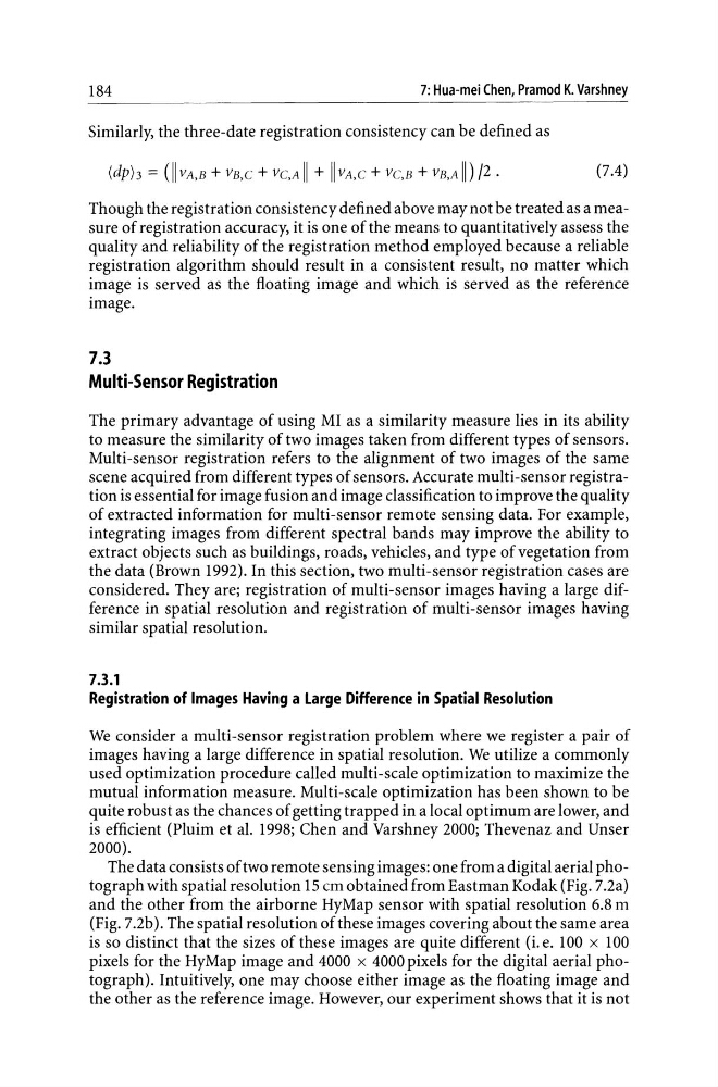
(dph = (II VA,B + VB,C + VC,A I I + I I VA,C + VC,B + VB,A II) /2 .
{7.4}
Though the registration consistency defined above may not be treated as a measure of registration accuracy, it is one of the means to quantitatively assess the
quality and reliability of the registration method employed because a reliable
registration algorithm should result in a consistent result, no matter which
image is served as the floating image and which is served as the reference
image.
7.3
Multi-Sensor Registration
The primary advantage of using MI as a similarity measure lies in its ability
to measure the similarity of two images taken from different types of sensors.
Multi-sensor registration refers to the alignment of two images of the same
scene acquired from different types of sensors. Accurate multi-sensor registration is essential for image fusion and image classification to improve the quality
of extracted information for multi-sensor remote sensing data. For example,
integrating images from different spectral bands may improve the ability to
extract objects such as buildings, roads, vehicles, and type of vegetation from
the data (Brown 1992). In this section, two multi-sensor registration cases are
considered. They are; registration of multi-sensor images having a large difference in spatial resolution and registration of multi-sensor images having
similar spatial resolution.
7.3.1
Registration of Images Having a Large Difference in Spatial Resolution
We consider a multi-sensor registration problem where we register a pair of
images having a large difference in spatial resolution. We utilize a commonly
used optimization procedure called multi-scale optimization to maximize the
mutual information measure. Multi-scale optimization has been shown to be
quite robust as the chances of getting trapped in a local optimum are lower, and
is efficient (Pluim et al. 1998; Chen and Varshney 2000; Thevenaz and Unser
2000).
The data consists of two remote sensing images: one from a digital aerial photograph with spatial resolution 15 cm obtained from Eastman Kodak (Fig. 7.2a)
and the other from the airborne HyMap sensor with spatial resolution 6.8 m
{Fig. 7.2b}. The spatial resolution of these images covering about the same area
is so distinct that the sizes of these images are quite different {i. e. 100 x 100
pixels for the HyMap image and 4000 x 4000 pixels for the digital aerial photograph}. Intuitively, one may choose either image as the floating image and
the other as the reference image. However, our experiment shows that it is not
7: Hua-mei Chen, Pramod K. Varshney
Similarly, the three-date registration consistency can be defined as
(dph = (II VA,B + VB,C + VC,A I I + I I VA,C + VC,B + VB,A II) /2 .
{7.4}
Though the registration consistency defined above may not be treated as a measure of registration accuracy, it is one of the means to quantitatively assess the
quality and reliability of the registration method employed because a reliable
registration algorithm should result in a consistent result, no matter which
image is served as the floating image and which is served as the reference
image.
7.3
Multi-Sensor Registration
The primary advantage of using MI as a similarity measure lies in its ability
to measure the similarity of two images taken from different types of sensors.
Multi-sensor registration refers to the alignment of two images of the same
scene acquired from different types of sensors. Accurate multi-sensor registration is essential for image fusion and image classification to improve the quality
of extracted information for multi-sensor remote sensing data. For example,
integrating images from different spectral bands may improve the ability to
extract objects such as buildings, roads, vehicles, and type of vegetation from
the data (Brown 1992). In this section, two multi-sensor registration cases are
considered. They are; registration of multi-sensor images having a large difference in spatial resolution and registration of multi-sensor images having
similar spatial resolution.
7.3.1
Registration of Images Having a Large Difference in Spatial Resolution
We consider a multi-sensor registration problem where we register a pair of
images having a large difference in spatial resolution. We utilize a commonly
used optimization procedure called multi-scale optimization to maximize the
mutual information measure. Multi-scale optimization has been shown to be
quite robust as the chances of getting trapped in a local optimum are lower, and
is efficient (Pluim et al. 1998; Chen and Varshney 2000; Thevenaz and Unser
2000).
The data consists of two remote sensing images: one from a digital aerial photograph with spatial resolution 15 cm obtained from Eastman Kodak (Fig. 7.2a)
and the other from the airborne HyMap sensor with spatial resolution 6.8 m
{Fig. 7.2b}. The spatial resolution of these images covering about the same area
is so distinct that the sizes of these images are quite different {i. e. 100 x 100
pixels for the HyMap image and 4000 x 4000 pixels for the digital aerial photograph}. Intuitively, one may choose either image as the floating image and
the other as the reference image. However, our experiment shows that it is not