

67
Georeferencing an Image
(Source: Used with permission from Microsoft)
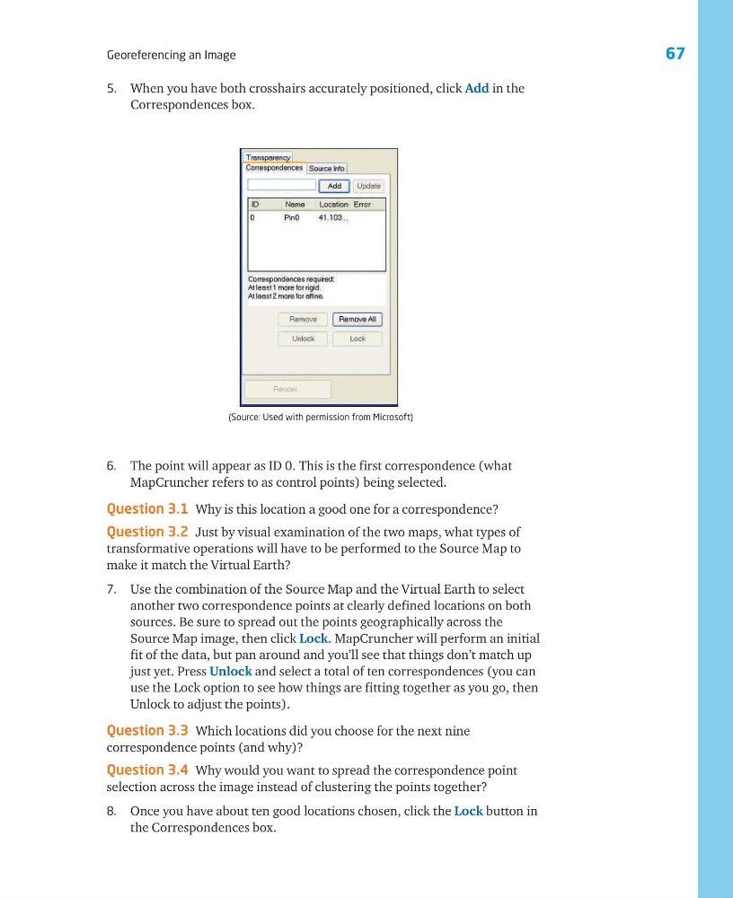
6. The point will appear as ID 0. This is the first correspondence (what
MapCruncher refers to as control points) being selected.
Question 3.1 Why is this location a good one for a correspondence?
Question 3.2 Just by visual examination of the two maps, what types of
transformative operations will have to be performed to the Source Map to
make it match the Virtual Earth?
7. Use the combination of the Source Map and the Virtual Earth to select
another two correspondence points at clearly defined locations on both
sources. Be sure to spread out the points geographically across the
Source Map image, then click Lock. MapCruncher will perform an initial
fit of the data, but pan around and you’ll see that things don’t match up
just yet. Press Unlock and select a total of ten correspondences (you can
use the Lock option to see how things are fitting together as you go, then
Unlock to adjust the points).
Question 3.3 Which locations did you choose for the next nine
correspondence points (and why)?
Question 3.4 Why would you want to spread the correspondence point
selection across the image instead of clustering the points together?
8. Once you have about ten good locations chosen, click the Lock button in
the Correspondences box.
5. When you have both crosshairs accurately positioned, click Add in the
Correspondences box.
Georeferencing an Image
(Source: Used with permission from Microsoft)
6. The point will appear as ID 0. This is the first correspondence (what
MapCruncher refers to as control points) being selected.
Question 3.1 Why is this location a good one for a correspondence?
Question 3.2 Just by visual examination of the two maps, what types of
transformative operations will have to be performed to the Source Map to
make it match the Virtual Earth?
7. Use the combination of the Source Map and the Virtual Earth to select
another two correspondence points at clearly defined locations on both
sources. Be sure to spread out the points geographically across the
Source Map image, then click Lock. MapCruncher will perform an initial
fit of the data, but pan around and you’ll see that things don’t match up
just yet. Press Unlock and select a total of ten correspondences (you can
use the Lock option to see how things are fitting together as you go, then
Unlock to adjust the points).
Question 3.3 Which locations did you choose for the next nine
correspondence points (and why)?
Question 3.4 Why would you want to spread the correspondence point
selection across the image instead of clustering the points together?
8. Once you have about ten good locations chosen, click the Lock button in
the Correspondences box.
5. When you have both crosshairs accurately positioned, click Add in the
Correspondences box.