

61
How Is Data Transformed to a Georeferenced Format?
Think about this scenario—surveying is being done
for a new beachfront development and a base map
of the area will be created (using GIS) from current
high-resolution remotely sensed imagery. Since the
base map (and all layers created from it, such as
property boundaries, utilities, and local land cover)
will be derived from it, this initial layer is critical.
However, something goes wrong in the georeferencing process of the image used to create the base
map, and thus the initial base map has incorrect coordinates—and then each layer created from it has
incorrect coordinates. Then on-site GPS coordinates
and measurements are reprojected to match the
new base map, and of course, they’re now inaccurate since they use an incorrectly referenced base
map. What’s going to be the end result of all this
for the land owners, developers, construction crews,
and other stakeholders involved in the project?
What kind of long-term or widespread problems can
be caused by this type of “cascading error” when
the initial referencing is incorrect or inaccurate?
What Happens When the Georeferencing Is Wrong?
Thinking Critically with Geospatial Technology 3.2
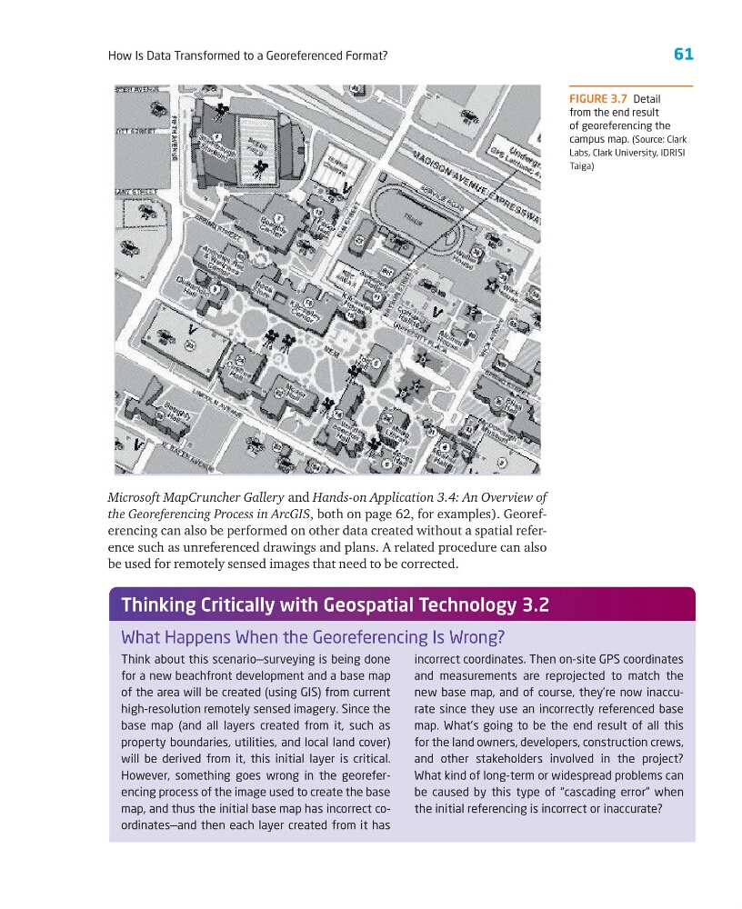
FIGURE 3.7 Detail
from the end result
of georeferencing the
campus map. (Source: Clark
Labs, Clark University, IDRISI
Taiga)
Microsoft MapCruncher Gallery and Hands-on Application 3.4: An Overview of
the Georeferencing Process in ArcGIS, both on page 62, for examples). Georeferencing can also be performed on other data created without a spatial reference such as unreferenced drawings and plans. A related procedure can also
be used for remotely sensed images that need to be corrected.
How Is Data Transformed to a Georeferenced Format?
Think about this scenario—surveying is being done
for a new beachfront development and a base map
of the area will be created (using GIS) from current
high-resolution remotely sensed imagery. Since the
base map (and all layers created from it, such as
property boundaries, utilities, and local land cover)
will be derived from it, this initial layer is critical.
However, something goes wrong in the georeferencing process of the image used to create the base
map, and thus the initial base map has incorrect coordinates—and then each layer created from it has
incorrect coordinates. Then on-site GPS coordinates
and measurements are reprojected to match the
new base map, and of course, they’re now inaccurate since they use an incorrectly referenced base
map. What’s going to be the end result of all this
for the land owners, developers, construction crews,
and other stakeholders involved in the project?
What kind of long-term or widespread problems can
be caused by this type of “cascading error” when
the initial referencing is incorrect or inaccurate?
What Happens When the Georeferencing Is Wrong?
Thinking Critically with Geospatial Technology 3.2
FIGURE 3.7 Detail
from the end result
of georeferencing the
campus map. (Source: Clark
Labs, Clark University, IDRISI
Taiga)
Microsoft MapCruncher Gallery and Hands-on Application 3.4: An Overview of
the Georeferencing Process in ArcGIS, both on page 62, for examples). Georeferencing can also be performed on other data created without a spatial reference such as unreferenced drawings and plans. A related procedure can also
be used for remotely sensed images that need to be corrected.