

60
Chapter 3 Getting Your Data to Match the Map
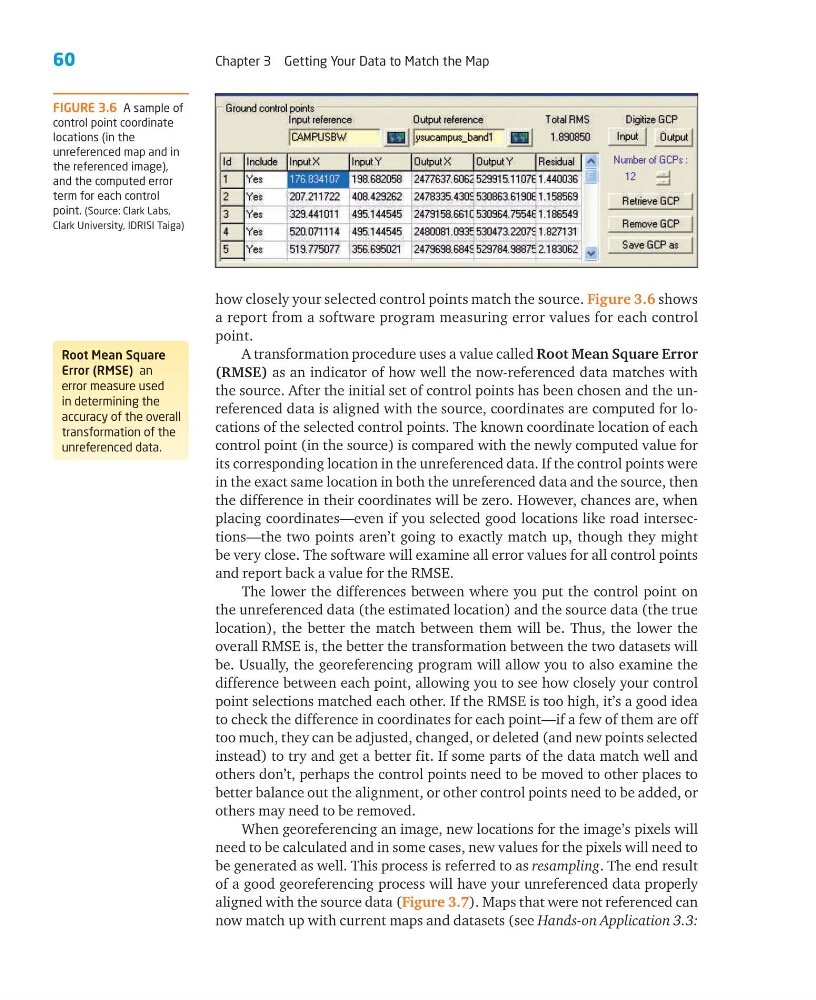
how closely your selected control points match the source. Figure 3.6 shows
a report from a software program measuring error values for each control
point.
A transformation procedure uses a value called Root Mean Square Error
(RMSE) as an indicator of how well the now-referenced data matches with
the source. After the initial set of control points has been chosen and the unreferenced data is aligned with the source, coordinates are computed for locations of the selected control points. The known coordinate location of each
control point (in the source) is compared with the newly computed value for
its corresponding location in the unreferenced data. If the control points were
in the exact same location in both the unreferenced data and the source, then
the difference in their coordinates will be zero. However, chances are, when
placing coordinates—even if you selected good locations like road intersections—the two points aren’t going to exactly match up, though they might
be very close. The software will examine all error values for all control points
and report back a value for the RMSE.
The lower the differences between where you put the control point on
the unreferenced data (the estimated location) and the source data (the true
location), the better the match between them will be. Thus, the lower the
overall RMSE is, the better the transformation between the two datasets will
be. Usually, the georeferencing program will allow you to also examine the
difference between each point, allowing you to see how closely your control
point selections matched each other. If the RMSE is too high, it’s a good idea
to check the difference in coordinates for each point—if a few of them are off
too much, they can be adjusted, changed, or deleted (and new points selected
instead) to try and get a better fit. If some parts of the data match well and
others don’t, perhaps the control points need to be moved to other places to
better balance out the alignment, or other control points need to be added, or
others may need to be removed.
When georeferencing an image, new locations for the image’s pixels will
need to be calculated and in some cases, new values for the pixels will need to
be generated as well. This process is referred to as resampling. The end result
of a good georeferencing process will have your unreferenced data properly
aligned with the source data (Figure 3.7). Maps that were not referenced can
now match up with current maps and datasets (see Hands-on Application 3.3:
Root Mean Square
Error (RMSE) an
error measure used
in determining the
accuracy of the overall
transformation of the
unreferenced data.
FIGURE 3.6 A sample of
control point coordinate
locations (in the
unreferenced map and in
the referenced image),
and the computed error
term for each control
point. (Source: Clark Labs,
Clark University, IDRISI Taiga)
Chapter 3 Getting Your Data to Match the Map
how closely your selected control points match the source. Figure 3.6 shows
a report from a software program measuring error values for each control
point.
A transformation procedure uses a value called Root Mean Square Error
(RMSE) as an indicator of how well the now-referenced data matches with
the source. After the initial set of control points has been chosen and the unreferenced data is aligned with the source, coordinates are computed for locations of the selected control points. The known coordinate location of each
control point (in the source) is compared with the newly computed value for
its corresponding location in the unreferenced data. If the control points were
in the exact same location in both the unreferenced data and the source, then
the difference in their coordinates will be zero. However, chances are, when
placing coordinates—even if you selected good locations like road intersections—the two points aren’t going to exactly match up, though they might
be very close. The software will examine all error values for all control points
and report back a value for the RMSE.
The lower the differences between where you put the control point on
the unreferenced data (the estimated location) and the source data (the true
location), the better the match between them will be. Thus, the lower the
overall RMSE is, the better the transformation between the two datasets will
be. Usually, the georeferencing program will allow you to also examine the
difference between each point, allowing you to see how closely your control
point selections matched each other. If the RMSE is too high, it’s a good idea
to check the difference in coordinates for each point—if a few of them are off
too much, they can be adjusted, changed, or deleted (and new points selected
instead) to try and get a better fit. If some parts of the data match well and
others don’t, perhaps the control points need to be moved to other places to
better balance out the alignment, or other control points need to be added, or
others may need to be removed.
When georeferencing an image, new locations for the image’s pixels will
need to be calculated and in some cases, new values for the pixels will need to
be generated as well. This process is referred to as resampling. The end result
of a good georeferencing process will have your unreferenced data properly
aligned with the source data (Figure 3.7). Maps that were not referenced can
now match up with current maps and datasets (see Hands-on Application 3.3:
Root Mean Square
Error (RMSE) an
error measure used
in determining the
accuracy of the overall
transformation of the
unreferenced data.
FIGURE 3.6 A sample of
control point coordinate
locations (in the
unreferenced map and in
the referenced image),
and the computed error
term for each control
point. (Source: Clark Labs,
Clark University, IDRISI Taiga)