

465
Exploring ArcGIS Explorer
7. Tilt the view down to so that you’re looking at the valley (and the
surrounding mountains) in perspective view.
8. Next, you’ll check the terrain’s Vertical Exaggeration. Press the ArcGIS
Explorer Button (the icon that has the AGX logo—the globe with the
arrows—in the upper left-hand corner of the screen) and then click on
ArcGIS Explorer options.
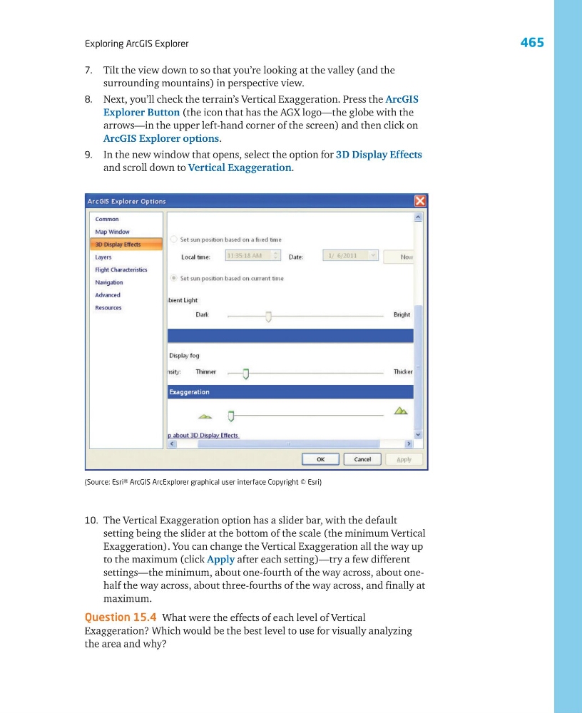
9. In the new window that opens, select the option for 3D Display Effects
and scroll down to Vertical Exaggeration.
10. The Vertical Exaggeration option has a slider bar, with the default
setting being the slider at the bottom of the scale (the minimum Vertical
Exaggeration). You can change the Vertical Exaggeration all the way up
to the maximum (click Apply after each setting)—try a few different
settings—the minimum, about one-fourth of the way across, about onehalf the way across, about three-fourths of the way across, and finally at
maximum.
Question 15.4 What were the effects of each level of Vertical
Exaggeration? Which would be the best level to use for visually analyzing
the area and why?
(Source: Esri® ArcGIS ArcExplorer graphical user interface Copyright © Esri)
Exploring ArcGIS Explorer
7. Tilt the view down to so that you’re looking at the valley (and the
surrounding mountains) in perspective view.
8. Next, you’ll check the terrain’s Vertical Exaggeration. Press the ArcGIS
Explorer Button (the icon that has the AGX logo—the globe with the
arrows—in the upper left-hand corner of the screen) and then click on
ArcGIS Explorer options.
9. In the new window that opens, select the option for 3D Display Effects
and scroll down to Vertical Exaggeration.
10. The Vertical Exaggeration option has a slider bar, with the default
setting being the slider at the bottom of the scale (the minimum Vertical
Exaggeration). You can change the Vertical Exaggeration all the way up
to the maximum (click Apply after each setting)—try a few different
settings—the minimum, about one-fourth of the way across, about onehalf the way across, about three-fourths of the way across, and finally at
maximum.
Question 15.4 What were the effects of each level of Vertical
Exaggeration? Which would be the best level to use for visually analyzing
the area and why?
(Source: Esri® ArcGIS ArcExplorer graphical user interface Copyright © Esri)