

464
Chapter 15 What’s Next for Geospatial Technology?
4. Examine the area around Tujunga Valley (along with the mountains to
the north of the Valley and Los Angeles to the south) with respect to the
contour lines shown on the map.
Question 15.1 How do the contour lines effectively represent the terrain
of the valley (as opposed to the mountains)?
Question 15.2 From examining the contour lines on the larger-scale
topographic map that appears once you’ve zoomed in, what is the contour
interval of the map?
Question 15.3 From examining the contour lines and heights, what are
the highest and lowest elevations of Tujunga Valley itself?
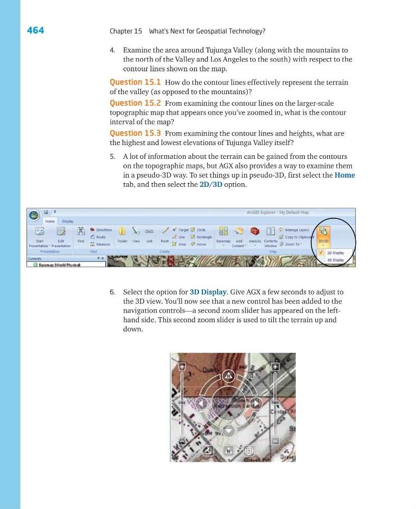
5. A lot of information about the terrain can be gained from the contours
on the topographic maps, but AGX also provides a way to examine them
in a pseudo-3D way. To set things up in pseudo-3D, first select the Home
tab, and then select the 2D/3D option.
6. Select the option for 3D Display. Give AGX a few seconds to adjust to
the 3D view. You’ll now see that a new control has been added to the
navigation controls—a second zoom slider has appeared on the lefthand side. This second zoom slider is used to tilt the terrain up and
down.
Chapter 15 What’s Next for Geospatial Technology?
4. Examine the area around Tujunga Valley (along with the mountains to
the north of the Valley and Los Angeles to the south) with respect to the
contour lines shown on the map.
Question 15.1 How do the contour lines effectively represent the terrain
of the valley (as opposed to the mountains)?
Question 15.2 From examining the contour lines on the larger-scale
topographic map that appears once you’ve zoomed in, what is the contour
interval of the map?
Question 15.3 From examining the contour lines and heights, what are
the highest and lowest elevations of Tujunga Valley itself?
5. A lot of information about the terrain can be gained from the contours
on the topographic maps, but AGX also provides a way to examine them
in a pseudo-3D way. To set things up in pseudo-3D, first select the Home
tab, and then select the 2D/3D option.
6. Select the option for 3D Display. Give AGX a few seconds to adjust to
the 3D view. You’ll now see that a new control has been added to the
navigation controls—a second zoom slider has appeared on the lefthand side. This second zoom slider is used to tilt the terrain up and
down.