

425
3D Modeling and Visualization
9. When everything is ready, click Grab.
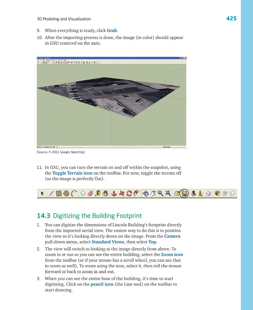
10. After the importing process is done, the image (in color) should appear
in GSU centered on the axes.
11. In GSU, you can turn the terrain on and off within the snapshot, using
the Toggle Terrain icon on the toolbar. For now, toggle the terrain off
(so the image is perfectly flat).
14.3 Digitizing the Building Footprint
1. You can digitize the dimensions of Lincoln Building’s footprint directly
from the imported aerial view. The easiest way to do this is to position
the view so it’s looking directly down on the image. From the Camera
pull-down menu, select Standard Views, then select Top.
2. The view will switch to looking at the image directly from above. To
zoom in or out so you can see the entire building, select the Zoom icon
from the toolbar (or if your mouse has a scroll wheel, you can use that
to zoom as well). To zoom using the icon, select it, then roll the mouse
forward or back to zoom in and out.
3. When you can see the entire base of the building, it’s time to start
digitizing. Click on the pencil icon (the Line tool) on the toolbar to
start drawing.
(Source: © 2011 Google SketchUp)
3D Modeling and Visualization
9. When everything is ready, click Grab.
10. After the importing process is done, the image (in color) should appear
in GSU centered on the axes.
11. In GSU, you can turn the terrain on and off within the snapshot, using
the Toggle Terrain icon on the toolbar. For now, toggle the terrain off
(so the image is perfectly flat).
14.3 Digitizing the Building Footprint
1. You can digitize the dimensions of Lincoln Building’s footprint directly
from the imported aerial view. The easiest way to do this is to position
the view so it’s looking directly down on the image. From the Camera
pull-down menu, select Standard Views, then select Top.
2. The view will switch to looking at the image directly from above. To
zoom in or out so you can see the entire building, select the Zoom icon
from the toolbar (or if your mouse has a scroll wheel, you can use that
to zoom as well). To zoom using the icon, select it, then roll the mouse
forward or back to zoom in and out.
3. When you can see the entire base of the building, it’s time to start
digitizing. Click on the pencil icon (the Line tool) on the toolbar to
start drawing.
(Source: © 2011 Google SketchUp)