

414
Chapter 14 See the World in 3D
file formats can be converted to KMZ (such as satellite imagery), which can
then be placed or draped across Google Earth (recall how you examined EOS
imagery in Google Earth in Geospatial Lab Application 12.1).
The big question that should be raised at this point is: How does Google
Earth know where to properly place that KMZ file? The Youngstown State
University stadium must have had some sort of spatial reference attached to it so
that it ends up placed over the imagery of the stadium’s location and not at some
random point on the globe. The best way of going about this is to know the object’s spatial location before any modeling begins—otherwise, you’ll be trying
to properly georeference the 3D model’s location after the fact. GSU works hand
in hand with Google Earth to obtain this data. GSU has the capability to take a
“snapshot” of imagery (like the area you can see with Google Earth), then import
that snapshot (complete with a model of the terrain being shown as well as the
spatial reference information for the area in the view) into GSU. Thus, in GSU,
you’ll have a color overhead image with spatial reference information to use as a
starting point for your modeling efforts (see Figure 14.10 for examples). When
you’ve completed your work in GSU, you can convert your SKP file (*.skp) into
a KMZ file (*.kmz), which will then contain the information to place the model
into its proper spatial location in Google Earth. This is how you’ll begin 3D modeling in Geospatial Lab Application 14.1—first by obtaining a “snapshot” of the
overhead view of the building, and then second by creating the building’s footprint from this starting point.
With the popularity of GSU and Google Earth, it’s become easy for people to create spatially referenced data in GSU and then place it into Google
Earth. To help facilitate the use of the programs (and to foster a geospatial
3D modeling community), Google has created an online 3D Warehouse as
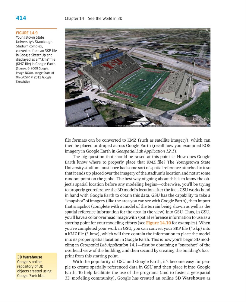
FIGURE 14.9
Youngstown State
University’s Stambaugh
Stadium complex,
converted from an SKP file
in Google SketchUp and
displayed as a “*.kmz” file
(KMZ file) in Google Earth.
(Source: © 2009 Google.
Image NOAA. Image State of
Ohio/OSIP. © 2011 Google
SketchUp)
3D Warehouse
Google’s online
repository of 3D
objects created using
Google SketchUp.
Chapter 14 See the World in 3D
file formats can be converted to KMZ (such as satellite imagery), which can
then be placed or draped across Google Earth (recall how you examined EOS
imagery in Google Earth in Geospatial Lab Application 12.1).
The big question that should be raised at this point is: How does Google
Earth know where to properly place that KMZ file? The Youngstown State
University stadium must have had some sort of spatial reference attached to it so
that it ends up placed over the imagery of the stadium’s location and not at some
random point on the globe. The best way of going about this is to know the object’s spatial location before any modeling begins—otherwise, you’ll be trying
to properly georeference the 3D model’s location after the fact. GSU works hand
in hand with Google Earth to obtain this data. GSU has the capability to take a
“snapshot” of imagery (like the area you can see with Google Earth), then import
that snapshot (complete with a model of the terrain being shown as well as the
spatial reference information for the area in the view) into GSU. Thus, in GSU,
you’ll have a color overhead image with spatial reference information to use as a
starting point for your modeling efforts (see Figure 14.10 for examples). When
you’ve completed your work in GSU, you can convert your SKP file (*.skp) into
a KMZ file (*.kmz), which will then contain the information to place the model
into its proper spatial location in Google Earth. This is how you’ll begin 3D modeling in Geospatial Lab Application 14.1—first by obtaining a “snapshot” of the
overhead view of the building, and then second by creating the building’s footprint from this starting point.
With the popularity of GSU and Google Earth, it’s become easy for people to create spatially referenced data in GSU and then place it into Google
Earth. To help facilitate the use of the programs (and to foster a geospatial
3D modeling community), Google has created an online 3D Warehouse as
FIGURE 14.9
Youngstown State
University’s Stambaugh
Stadium complex,
converted from an SKP file
in Google SketchUp and
displayed as a “*.kmz” file
(KMZ file) in Google Earth.
(Source: © 2009 Google.
Image NOAA. Image State of
Ohio/OSIP. © 2011 Google
SketchUp)
3D Warehouse
Google’s online
repository of 3D
objects created using
Google SketchUp.