

396
Chapter 13 Digital Landscaping
3. Reset the Elevation Exaggeration to a value of 1 when you’re done.
From here, we’ll examine the elevation values of the terrain surface
itself. Although Google Earth will always show the imagery over the
terrain model, elevation information of each location is available.
4. In the Layers box, under the More option, turn on the “Parks and
Recreation” layer. Several new symbols will appear around the Grand
Canyon, designating specific locales within the park. Wherever you
move the cursor on the screen, a new value for elevation is computed in
the “elev” option at the bottom of the view. By zooming into one of the
new marker spots and placing the cursor on its symbol on the screen,
you can determine the elevation value for that location.
Question 13.3 At what elevations are the heights of all the Visitors Centers
(labeled with a question mark in a circle as their placemark) within the park?
5. At this point, we’ll be moving onto a new software package called
MICRODEM, which allows you to work directly with the terrain models and
data themselves, not just use the fully processed versions in Google Earth.
Important note: Don’t close Google Earth just yet. You’ll use it later for
another way to take a look at the data you’ll use next with MICRODEM.
6. Use Google Earth to “Fly To” Hanging Rock Canyon, California.
13.4 Getting Started with MICRODEM
1. Start MICRODEM (the default install is an icon called MICRODEM). It
will open with the default screen full of buttons on the toolbar.
2. To examine a DEM, select the File pull-down menu and choose Open DEM.
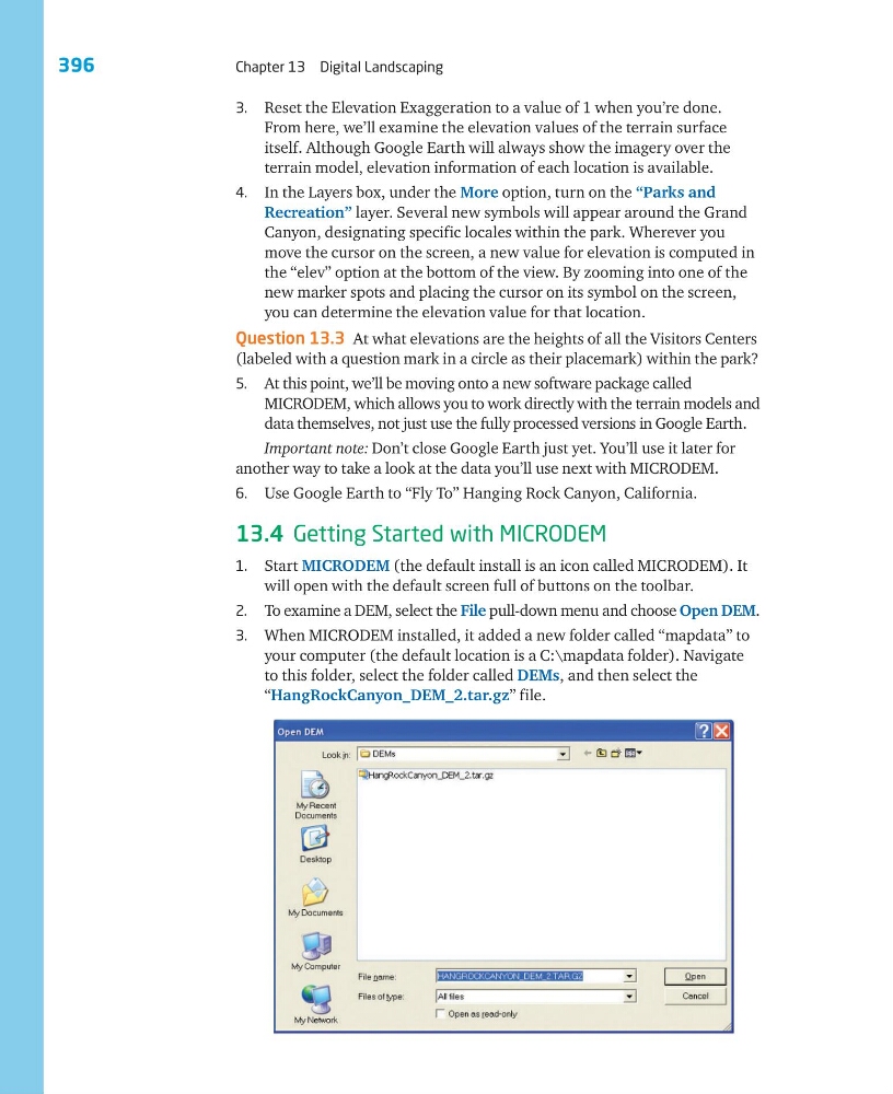
3. When MICRODEM installed, it added a new folder called “mapdata” to
your computer (the default location is a C:\mapdata folder). Navigate
to this folder, select the folder called DEMs, and then select the
“HangRockCanyon_DEM_2.tar.gz” file.
Chapter 13 Digital Landscaping
3. Reset the Elevation Exaggeration to a value of 1 when you’re done.
From here, we’ll examine the elevation values of the terrain surface
itself. Although Google Earth will always show the imagery over the
terrain model, elevation information of each location is available.
4. In the Layers box, under the More option, turn on the “Parks and
Recreation” layer. Several new symbols will appear around the Grand
Canyon, designating specific locales within the park. Wherever you
move the cursor on the screen, a new value for elevation is computed in
the “elev” option at the bottom of the view. By zooming into one of the
new marker spots and placing the cursor on its symbol on the screen,
you can determine the elevation value for that location.
Question 13.3 At what elevations are the heights of all the Visitors Centers
(labeled with a question mark in a circle as their placemark) within the park?
5. At this point, we’ll be moving onto a new software package called
MICRODEM, which allows you to work directly with the terrain models and
data themselves, not just use the fully processed versions in Google Earth.
Important note: Don’t close Google Earth just yet. You’ll use it later for
another way to take a look at the data you’ll use next with MICRODEM.
6. Use Google Earth to “Fly To” Hanging Rock Canyon, California.
13.4 Getting Started with MICRODEM
1. Start MICRODEM (the default install is an icon called MICRODEM). It
will open with the default screen full of buttons on the toolbar.
2. To examine a DEM, select the File pull-down menu and choose Open DEM.
3. When MICRODEM installed, it added a new folder called “mapdata” to
your computer (the default location is a C:\mapdata folder). Navigate
to this folder, select the folder called DEMs, and then select the
“HangRockCanyon_DEM_2.tar.gz” file.