

394
Chapter 13 Digital Landscaping
5. There are two references to heights or elevation values in the bottom
portion of the view:
a The heading marked “elev” shows the height of the terrain model (that
is, the height above the vertical datum) where the cursor is placed.
a The heading marked “Eye alt” shows Google Earth’s measurement for
how high above the terrain (or the vertical datum) your vantage point is.
Maneuver your view so your “Eye alt” is at a good level above the terrain
so that you can see over the mountains and into the canyons—this will
be a good height to start flying over the terrain.
6. Use the mouse and the Move tools to practice flying around the Grand
Canyon. You can fly over the terrain, dip in and out of valleys, and skim
over the mountaintops. When you’ve got a good feel for flying over 3D
terrain in Google Earth, then move onto the next step.
13.2 Recording Animations in Google Earth
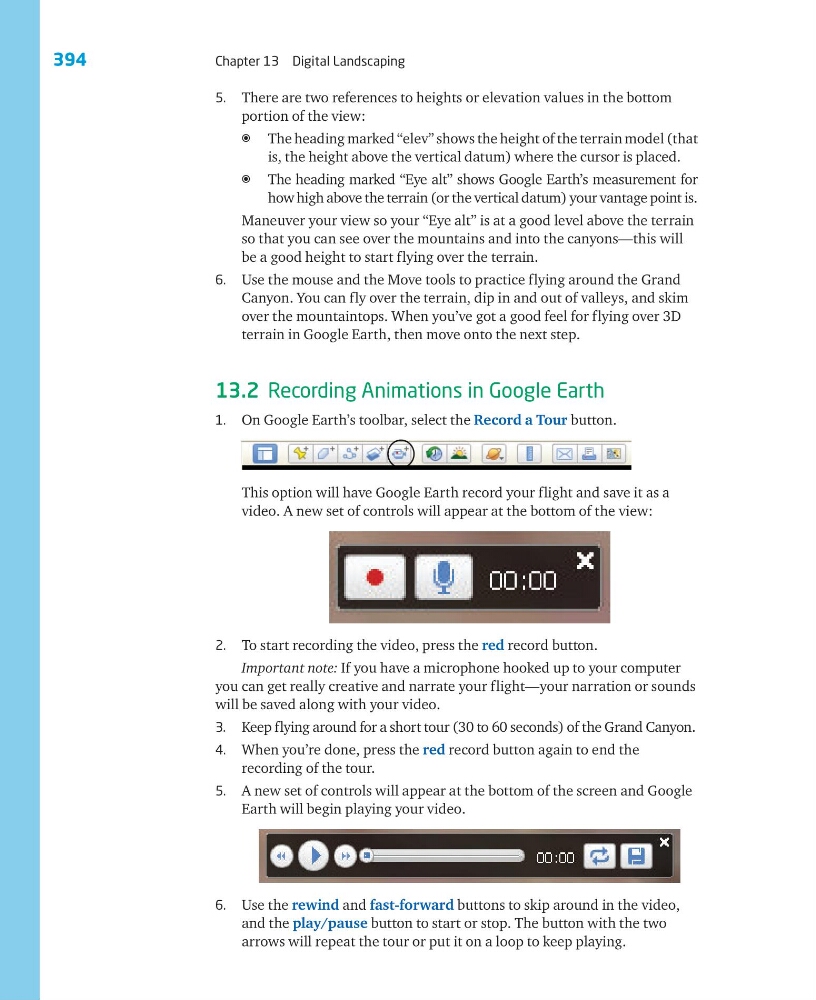
1. On Google Earth’s toolbar, select the Record a Tour button.
This option will have Google Earth record your flight and save it as a
video. A new set of controls will appear at the bottom of the view:
2. To start recording the video, press the red record button.
Important note: If you have a microphone hooked up to your computer
you can get really creative and narrate your flight—your narration or sounds
will be saved along with your video.
3. Keep flying around for a short tour (30 to 60 seconds) of the Grand Canyon.
4. When you’re done, press the red record button again to end the
recording of the tour.
5. A new set of controls will appear at the bottom of the screen and Google
Earth will begin playing your video.
6. Use the rewind and fast-forward buttons to skip around in the video,
and the play/pause button to start or stop. The button with the two
arrows will repeat the tour or put it on a loop to keep playing.
Chapter 13 Digital Landscaping
5. There are two references to heights or elevation values in the bottom
portion of the view:
a The heading marked “elev” shows the height of the terrain model (that
is, the height above the vertical datum) where the cursor is placed.
a The heading marked “Eye alt” shows Google Earth’s measurement for
how high above the terrain (or the vertical datum) your vantage point is.
Maneuver your view so your “Eye alt” is at a good level above the terrain
so that you can see over the mountains and into the canyons—this will
be a good height to start flying over the terrain.
6. Use the mouse and the Move tools to practice flying around the Grand
Canyon. You can fly over the terrain, dip in and out of valleys, and skim
over the mountaintops. When you’ve got a good feel for flying over 3D
terrain in Google Earth, then move onto the next step.
13.2 Recording Animations in Google Earth
1. On Google Earth’s toolbar, select the Record a Tour button.
This option will have Google Earth record your flight and save it as a
video. A new set of controls will appear at the bottom of the view:
2. To start recording the video, press the red record button.
Important note: If you have a microphone hooked up to your computer
you can get really creative and narrate your flight—your narration or sounds
will be saved along with your video.
3. Keep flying around for a short tour (30 to 60 seconds) of the Grand Canyon.
4. When you’re done, press the red record button again to end the
recording of the tour.
5. A new set of controls will appear at the bottom of the screen and Google
Earth will begin playing your video.
6. Use the rewind and fast-forward buttons to skip around in the video,
and the play/pause button to start or stop. The button with the two
arrows will repeat the tour or put it on a loop to keep playing.