

19
Introduction to Geospatial Concepts and Google Earth
help identify just what the building is? (You may need to switch back and
forth between the aerial view and the street view to answer this question.)
17. With a number of remote sensing concepts, it’s important to think of
viewing the ground from above and that many features you can view from
a street level are difficult to perceive from an aerial view. Chapter 9 delves
further into interpreting aerial images and some strategies and tips for
doing so, while Chapter 10 deals with how this type of remotely sensed
imagery is acquired. Chapters 11 and 12 explore obtaining imagery from
various satellites.
18. Here’s another way of looking at the Corn Palace—a 3D representation.
In the GE Layers options, select 3D Buildings. A 3D representation of
the Corn Palace will appear over top of the imagery of the building. Use
the zoom and tilt controls and navigate around the building to get a
better look at the 3D model of the Corn Palace, including its façade and
turrets. Turn off the option for 3D Buildings when you’re done.
19. There are numerous buildings and objects that have 3D representations
designed for use in GE. In Chapter 14, you’ll investigate more about
working with 3D versions of geospatial data, as well as constructing your
own 3D buildings and viewing them in GE.
1.2 Finding Your Way Around with Google Earth
1. From the Layers Box, turn on the Roads layer. You’ll see major roads
(interstates, state highways) and their labels appear, as well as local
roads when you’re zoomed in close.
2. We’re going to leave the Corn Palace behind and continue west through
South Dakota to Wall Drug, a famous tourist location. More information
on Wall Drug can be found at http://www.walldrug.com.
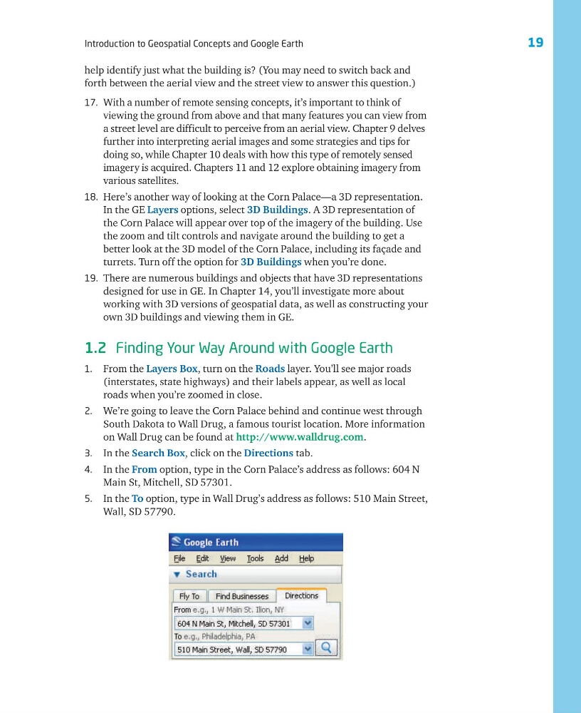
3. In the Search Box, click on the Directions tab.
4. In the From option, type in the Corn Palace’s address as follows: 604 N
Main St, Mitchell, SD 57301.
5. In the To option, type in Wall Drug’s address as follows: 510 Main Street,
Wall, SD 57790.
Introduction to Geospatial Concepts and Google Earth
help identify just what the building is? (You may need to switch back and
forth between the aerial view and the street view to answer this question.)
17. With a number of remote sensing concepts, it’s important to think of
viewing the ground from above and that many features you can view from
a street level are difficult to perceive from an aerial view. Chapter 9 delves
further into interpreting aerial images and some strategies and tips for
doing so, while Chapter 10 deals with how this type of remotely sensed
imagery is acquired. Chapters 11 and 12 explore obtaining imagery from
various satellites.
18. Here’s another way of looking at the Corn Palace—a 3D representation.
In the GE Layers options, select 3D Buildings. A 3D representation of
the Corn Palace will appear over top of the imagery of the building. Use
the zoom and tilt controls and navigate around the building to get a
better look at the 3D model of the Corn Palace, including its façade and
turrets. Turn off the option for 3D Buildings when you’re done.
19. There are numerous buildings and objects that have 3D representations
designed for use in GE. In Chapter 14, you’ll investigate more about
working with 3D versions of geospatial data, as well as constructing your
own 3D buildings and viewing them in GE.
1.2 Finding Your Way Around with Google Earth
1. From the Layers Box, turn on the Roads layer. You’ll see major roads
(interstates, state highways) and their labels appear, as well as local
roads when you’re zoomed in close.
2. We’re going to leave the Corn Palace behind and continue west through
South Dakota to Wall Drug, a famous tourist location. More information
on Wall Drug can be found at http://www.walldrug.com.
3. In the Search Box, click on the Directions tab.
4. In the From option, type in the Corn Palace’s address as follows: 604 N
Main St, Mitchell, SD 57301.
5. In the To option, type in Wall Drug’s address as follows: 510 Main Street,
Wall, SD 57790.