

18
Chapter 1 It’s a Geospatial World Out There
wheel back and forth. Pan and zoom over to the location of the Corn
Palace. To confirm that you’re in the right place, type the address of
the Corn Palace into the Fly To box as follows: 604 North Main Street,
Mitchell, SD 57301. (GE will automatically adjust to that location.)
12. For now, turn off the Photos options (remove the checkmark from the
box).
13. Zoom in on the Corn Palace so that it fills most of the view and you can
make out some details about it.
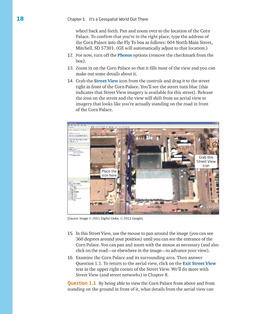
14. Grab the Street View icon from the controls and drag it to the street
right in front of the Corn Palace. You’ll see the street turn blue (this
indicates that Street View imagery is available for this street). Release
the icon on the street and the view will shift from an aerial view to
imagery that looks like you’re actually standing on the road in front
of the Corn Palace.
15. In this Street View, use the mouse to pan around the image (you can see
360 degrees around your position) until you can see the entrance of the
Corn Palace. You can pan and zoom with the mouse as necessary (and also
click on the road—or elsewhere in the image—to advance your view).
16. Examine the Corn Palace and its surrounding area. Then answer
Question 1.1. To return to the aerial view, click on the Exit Street View
text in the upper right corner of the Street View. We’ll do more with
Street View (and street networks) in Chapter 8.
Question 1.1 By being able to view the Corn Palace from above and from
standing on the ground in front of it, what details from the aerial view can
(Source: Image © 2011 Digital Globe, © 2011 Google)
Place the
icon here
Grab this
Street View
icon
Chapter 1 It’s a Geospatial World Out There
wheel back and forth. Pan and zoom over to the location of the Corn
Palace. To confirm that you’re in the right place, type the address of
the Corn Palace into the Fly To box as follows: 604 North Main Street,
Mitchell, SD 57301. (GE will automatically adjust to that location.)
12. For now, turn off the Photos options (remove the checkmark from the
box).
13. Zoom in on the Corn Palace so that it fills most of the view and you can
make out some details about it.
14. Grab the Street View icon from the controls and drag it to the street
right in front of the Corn Palace. You’ll see the street turn blue (this
indicates that Street View imagery is available for this street). Release
the icon on the street and the view will shift from an aerial view to
imagery that looks like you’re actually standing on the road in front
of the Corn Palace.
15. In this Street View, use the mouse to pan around the image (you can see
360 degrees around your position) until you can see the entrance of the
Corn Palace. You can pan and zoom with the mouse as necessary (and also
click on the road—or elsewhere in the image—to advance your view).
16. Examine the Corn Palace and its surrounding area. Then answer
Question 1.1. To return to the aerial view, click on the Exit Street View
text in the upper right corner of the Street View. We’ll do more with
Street View (and street networks) in Chapter 8.
Question 1.1 By being able to view the Corn Palace from above and from
standing on the ground in front of it, what details from the aerial view can
(Source: Image © 2011 Digital Globe, © 2011 Google)
Place the
icon here
Grab this
Street View
icon