

357
What Is Terra and What Can It Do?
The last Terra instrument is ASTER (Advanced Spaceborne Thermal Emission and Reflection Radiometer). ASTER has relatively high spatial resolution
and is often referred to as a sort of “zoom lens” for Terra’s other instruments.
With its thermal and infrared measurements, ASTER is also used to obtain
information about land surface temperature. In addition, through ASTER’s
thermal capabilities, natural hazards such as wildfires can be monitored, or
phenomena such as volcanoes can be observed and data obtained on their
health and lava flows (see Figure 12.7 on page 358 for an example of ASTER
Recent and archived MODIS data is available online
at NASA’s MODIS Rapid Response System. Open
your Web browser and go to http://rapidfire.sci.
gsfc.nasa.gov/gallery. Several MODIS images (not
the raw data, but processed images) can be viewed.
Check out some of the images from recent dates
and see what kind of phenomena NASA is tracking.
Select the Real-Time link on the Web page for the
most recent MODIS acquisition data available. Use
the imagery from today’s date (or if today’s date
isn’t available yet, use the most recent day). What
kinds of features are currently being monitored or
examined by MODIS?
In this chapter’s Geospatial Lab Application,
you’ll examine more MODIS imagery using some
other tools available from NASA.
Hands-on Application 12.1
MODIS Rapid-Fire Online
ASTER the Advanced
Spaceborne Thermal
Emission and Reflection
Radiometer instrument
onboard Terra.
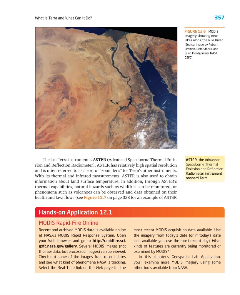
FIGURE 12.6 MODIS
imagery showing new
lakes along the Nile River.
(Source: Image by Robert
Simmon, Reto Stöckli, and
Brian Montgomery, NASA
GSFC)
What Is Terra and What Can It Do?
The last Terra instrument is ASTER (Advanced Spaceborne Thermal Emission and Reflection Radiometer). ASTER has relatively high spatial resolution
and is often referred to as a sort of “zoom lens” for Terra’s other instruments.
With its thermal and infrared measurements, ASTER is also used to obtain
information about land surface temperature. In addition, through ASTER’s
thermal capabilities, natural hazards such as wildfires can be monitored, or
phenomena such as volcanoes can be observed and data obtained on their
health and lava flows (see Figure 12.7 on page 358 for an example of ASTER
Recent and archived MODIS data is available online
at NASA’s MODIS Rapid Response System. Open
your Web browser and go to http://rapidfire.sci.
gsfc.nasa.gov/gallery. Several MODIS images (not
the raw data, but processed images) can be viewed.
Check out some of the images from recent dates
and see what kind of phenomena NASA is tracking.
Select the Real-Time link on the Web page for the
most recent MODIS acquisition data available. Use
the imagery from today’s date (or if today’s date
isn’t available yet, use the most recent day). What
kinds of features are currently being monitored or
examined by MODIS?
In this chapter’s Geospatial Lab Application,
you’ll examine more MODIS imagery using some
other tools available from NASA.
Hands-on Application 12.1
MODIS Rapid-Fire Online
ASTER the Advanced
Spaceborne Thermal
Emission and Reflection
Radiometer instrument
onboard Terra.
FIGURE 12.6 MODIS
imagery showing new
lakes along the Nile River.
(Source: Image by Robert
Simmon, Reto Stöckli, and
Brian Montgomery, NASA
GSFC)