

358
Chapter 12 Studying the Environment from Space
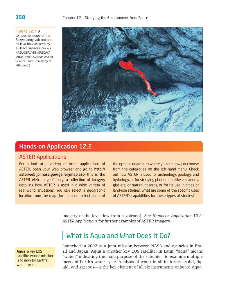
imagery of the lava flow from a volcano). See Hands-on Application 12.2:
ASTER Applications for further examples of ASTER imagery.
What Is Aqua and What Does It Do?
Launched in 2002 as a joint mission between NASA and agencies in Brazil and Japan, Aqua is another key EOS satellite. In Latin, “Aqua” means
“water,” indicating the main purpose of the satellite—to examine multiple
facets of Earth’s water cycle. Analysis of water in all its forms—solid, liquid, and gaseous—is the key element of all six instruments onboard Aqua.
For a look at a variety of other applications of
ASTER, open your Web browser and go to http://
asterweb.jpl.nasa.gov/gallerymap.asp—this is the
ASTER Web Image Gallery, a collection of imagery
detailing how ASTER is used in a wide variety of
real-world situations. You can select a geographic
location from the map (for instance, select some of
the options nearest to where you are now), or choose
from the categories on the left-hand menu. Check
out how ASTER is used for archeology, geology, and
hydrology, or for studying phenomena like volcanoes,
glaciers, or natural hazards, or for its use in cities or
land-use studies. What are some of the specific uses
of ASTER’s capabilities for these types of studies?
Hands-on Application 12.2
ASTER Applications
Aqua a key EOS
satellite whose mission
is to monitor Earth’s
water cycle.
FIGURE 12.7 A
composite image of the
Bezymianny volcano and
its lava flow as seen by
ASTER’s sensors. (Source:
NASA/GSFC/MITI/ERSDAC/
JAROS, and U.S./Japan ASTER
Science Team, University of
Pittsburgh)
Chapter 12 Studying the Environment from Space
imagery of the lava flow from a volcano). See Hands-on Application 12.2:
ASTER Applications for further examples of ASTER imagery.
What Is Aqua and What Does It Do?
Launched in 2002 as a joint mission between NASA and agencies in Brazil and Japan, Aqua is another key EOS satellite. In Latin, “Aqua” means
“water,” indicating the main purpose of the satellite—to examine multiple
facets of Earth’s water cycle. Analysis of water in all its forms—solid, liquid, and gaseous—is the key element of all six instruments onboard Aqua.
For a look at a variety of other applications of
ASTER, open your Web browser and go to http://
asterweb.jpl.nasa.gov/gallerymap.asp—this is the
ASTER Web Image Gallery, a collection of imagery
detailing how ASTER is used in a wide variety of
real-world situations. You can select a geographic
location from the map (for instance, select some of
the options nearest to where you are now), or choose
from the categories on the left-hand menu. Check
out how ASTER is used for archeology, geology, and
hydrology, or for studying phenomena like volcanoes,
glaciers, or natural hazards, or for its use in cities or
land-use studies. What are some of the specific uses
of ASTER’s capabilities for these types of studies?
Hands-on Application 12.2
ASTER Applications
Aqua a key EOS
satellite whose mission
is to monitor Earth’s
water cycle.
FIGURE 12.7 A
composite image of the
Bezymianny volcano and
its lava flow as seen by
ASTER’s sensors. (Source:
NASA/GSFC/MITI/ERSDAC/
JAROS, and U.S./Japan ASTER
Science Team, University of
Pittsburgh)