

356
Chapter 12 Studying the Environment from Space
MODIS imagery is very coarse spatial resolution (most images have
1-kilometer resolution). However, the swath width of MODIS is 2330 kilometers, making it possible to examine broad-scale phenomena of large geographic regions. MODIS views most of the globe in one day with complete
global coverage being completed on a second day. With this quick revisit
time, MODIS allows scientists to look at changes in sea surface temperature
or snow cover over time, global leaf-area index studies, and active large-scale
fires, all on a regular basis. For instance, the red and near-infrared bands
sensed by MODIS can be used to regularly compute global measures of NDVI
(see Chapter 10) allowing monitoring of the health of the planet’s trees and
vegetation. Another application of MODIS is the ability to study the health
of phytoplankton in the oceans. As NASA notes, when phytoplankton is unhealthy or under heavy stress, it takes the sunlight it’s absorbed and re-emits it
as fluorescence, which can then be observed by MODIS. In this way, scientists
can track potential harmful algal (phytoplankton) blooms around the world
via MODIS. See Figure 12.6 for an example of MODIS imagery of Egypt and
the Nile River—new lakes in the desert are visible adjoining the Nile. Also,
check out Hands-on Application 12.1: MODIS Rapid-Fire Online for examples
of current MODIS imagery online.
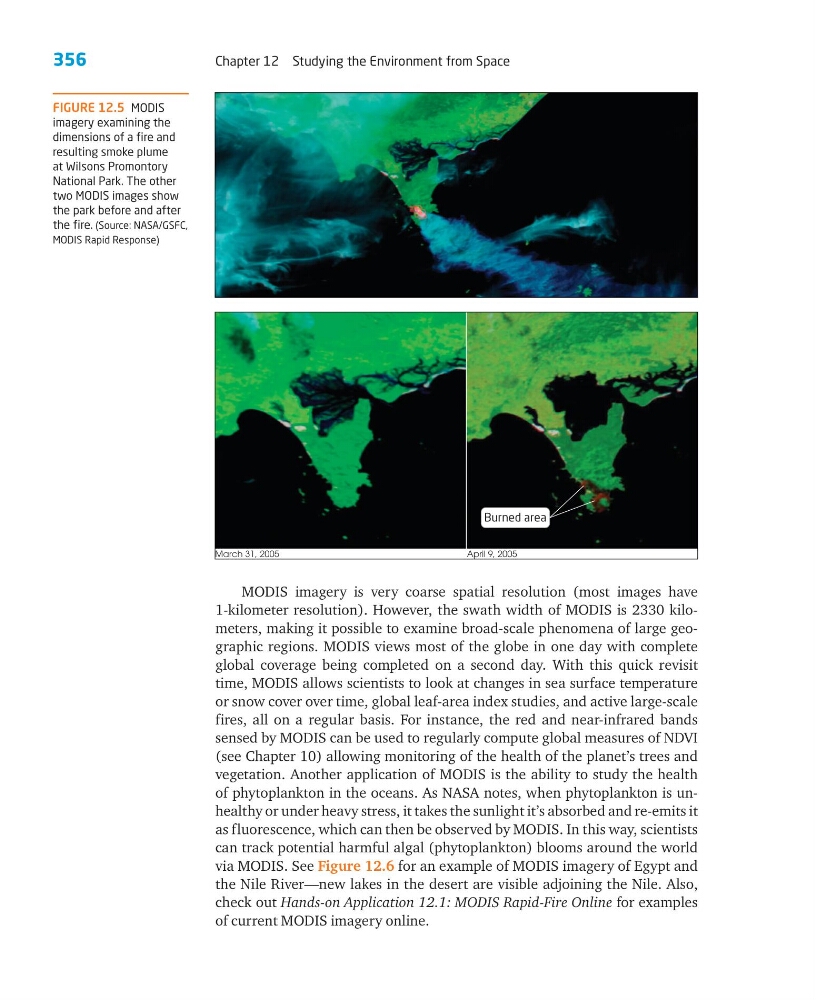
FIGURE 12.5 MODIS
imagery examining the
dimensions of a fire and
resulting smoke plume
at Wilsons Promontory
National Park. The other
two MODIS images show
the park before and after
the fire. (Source: NASA/GSFC,
MODIS Rapid Response)
March 31, 2005
April 9, 2005
Burned area
Chapter 12 Studying the Environment from Space
MODIS imagery is very coarse spatial resolution (most images have
1-kilometer resolution). However, the swath width of MODIS is 2330 kilometers, making it possible to examine broad-scale phenomena of large geographic regions. MODIS views most of the globe in one day with complete
global coverage being completed on a second day. With this quick revisit
time, MODIS allows scientists to look at changes in sea surface temperature
or snow cover over time, global leaf-area index studies, and active large-scale
fires, all on a regular basis. For instance, the red and near-infrared bands
sensed by MODIS can be used to regularly compute global measures of NDVI
(see Chapter 10) allowing monitoring of the health of the planet’s trees and
vegetation. Another application of MODIS is the ability to study the health
of phytoplankton in the oceans. As NASA notes, when phytoplankton is unhealthy or under heavy stress, it takes the sunlight it’s absorbed and re-emits it
as fluorescence, which can then be observed by MODIS. In this way, scientists
can track potential harmful algal (phytoplankton) blooms around the world
via MODIS. See Figure 12.6 for an example of MODIS imagery of Egypt and
the Nile River—new lakes in the desert are visible adjoining the Nile. Also,
check out Hands-on Application 12.1: MODIS Rapid-Fire Online for examples
of current MODIS imagery online.
FIGURE 12.5 MODIS
imagery examining the
dimensions of a fire and
resulting smoke plume
at Wilsons Promontory
National Park. The other
two MODIS images show
the park before and after
the fire. (Source: NASA/GSFC,
MODIS Rapid Response)
March 31, 2005
April 9, 2005
Burned area