

354
Chapter 12 Studying the Environment from Space
Likewise, the heights of plumes of smoke given off by wildfires or volcanoes
can be measured using MISR’s stereo capabilities. In addition, by showing the
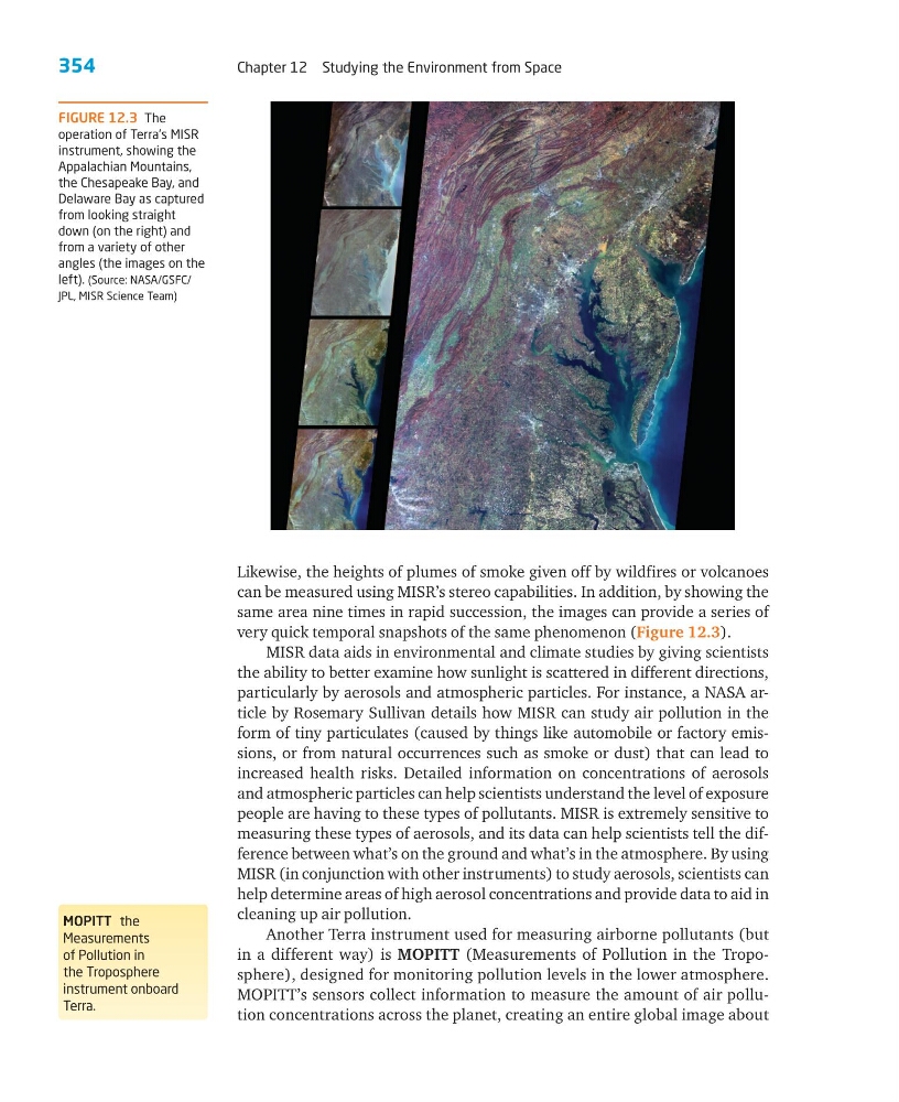
same area nine times in rapid succession, the images can provide a series of
very quick temporal snapshots of the same phenomenon (Figure 12.3).
MISR data aids in environmental and climate studies by giving scientists
the ability to better examine how sunlight is scattered in different directions,
particularly by aerosols and atmospheric particles. For instance, a NASA article by Rosemary Sullivan details how MISR can study air pollution in the
form of tiny particulates (caused by things like automobile or factory emissions, or from natural occurrences such as smoke or dust) that can lead to
increased health risks. Detailed information on concentrations of aerosols
and atmospheric particles can help scientists understand the level of exposure
people are having to these types of pollutants. MISR is extremely sensitive to
measuring these types of aerosols, and its data can help scientists tell the difference between what’s on the ground and what’s in the atmosphere. By using
MISR (in conjunction with other instruments) to study aerosols, scientists can
help determine areas of high aerosol concentrations and provide data to aid in
cleaning up air pollution.
Another Terra instrument used for measuring airborne pollutants (but
in a different way) is MOPITT (Measurements of Pollution in the Troposphere), designed for monitoring pollution levels in the lower atmosphere.
MOPITT’s sensors collect information to measure the amount of air pollution concentrations across the planet, creating an entire global image about
MOPITT the
Measurements
of Pollution in
the Troposphere
instrument onboard
Terra.
FIGURE 12.3 The
operation of Terra’s MISR
instrument, showing the
Appalachian Mountains,
the Chesapeake Bay, and
Delaware Bay as captured
from looking straight
down (on the right) and
from a variety of other
angles (the images on the
left). (Source: NASA/GSFC/
JPL, MISR Science Team)
Chapter 12 Studying the Environment from Space
Likewise, the heights of plumes of smoke given off by wildfires or volcanoes
can be measured using MISR’s stereo capabilities. In addition, by showing the
same area nine times in rapid succession, the images can provide a series of
very quick temporal snapshots of the same phenomenon (Figure 12.3).
MISR data aids in environmental and climate studies by giving scientists
the ability to better examine how sunlight is scattered in different directions,
particularly by aerosols and atmospheric particles. For instance, a NASA article by Rosemary Sullivan details how MISR can study air pollution in the
form of tiny particulates (caused by things like automobile or factory emissions, or from natural occurrences such as smoke or dust) that can lead to
increased health risks. Detailed information on concentrations of aerosols
and atmospheric particles can help scientists understand the level of exposure
people are having to these types of pollutants. MISR is extremely sensitive to
measuring these types of aerosols, and its data can help scientists tell the difference between what’s on the ground and what’s in the atmosphere. By using
MISR (in conjunction with other instruments) to study aerosols, scientists can
help determine areas of high aerosol concentrations and provide data to aid in
cleaning up air pollution.
Another Terra instrument used for measuring airborne pollutants (but
in a different way) is MOPITT (Measurements of Pollution in the Troposphere), designed for monitoring pollution levels in the lower atmosphere.
MOPITT’s sensors collect information to measure the amount of air pollution concentrations across the planet, creating an entire global image about
MOPITT the
Measurements
of Pollution in
the Troposphere
instrument onboard
Terra.
FIGURE 12.3 The
operation of Terra’s MISR
instrument, showing the
Appalachian Mountains,
the Chesapeake Bay, and
Delaware Bay as captured
from looking straight
down (on the right) and
from a variety of other
angles (the images on the
left). (Source: NASA/GSFC/
JPL, MISR Science Team)