

353
What Is Terra and What Can It Do?
this morning constellation are Landsat 7 (which passes at 10:01 a.m.), EO-1
(which passes at 10:02 a.m.), and another satellite called SAC-C.
“Terra” means “Earth” in Latin, which is an appropriate name for the satellite, as its instruments provide numerous measures of (among many other
functions) the processes involved with Earth’s land and climate. There are five
instruments onboard Terra, each with its own purpose and environmental
monitoring capabilities. The data and imagery collected by Terra’s instruments are processed into a number of specific products that are then distributed for use.
The first of Terra’s instruments is CERES (Clouds and Earth’s Radiant
Energy System), a system designed to provide regular energy measurements
(such as heat energy) from Earth’s surface to the top of the atmosphere. Like
its name indicates, CERES is used to study clouds and see what effect they
have on Earth’s energy. Using CERES to study clouds provides critical information about Earth’s climate and temperature. As NASA notes, clouds play a
defining role in the heat budget of Earth, but different type of clouds affect
Earth in different ways—for instance, low clouds reflect more sunlight (and
thus, help cool the planet) while high clouds reflect less but effectively keep
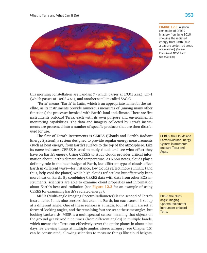
more heat on Earth. By combining CERES data with data from other EOS instruments, scientists are able to examine cloud properties and information
about Earth’s heat and radiation (see Figure 12.2 for an example of using
CERES for examining Earth’s radiated energy).
MISR (Multi-angle Imaging SpectroRadiometer) is the second of Terra’s
instruments. It has nine sensors that examine Earth, but each sensor is set up
at a different angle. One of these sensors is at nadir, four of them are set at
forward-looking angles, and the remaining four are set at the same angles, but
looking backwards. MISR is a multispectral sensor, meaning that objects on
the ground get viewed nine times (from different angles) in multiple bands,
which means that Terra can effectively cover the entire planet in about nine
days. By viewing things at multiple angles, stereo imagery (see Chapter 15)
can be constructed, allowing scientists to measure things like cloud heights.
CERES the Clouds and
Earth’s Radiant Energy
System instruments
onboard Terra and
Aqua.
MISR the Multiangle Imaging
SpectroRadiometer
instrument onboard
Terra.
FIGURE 12.2 A global
composite of CERES
imagery from June 2010,
showing the radiated
energy from Earth (blue
areas are colder, red areas
are warmer). (Source:
Kevin Ward, NASA Earth
Observations)
What Is Terra and What Can It Do?
this morning constellation are Landsat 7 (which passes at 10:01 a.m.), EO-1
(which passes at 10:02 a.m.), and another satellite called SAC-C.
“Terra” means “Earth” in Latin, which is an appropriate name for the satellite, as its instruments provide numerous measures of (among many other
functions) the processes involved with Earth’s land and climate. There are five
instruments onboard Terra, each with its own purpose and environmental
monitoring capabilities. The data and imagery collected by Terra’s instruments are processed into a number of specific products that are then distributed for use.
The first of Terra’s instruments is CERES (Clouds and Earth’s Radiant
Energy System), a system designed to provide regular energy measurements
(such as heat energy) from Earth’s surface to the top of the atmosphere. Like
its name indicates, CERES is used to study clouds and see what effect they
have on Earth’s energy. Using CERES to study clouds provides critical information about Earth’s climate and temperature. As NASA notes, clouds play a
defining role in the heat budget of Earth, but different type of clouds affect
Earth in different ways—for instance, low clouds reflect more sunlight (and
thus, help cool the planet) while high clouds reflect less but effectively keep
more heat on Earth. By combining CERES data with data from other EOS instruments, scientists are able to examine cloud properties and information
about Earth’s heat and radiation (see Figure 12.2 for an example of using
CERES for examining Earth’s radiated energy).
MISR (Multi-angle Imaging SpectroRadiometer) is the second of Terra’s
instruments. It has nine sensors that examine Earth, but each sensor is set up
at a different angle. One of these sensors is at nadir, four of them are set at
forward-looking angles, and the remaining four are set at the same angles, but
looking backwards. MISR is a multispectral sensor, meaning that objects on
the ground get viewed nine times (from different angles) in multiple bands,
which means that Terra can effectively cover the entire planet in about nine
days. By viewing things at multiple angles, stereo imagery (see Chapter 15)
can be constructed, allowing scientists to measure things like cloud heights.
CERES the Clouds and
Earth’s Radiant Energy
System instruments
onboard Terra and
Aqua.
MISR the Multiangle Imaging
SpectroRadiometer
instrument onboard
Terra.
FIGURE 12.2 A global
composite of CERES
imagery from June 2010,
showing the radiated
energy from Earth (blue
areas are colder, red areas
are warmer). (Source:
Kevin Ward, NASA Earth
Observations)