

352
Chapter 12 Studying the Environment from Space
constant data streams of observation data about whatever environmental system they’re examining.
There are a lot of different uses and products of EOS data. This chapter
can’t hope to cover all of them, just demonstrate some sample applications.
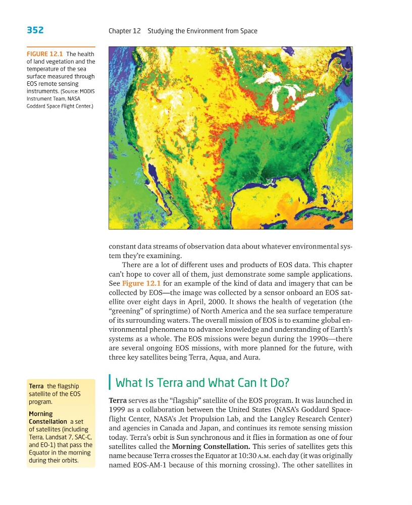
See Figure 12.1 for an example of the kind of data and imagery that can be
collected by EOS—the image was collected by a sensor onboard an EOS satellite over eight days in April, 2000. It shows the health of vegetation (the
“greening” of springtime) of North America and the sea surface temperature
of its surrounding waters. The overall mission of EOS is to examine global environmental phenomena to advance knowledge and understanding of Earth’s
systems as a whole. The EOS missions were begun during the 1990s—there
are several ongoing EOS missions, with more planned for the future, with
three key satellites being Terra, Aqua, and Aura.
What Is Terra and What Can It Do?
Terra serves as the “flagship” satellite of the EOS program. It was launched in
1999 as a collaboration between the United States (NASA’s Goddard Spaceflight Center, NASA’s Jet Propulsion Lab, and the Langley Research Center)
and agencies in Canada and Japan, and continues its remote sensing mission
today. Terra’s orbit is Sun synchronous and it flies in formation as one of four
satellites called the Morning Constellation. This series of satellites gets this
name because Terra crosses the Equator at 10:30 a.m. each day (it was originally
named EOS-AM-1 because of this morning crossing). The other satellites in
FIGURE 12.1 The health
of land vegetation and the
temperature of the sea
surface measured through
EOS remote sensing
instruments. (Source: MODIS
Instrument Team, NASA
Goddard Space Flight Center.)
Terra the flagship
satellite of the EOS
program.
Morning
Constellation a set
of satellites (including
Terra, Landsat 7, SAC-C,
and EO-1) that pass the
Equator in the morning
during their orbits.
Chapter 12 Studying the Environment from Space
constant data streams of observation data about whatever environmental system they’re examining.
There are a lot of different uses and products of EOS data. This chapter
can’t hope to cover all of them, just demonstrate some sample applications.
See Figure 12.1 for an example of the kind of data and imagery that can be
collected by EOS—the image was collected by a sensor onboard an EOS satellite over eight days in April, 2000. It shows the health of vegetation (the
“greening” of springtime) of North America and the sea surface temperature
of its surrounding waters. The overall mission of EOS is to examine global environmental phenomena to advance knowledge and understanding of Earth’s
systems as a whole. The EOS missions were begun during the 1990s—there
are several ongoing EOS missions, with more planned for the future, with
three key satellites being Terra, Aqua, and Aura.
What Is Terra and What Can It Do?
Terra serves as the “flagship” satellite of the EOS program. It was launched in
1999 as a collaboration between the United States (NASA’s Goddard Spaceflight Center, NASA’s Jet Propulsion Lab, and the Langley Research Center)
and agencies in Canada and Japan, and continues its remote sensing mission
today. Terra’s orbit is Sun synchronous and it flies in formation as one of four
satellites called the Morning Constellation. This series of satellites gets this
name because Terra crosses the Equator at 10:30 a.m. each day (it was originally
named EOS-AM-1 because of this morning crossing). The other satellites in
FIGURE 12.1 The health
of land vegetation and the
temperature of the sea
surface measured through
EOS remote sensing
instruments. (Source: MODIS
Instrument Team, NASA
Goddard Space Flight Center.)
Terra the flagship
satellite of the EOS
program.
Morning
Constellation a set
of satellites (including
Terra, Landsat 7, SAC-C,
and EO-1) that pass the
Equator in the morning
during their orbits.