

192
Chapter 7 Using GIS to Make a Map
How Is Data Displayed on a GIS Map?
There are several different types of maps that can be made using GIS tools.
The purpose of a reference map (like what you would see in an atlas or a road
map) is to give location information or highlight different features. A map of
park trails, a Manhattan restaurant guide map, a map of the casinos on the
Las Vegas Strip, or a zoning map of your neighborhood are all examples of
reference maps. Topographic maps (that also show landforms) are another
example of reference maps (and we’ll deal with them in Chapter 13).
Another main type of map is the thematic map, which is geared toward
conveying one particular theme to the reader. Thematic maps might be used
to show things such as the increase in U.S. population for each state or U.S.
Presidential election results by county (see Hands-on Application 7.3: Census
Bureau Thematic Maps for examples of different types of thematic maps online). In GIS, a layer’s attributes are used for displaying information on the
map. For instance, to create a map of the 2008 U.S. Presidential election
reference map a map
that serves to show the
location of features,
rather than thematic
information.
thematic map a
map that displays a
particular theme or
feature.
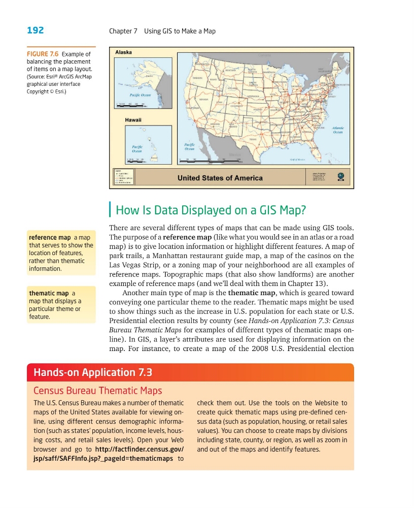
FIGURE 7.6 Example of
balancing the placement
of items on a map layout.
(Source: Esri® ArcGIS ArcMap
graphical user interface
Copyright © Esri.)
The U.S. Census Bureau makes a number of thematic
maps of the United States available for viewing online, using different census demographic information (such as states’ population, income levels, housing costs, and retail sales levels). Open your Web
browser and go to http://factfinder.census.gov/
jsp/saff/SAFFInfo.jsp?_pageId=thematicmaps to
check them out. Use the tools on the Website to
create quick thematic maps using pre-defined census data (such as population, housing, or retail sales
values). You can choose to create maps by divisions
including state, county, or region, as well as zoom in
and out of the maps and identify features.
Hands-on Application 7.3
Census Bureau Thematic Maps
Chapter 7 Using GIS to Make a Map
How Is Data Displayed on a GIS Map?
There are several different types of maps that can be made using GIS tools.
The purpose of a reference map (like what you would see in an atlas or a road
map) is to give location information or highlight different features. A map of
park trails, a Manhattan restaurant guide map, a map of the casinos on the
Las Vegas Strip, or a zoning map of your neighborhood are all examples of
reference maps. Topographic maps (that also show landforms) are another
example of reference maps (and we’ll deal with them in Chapter 13).
Another main type of map is the thematic map, which is geared toward
conveying one particular theme to the reader. Thematic maps might be used
to show things such as the increase in U.S. population for each state or U.S.
Presidential election results by county (see Hands-on Application 7.3: Census
Bureau Thematic Maps for examples of different types of thematic maps online). In GIS, a layer’s attributes are used for displaying information on the
map. For instance, to create a map of the 2008 U.S. Presidential election
reference map a map
that serves to show the
location of features,
rather than thematic
information.
thematic map a
map that displays a
particular theme or
feature.
FIGURE 7.6 Example of
balancing the placement
of items on a map layout.
(Source: Esri® ArcGIS ArcMap
graphical user interface
Copyright © Esri.)
The U.S. Census Bureau makes a number of thematic
maps of the United States available for viewing online, using different census demographic information (such as states’ population, income levels, housing costs, and retail sales levels). Open your Web
browser and go to http://factfinder.census.gov/
jsp/saff/SAFFInfo.jsp?_pageId=thematicmaps to
check them out. Use the tools on the Website to
create quick thematic maps using pre-defined census data (such as population, housing, or retail sales
values). You can choose to create maps by divisions
including state, county, or region, as well as zoom in
and out of the maps and identify features.
Hands-on Application 7.3
Census Bureau Thematic Maps