

What Are Some Design Elements Included in Maps?
189
at. For instance, digitizing features on a small-scale map (like a 1:250,000
scale) are going to be much more generalized than data derived from largerscale maps (like a 1:24,000 scale) or things such as aerial photos at a larger
scale (for example, 1:6000). See Chapter 9 for more information on using
aerial photos for analysis.
What Are Some Design Elements Included
in Maps?
There are several elements that should show up on a good map. For instance,
someone reading a map should be able to quickly figure out what scale the
map is. A map element might simply be text of the RF (such as 1:24,000,
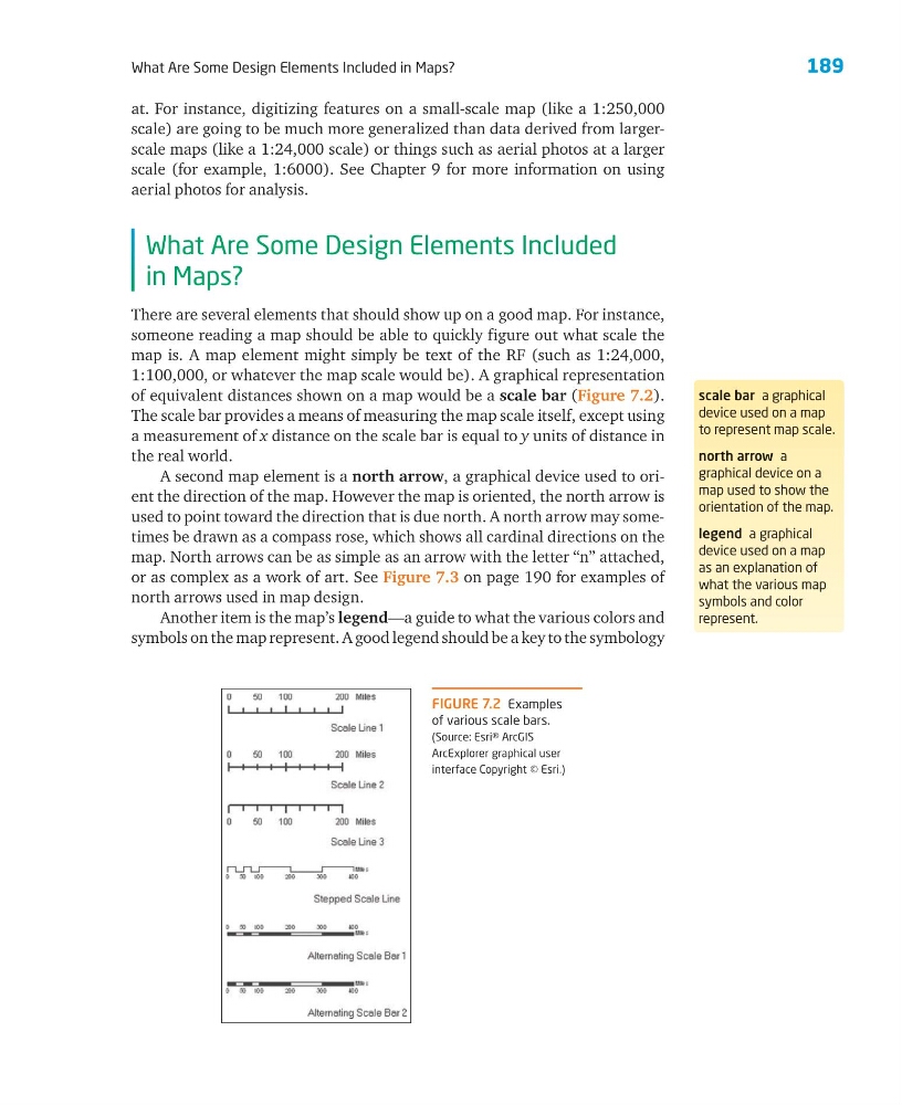
1:100,000, or whatever the map scale would be). A graphical representation
of equivalent distances shown on a map would be a scale bar (Figure 7.2).
The scale bar provides a means of measuring the map scale itself, except using
a measurement of x distance on the scale bar is equal to y units of distance in
the real world.
A second map element is a north arrow, a graphical device used to orient the direction of the map. However the map is oriented, the north arrow is
used to point toward the direction that is due north. A north arrow may sometimes be drawn as a compass rose, which shows all cardinal directions on the
map. North arrows can be as simple as an arrow with the letter “n” attached,
or as complex as a work of art. See Figure 7.3 on page 190 for examples of
north arrows used in map design.
Another item is the map’s legend—a guide to what the various colors and
symbols on the map represent. A good legend should be a key to the symbology
scale bar a graphical
device used on a map
to represent map scale.
north arrow a
graphical device on a
map used to show the
orientation of the map.
legend a graphical
device used on a map
as an explanation of
what the various map
symbols and color
represent.
FIGURE 7.2 Examples
of various scale bars.
(Source: Esri® ArcGIS
ArcExplorer graphical user
interface Copyright © Esri.)
189
at. For instance, digitizing features on a small-scale map (like a 1:250,000
scale) are going to be much more generalized than data derived from largerscale maps (like a 1:24,000 scale) or things such as aerial photos at a larger
scale (for example, 1:6000). See Chapter 9 for more information on using
aerial photos for analysis.
What Are Some Design Elements Included
in Maps?
There are several elements that should show up on a good map. For instance,
someone reading a map should be able to quickly figure out what scale the
map is. A map element might simply be text of the RF (such as 1:24,000,
1:100,000, or whatever the map scale would be). A graphical representation
of equivalent distances shown on a map would be a scale bar (Figure 7.2).
The scale bar provides a means of measuring the map scale itself, except using
a measurement of x distance on the scale bar is equal to y units of distance in
the real world.
A second map element is a north arrow, a graphical device used to orient the direction of the map. However the map is oriented, the north arrow is
used to point toward the direction that is due north. A north arrow may sometimes be drawn as a compass rose, which shows all cardinal directions on the
map. North arrows can be as simple as an arrow with the letter “n” attached,
or as complex as a work of art. See Figure 7.3 on page 190 for examples of
north arrows used in map design.
Another item is the map’s legend—a guide to what the various colors and
symbols on the map represent. A good legend should be a key to the symbology
scale bar a graphical
device used on a map
to represent map scale.
north arrow a
graphical device on a
map used to show the
orientation of the map.
legend a graphical
device used on a map
as an explanation of
what the various map
symbols and color
represent.
FIGURE 7.2 Examples
of various scale bars.
(Source: Esri® ArcGIS
ArcExplorer graphical user
interface Copyright © Esri.)