

123
GIS Introduction: AEJEE Version
4. Change the states dataset to something more appealing to you, click
Apply to make the changes, and then click OK to close the dialog box.
5. Do the same for the cities and interstates shapefiles. Note that you can
alter the points for the cities into shapes like stars, triangles, or crosses,
and change their size as well. Several different styles are available for
the lines of the interstates file as well.
5.4 Obtaining Projection Information
1. Chapter 2 discussed the importance of projections, coordinate systems,
and datums. All of the information associated with these concepts can
be accessed using AEJEE.
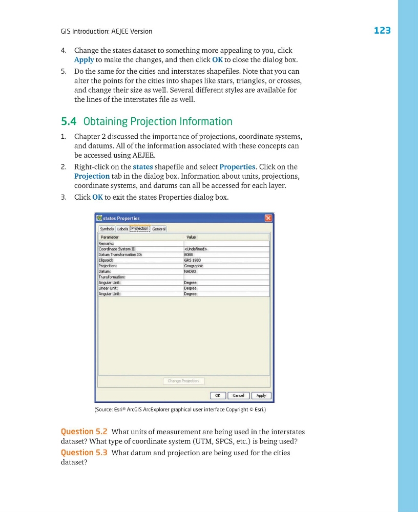
2. Right-click on the states shapefile and select Properties. Click on the
Projection tab in the dialog box. Information about units, projections,
coordinate systems, and datums can all be accessed for each layer.
3. Click OK to exit the states Properties dialog box.
(Source: Esri® ArcGIS ArcExplorer graphical user interface Copyright © Esri.)
Question 5.2 What units of measurement are being used in the interstates
dataset? What type of coordinate system (UTM, SPCS, etc.) is being used?
Question 5.3 What datum and projection are being used for the cities
dataset?
GIS Introduction: AEJEE Version
4. Change the states dataset to something more appealing to you, click
Apply to make the changes, and then click OK to close the dialog box.
5. Do the same for the cities and interstates shapefiles. Note that you can
alter the points for the cities into shapes like stars, triangles, or crosses,
and change their size as well. Several different styles are available for
the lines of the interstates file as well.
5.4 Obtaining Projection Information
1. Chapter 2 discussed the importance of projections, coordinate systems,
and datums. All of the information associated with these concepts can
be accessed using AEJEE.
2. Right-click on the states shapefile and select Properties. Click on the
Projection tab in the dialog box. Information about units, projections,
coordinate systems, and datums can all be accessed for each layer.
3. Click OK to exit the states Properties dialog box.
(Source: Esri® ArcGIS ArcExplorer graphical user interface Copyright © Esri.)
Question 5.2 What units of measurement are being used in the interstates
dataset? What type of coordinate system (UTM, SPCS, etc.) is being used?
Question 5.3 What datum and projection are being used for the cities
dataset?