

80
Basic biogeography: estimating biodiversity and mapping nature
Figure 4.13 An example of the US National Vegetation
Classifi cation, a hierarchical, physiognomic – fl oristic
classifi cation of vegetation types. From http://
biology.usgs.gov/npsveg/nvcs.html (retrieved January
2004).
conservation and management purposes, the two
approaches are typically seen to be complementary
and, indeed, both are necessary for the development of
a multi - scalar approach.
In the UK, the NVC uses communities as the fundamental unit of vegetation classifi cation, recognizing
286 of them in the UK. The data used to derive the
classifi cation were obtained from a staggering 35,000
samples, with samples taken from 80 per cent of the
10 × 10 km grid cells on the mainland. Schemes such
as this have found widespread application, not only for
informing practical conservation decisions, underpinning protected area legislation, and as a tool for ecological impact assessment, but also as baseline data for
a wide range of scientifi c studies.
In conclusion, the identifi cation and mapping of
ecosystems, biomes and communities continues to be
fundamental to conservation planning and is the
basis of many national and international conservation
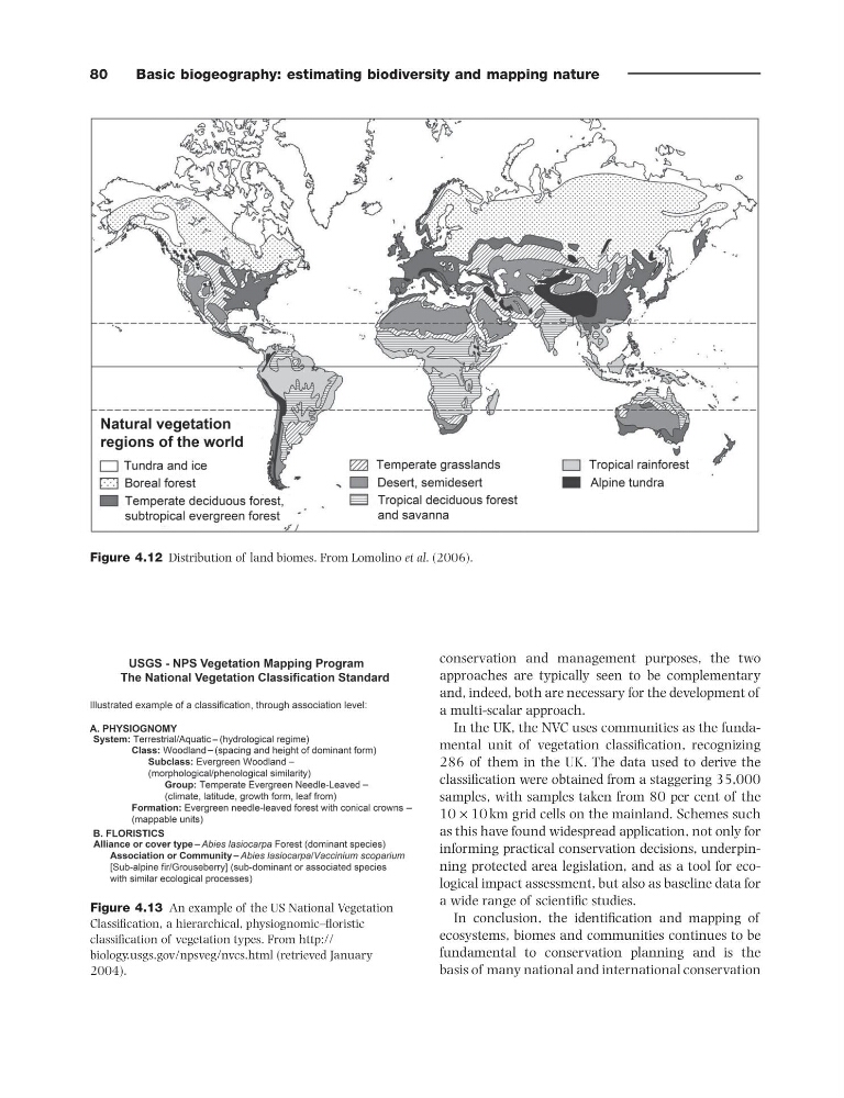
Figure 4.12 Distribution of land biomes. From Lomolino et al . (2006).
Basic biogeography: estimating biodiversity and mapping nature
Figure 4.13 An example of the US National Vegetation
Classifi cation, a hierarchical, physiognomic – fl oristic
classifi cation of vegetation types. From http://
biology.usgs.gov/npsveg/nvcs.html (retrieved January
2004).
conservation and management purposes, the two
approaches are typically seen to be complementary
and, indeed, both are necessary for the development of
a multi - scalar approach.
In the UK, the NVC uses communities as the fundamental unit of vegetation classifi cation, recognizing
286 of them in the UK. The data used to derive the
classifi cation were obtained from a staggering 35,000
samples, with samples taken from 80 per cent of the
10 × 10 km grid cells on the mainland. Schemes such
as this have found widespread application, not only for
informing practical conservation decisions, underpinning protected area legislation, and as a tool for ecological impact assessment, but also as baseline data for
a wide range of scientifi c studies.
In conclusion, the identifi cation and mapping of
ecosystems, biomes and communities continues to be
fundamental to conservation planning and is the
basis of many national and international conservation
Figure 4.12 Distribution of land biomes. From Lomolino et al . (2006).