

Tropical landforms
547
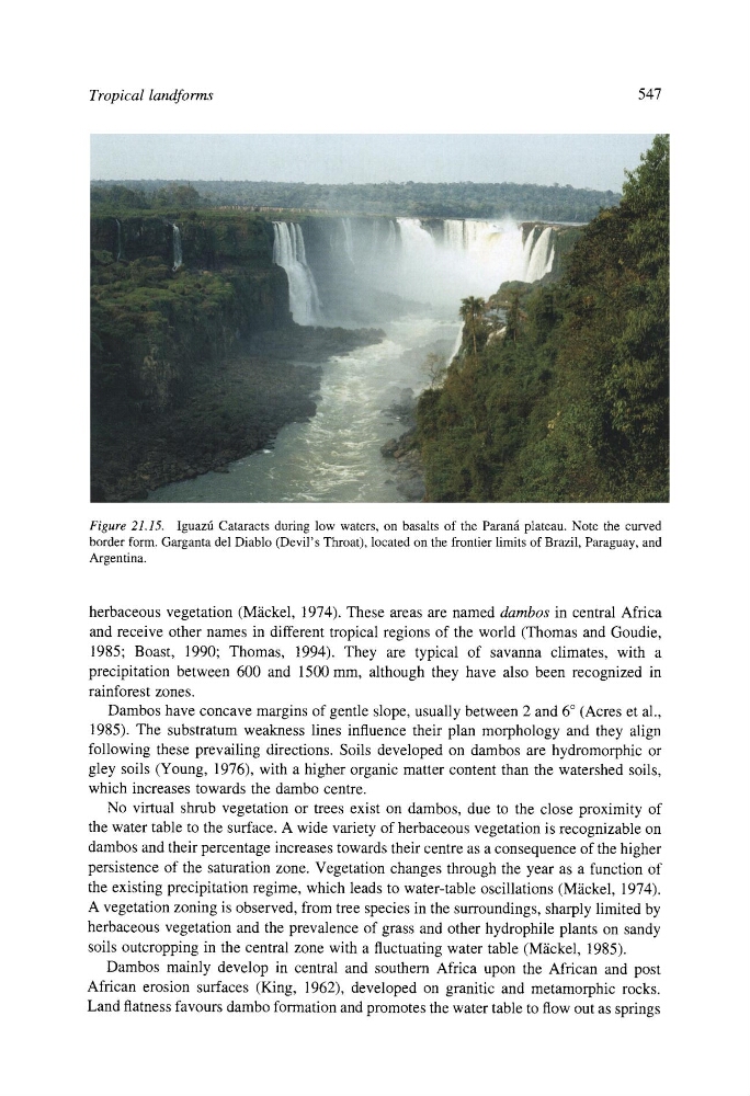
Figure 21.15. Iguazti Cataracts during low waters, on basalts of the Paran~i plateau. Note the curved
border form. Garganta del Diablo (Devil' s Throat), located on the frontier limits of Brazil, Paraguay, and
Argentina.
herbaceous vegetation (M~ickel, 1974). These areas are named dambos in central Africa
and receive other names in different tropical regions of the world (Thomas and Goudie,
1985; Boast, 1990; Thomas, 1994). They are typical of savanna climates, with a
precipitation between 600 and 1500 mm, although they have also been recognized in
rainforest zones.
Dambos have concave margins of gentle slope, usually between 2 and 6 ~ (Acres et al.,
1985). The substratum weakness lines influence their plan morphology and they align
following these prevailing directions. Soils developed on dambos are hydromorphic or
gley soils (Young, 1976), with a higher organic matter content than the watershed soils,
which increases towards the dambo centre.
No virtual shrub vegetation or trees exist on dambos, due to the close proximity of
the water table to the surface. A wide variety of herbaceous vegetation is recognizable on
dambos and their percentage increases towards their centre as a consequence of the higher
persistence of the saturation zone. Vegetation changes through the year as a function of
the existing precipitation regime, which leads to water-table oscillations (Miickel, 1974).
A vegetation zoning is observed, from tree species in the surroundings, sharply limited by
herbaceous vegetation and the prevalence of grass and other hydrophile plants on sandy
soils outcropping in the central zone with a fluctuating water table (M~ickel, 1985).
Dambos mainly develop in central and southern Africa upon the African and post
African erosion surfaces (King, 1962), developed on granitic and metamorphic rocks.
Land flatness favours dambo formation and promotes the water table to flow out as springs
547
Figure 21.15. Iguazti Cataracts during low waters, on basalts of the Paran~i plateau. Note the curved
border form. Garganta del Diablo (Devil' s Throat), located on the frontier limits of Brazil, Paraguay, and
Argentina.
herbaceous vegetation (M~ickel, 1974). These areas are named dambos in central Africa
and receive other names in different tropical regions of the world (Thomas and Goudie,
1985; Boast, 1990; Thomas, 1994). They are typical of savanna climates, with a
precipitation between 600 and 1500 mm, although they have also been recognized in
rainforest zones.
Dambos have concave margins of gentle slope, usually between 2 and 6 ~ (Acres et al.,
1985). The substratum weakness lines influence their plan morphology and they align
following these prevailing directions. Soils developed on dambos are hydromorphic or
gley soils (Young, 1976), with a higher organic matter content than the watershed soils,
which increases towards the dambo centre.
No virtual shrub vegetation or trees exist on dambos, due to the close proximity of
the water table to the surface. A wide variety of herbaceous vegetation is recognizable on
dambos and their percentage increases towards their centre as a consequence of the higher
persistence of the saturation zone. Vegetation changes through the year as a function of
the existing precipitation regime, which leads to water-table oscillations (Miickel, 1974).
A vegetation zoning is observed, from tree species in the surroundings, sharply limited by
herbaceous vegetation and the prevalence of grass and other hydrophile plants on sandy
soils outcropping in the central zone with a fluctuating water table (M~ickel, 1985).
Dambos mainly develop in central and southern Africa upon the African and post
African erosion surfaces (King, 1962), developed on granitic and metamorphic rocks.
Land flatness favours dambo formation and promotes the water table to flow out as springs