

Desert lakes: playa lakes and sebkhas
389
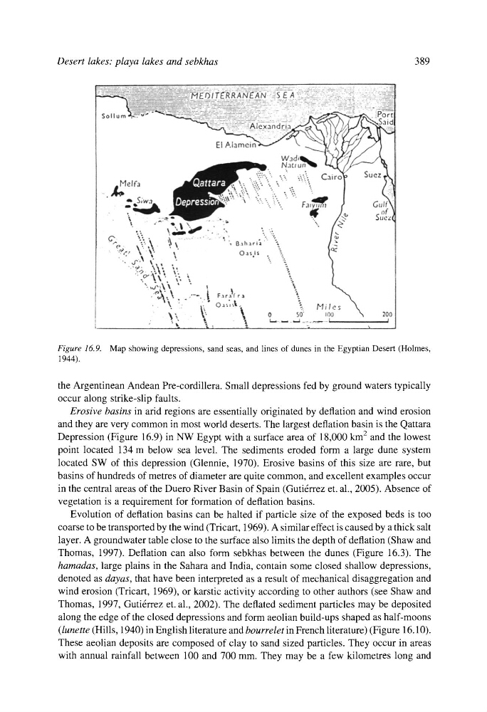
Figure 16.9. Map showing depressions, sand seas, and lines of dunes in the Egyptian Desert (Holmes,
1944).
the Argentinean Andean Pre-cordillera. Small depressions fed by ground waters typically
occur along strike-slip faults.
Erosive basins in arid regions are essentially originated by deflation and wind erosion
and they are very common in most world deserts. The largest deflation basin is the Qattara
Depression (Figure 16.9) in NW Egypt with a surface area of 18,000 klTl 2 and the lowest
point located 134 m below sea level. The sediments eroded form a large dune system
located SW of this depression (Glennie, 1970). Erosive basins of this size are rare, but
basins of hundreds of metres of diameter are quite common, and excellent examples occur
in the central areas of the Duero River Basin of Spain (Guti6rrez et. al., 2005). Absence of
vegetation is a requirement for formation of deflation basins.
Evolution of deflation basins can be halted if particle size of the exposed beds is too
coarse to be transported by the wind (Tricart, 1969). A similar effect is caused by a thick salt
layer. A groundwater table close to the surface also limits the depth of deflation (Shaw and
Thomas, 1997). Deflation can also form sebkhas between the dunes (Figure 16.3). The
hamadas, large plains in the Sahara and India, contain some closed shallow depressions,
denoted as dayas, that have been interpreted as a result of mechanical disaggregation and
wind erosion (Tricart, 1969), or karstic activity according to other authors (see Shaw and
Thomas, 1997, Guti6rrez et. al., 2002). The deflated sediment particles may be deposited
along the edge of the closed depressions and form aeolian build-ups shaped as half-moons
(lunette (Hills, 1940) in English literature and bourrelet in French literature) (Figure 16.10).
These aeolian deposits are composed of clay to sand sized particles. They occur in areas
with annual rainfall between 100 and 700 mm. They may be a few kilometres long and
389
Figure 16.9. Map showing depressions, sand seas, and lines of dunes in the Egyptian Desert (Holmes,
1944).
the Argentinean Andean Pre-cordillera. Small depressions fed by ground waters typically
occur along strike-slip faults.
Erosive basins in arid regions are essentially originated by deflation and wind erosion
and they are very common in most world deserts. The largest deflation basin is the Qattara
Depression (Figure 16.9) in NW Egypt with a surface area of 18,000 klTl 2 and the lowest
point located 134 m below sea level. The sediments eroded form a large dune system
located SW of this depression (Glennie, 1970). Erosive basins of this size are rare, but
basins of hundreds of metres of diameter are quite common, and excellent examples occur
in the central areas of the Duero River Basin of Spain (Guti6rrez et. al., 2005). Absence of
vegetation is a requirement for formation of deflation basins.
Evolution of deflation basins can be halted if particle size of the exposed beds is too
coarse to be transported by the wind (Tricart, 1969). A similar effect is caused by a thick salt
layer. A groundwater table close to the surface also limits the depth of deflation (Shaw and
Thomas, 1997). Deflation can also form sebkhas between the dunes (Figure 16.3). The
hamadas, large plains in the Sahara and India, contain some closed shallow depressions,
denoted as dayas, that have been interpreted as a result of mechanical disaggregation and
wind erosion (Tricart, 1969), or karstic activity according to other authors (see Shaw and
Thomas, 1997, Guti6rrez et. al., 2002). The deflated sediment particles may be deposited
along the edge of the closed depressions and form aeolian build-ups shaped as half-moons
(lunette (Hills, 1940) in English literature and bourrelet in French literature) (Figure 16.10).
These aeolian deposits are composed of clay to sand sized particles. They occur in areas
with annual rainfall between 100 and 700 mm. They may be a few kilometres long and