

338
Climatic Geomorphology
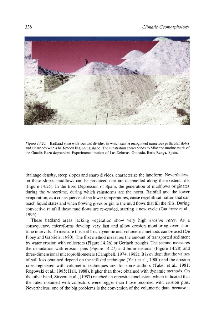
Figure 14.24. Badland zone with rounded divides, in which can be recognized numerous pellicular slides
and cicatrices with a half-moon beginning shape. The substratum corresponds to Miocene marine marls of
the Guadix-Baza depression. Experimental station of Las Dehesas, Granada, Betic Range, Spain.
drainage density, steep slopes and sharp divides, characterize the landform. Nevertheless,
on these slopes mudflows can be produced that are channelled along the existent rills
(Figure 14.25). In the Ebro Depression of Spain, the generation of mudflows originates
during the wintertime, during which rainstorms are the norm. Rainfall and the lower
evaporation, as a consequence of the lower temperatures, cause regolith saturation that can
reach liquid states and when flowing gives origin to the mud flows that fill the rills. During
convective rainfall these mud flows are re-eroded, starting a new cycle (Guti6rrez et al.,
1995).
These badland areas lacking vegetation show very high erosion rates. As a
consequence, microforms develop very fast and allow erosion monitoring over short
time intervals. To measure this soil loss, dynamic and volumetric methods can be used (De
Ploey and Gabriels, 1980). The first method measures the amount of transported sediment
by water erosion with collectors (Figure 14.26) or Gerlach troughs. The second measures
the denudation with erosion pins (Figure 14.27) and bidimensional (Figure 14.28) and
three-dimensional microprofilometers (Campbell, 1974, 1982). It is evident that the values
of soil loss obtained depend on the utilized technique (Yair et al., 1980) and the erosion
rates registered with volumetric techniques are, for some authors (Takei et al., 1981;
Rogowski et al., 1985; Hall, 1988), higher than those obtained with dynamic methods. On
the other hand, Sirvent et al., (1997) reached an opposite conclusion, which indicated that
the rates obtained with collectors were bigger than those recorded with erosion pins.
Nevertheless, one of the big problems is the conversion of the volumetric data, because it
Climatic Geomorphology
Figure 14.24. Badland zone with rounded divides, in which can be recognized numerous pellicular slides
and cicatrices with a half-moon beginning shape. The substratum corresponds to Miocene marine marls of
the Guadix-Baza depression. Experimental station of Las Dehesas, Granada, Betic Range, Spain.
drainage density, steep slopes and sharp divides, characterize the landform. Nevertheless,
on these slopes mudflows can be produced that are channelled along the existent rills
(Figure 14.25). In the Ebro Depression of Spain, the generation of mudflows originates
during the wintertime, during which rainstorms are the norm. Rainfall and the lower
evaporation, as a consequence of the lower temperatures, cause regolith saturation that can
reach liquid states and when flowing gives origin to the mud flows that fill the rills. During
convective rainfall these mud flows are re-eroded, starting a new cycle (Guti6rrez et al.,
1995).
These badland areas lacking vegetation show very high erosion rates. As a
consequence, microforms develop very fast and allow erosion monitoring over short
time intervals. To measure this soil loss, dynamic and volumetric methods can be used (De
Ploey and Gabriels, 1980). The first method measures the amount of transported sediment
by water erosion with collectors (Figure 14.26) or Gerlach troughs. The second measures
the denudation with erosion pins (Figure 14.27) and bidimensional (Figure 14.28) and
three-dimensional microprofilometers (Campbell, 1974, 1982). It is evident that the values
of soil loss obtained depend on the utilized technique (Yair et al., 1980) and the erosion
rates registered with volumetric techniques are, for some authors (Takei et al., 1981;
Rogowski et al., 1985; Hall, 1988), higher than those obtained with dynamic methods. On
the other hand, Sirvent et al., (1997) reached an opposite conclusion, which indicated that
the rates obtained with collectors were bigger than those recorded with erosion pins.
Nevertheless, one of the big problems is the conversion of the volumetric data, because it