

Some aspects on applied geomorphology in periglacial regions
213
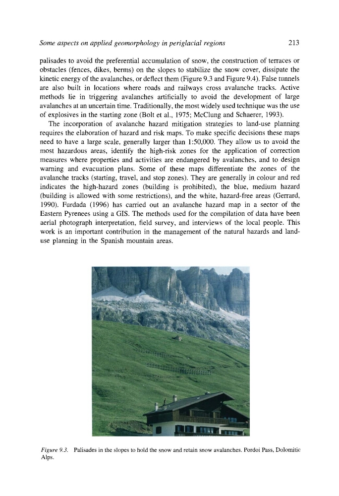
palisades to avoid the preferential accumulation of snow, the construction of terraces or
obstacles (fences, dikes, berms) on the slopes to stabilize the snow cover, dissipate the
kinetic energy of the avalanches, or deflect them (Figure 9.3 and Figure 9.4). False tunnels
are also built in locations where roads and railways cross avalanche tracks. Active
methods lie in triggering avalanches artificially to avoid the development of large
avalanches at an uncertain time. Traditionally, the most widely used technique was the use
of explosives in the starting zone (Bolt et al., 1975; McClung and Schaerer, 1993).
The incorporation of avalanche hazard mitigation strategies to land-use planning
requires the elaboration of hazard and risk maps. To make specific decisions these maps
need to have a large scale, generally larger than 1:50,000. They allow us to avoid the
most hazardous areas, identify the high-risk zones for the application of correction
measures where properties and activities are endangered by avalanches, and to design
warning and evacuation plans. Some of these maps differentiate the zones of the
avalanche tracks (starting, travel, and stop zones). They are generally in colour and red
indicates the high-hazard zones (building is prohibited), the blue, medium hazard
(building is allowed with some restrictions), and the white, hazard-free areas (Gerrard,
1990). Furdada (1996) has carried out an avalanche hazard map in a sector of the
Eastern Pyrenees using a GIS. The methods used for the compilation of data have been
aerial photograph interpretation, field survey, and interviews of the local people. This
work is an important contribution in the management of the natural hazards and landuse planning in the Spanish mountain areas.
Figure 9.3. Palisades in the slopes to hold the snow and retain snow avalanches. Pordoi Pass, Dolomitic
Alps.
213
palisades to avoid the preferential accumulation of snow, the construction of terraces or
obstacles (fences, dikes, berms) on the slopes to stabilize the snow cover, dissipate the
kinetic energy of the avalanches, or deflect them (Figure 9.3 and Figure 9.4). False tunnels
are also built in locations where roads and railways cross avalanche tracks. Active
methods lie in triggering avalanches artificially to avoid the development of large
avalanches at an uncertain time. Traditionally, the most widely used technique was the use
of explosives in the starting zone (Bolt et al., 1975; McClung and Schaerer, 1993).
The incorporation of avalanche hazard mitigation strategies to land-use planning
requires the elaboration of hazard and risk maps. To make specific decisions these maps
need to have a large scale, generally larger than 1:50,000. They allow us to avoid the
most hazardous areas, identify the high-risk zones for the application of correction
measures where properties and activities are endangered by avalanches, and to design
warning and evacuation plans. Some of these maps differentiate the zones of the
avalanche tracks (starting, travel, and stop zones). They are generally in colour and red
indicates the high-hazard zones (building is prohibited), the blue, medium hazard
(building is allowed with some restrictions), and the white, hazard-free areas (Gerrard,
1990). Furdada (1996) has carried out an avalanche hazard map in a sector of the
Eastern Pyrenees using a GIS. The methods used for the compilation of data have been
aerial photograph interpretation, field survey, and interviews of the local people. This
work is an important contribution in the management of the natural hazards and landuse planning in the Spanish mountain areas.
Figure 9.3. Palisades in the slopes to hold the snow and retain snow avalanches. Pordoi Pass, Dolomitic
Alps.