

212
Climatic Geomorphology
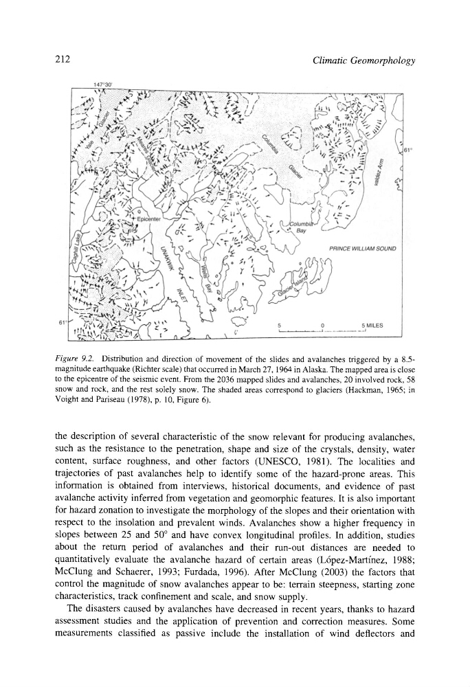
Figure 9.2. Distribution and direction of movement of the slides and avalanches triggered by a 8.5magnitude earthquake (Richter scale) that occurred in March 27, 1964 in Alaska. The mapped area is close
to the epicentre of the seismic event. From the 2036 mapped slides and avalanches, 20 involved rock, 58
snow and rock, and the rest solely snow. The shaded areas correspond to glaciers (Hackman, 1965; in
Voight and Pariseau (1978), p. 10, Figure 6).
the description of several characteristic of the snow relevant for producing avalanches,
such as the resistance to the penetration, shape and size of the crystals, density, water
content, surface roughness, and other factors (UNESCO, 1981). The localities and
trajectories of past avalanches help to identify some of the hazard-prone areas. This
information is obtained from interviews, historical documents, and evidence of past
avalanche activity inferred from vegetation and geomorphic features. It is also important
for hazard zonation to investigate the morphology of the slopes and their orientation with
respect to the insolation and prevalent winds. Avalanches show a higher frequency in
slopes between 25 and 50 ~ and have convex longitudinal profiles. In addition, studies
about the return period of avalanches and their run-out distances are needed to
quantitatively evaluate the avalanche hazard of certain areas (L6pez-Martinez, 1988;
McClung and Schaerer, 1993; Furdada, 1996). After McClung (2003) the factors that
control the magnitude of snow avalanches appear to be: terrain steepness, starting zone
characteristics, track confinement and scale, and snow supply.
The disasters caused by avalanches have decreased in recent years, thanks to hazard
assessment studies and the application of prevention and correction measures. Some
measurements classified as passive include the installation of wind deflectors and
Climatic Geomorphology
Figure 9.2. Distribution and direction of movement of the slides and avalanches triggered by a 8.5magnitude earthquake (Richter scale) that occurred in March 27, 1964 in Alaska. The mapped area is close
to the epicentre of the seismic event. From the 2036 mapped slides and avalanches, 20 involved rock, 58
snow and rock, and the rest solely snow. The shaded areas correspond to glaciers (Hackman, 1965; in
Voight and Pariseau (1978), p. 10, Figure 6).
the description of several characteristic of the snow relevant for producing avalanches,
such as the resistance to the penetration, shape and size of the crystals, density, water
content, surface roughness, and other factors (UNESCO, 1981). The localities and
trajectories of past avalanches help to identify some of the hazard-prone areas. This
information is obtained from interviews, historical documents, and evidence of past
avalanche activity inferred from vegetation and geomorphic features. It is also important
for hazard zonation to investigate the morphology of the slopes and their orientation with
respect to the insolation and prevalent winds. Avalanches show a higher frequency in
slopes between 25 and 50 ~ and have convex longitudinal profiles. In addition, studies
about the return period of avalanches and their run-out distances are needed to
quantitatively evaluate the avalanche hazard of certain areas (L6pez-Martinez, 1988;
McClung and Schaerer, 1993; Furdada, 1996). After McClung (2003) the factors that
control the magnitude of snow avalanches appear to be: terrain steepness, starting zone
characteristics, track confinement and scale, and snow supply.
The disasters caused by avalanches have decreased in recent years, thanks to hazard
assessment studies and the application of prevention and correction measures. Some
measurements classified as passive include the installation of wind deflectors and