

4.1. BIOTOPE MAPPING
The Advanced Imaging Spectrometer for Applications (AISA) sensor was flown at
an altitude of approximately 1500 m on January 7, 2001 to collect hyperspectral
imagery over the study area at 1.5 m spatial resolution in 25 10 nm wide spectral
channels (personal communication, Oliver Weatherbee). To avoid sun glint, overflights
were conducted in the early morning and late afternoon when solar illumination angle
was less than 30
o . Concurrent with the collection of upwelling spectral radiance, a
Fiber Optic Downwelling Irradiance System (FODIS) incorporated in the AISA sensor
package measured downwelling irradiance in the same spectral channels. Subsequent
to the overflights, the apparent at-platform remote sensing reflectance (R rs ) was
calculated for each spectral channel. A combined rudimentary atmospheric-water
column radiance correction of the AISA spectral R rs images was performed by use of
the “darkest pixel” method (Gordon, 1978; Gordon and Clark, 1981), using adjacent
deep water pixels within the AISA coverage region. The AISA system was calibrated
prior to the overflights with reference to NIST traceable integrating sphere (personal
communication, Oliver Weatherbee).
Ground geopositioning for the AISA pixels was provided to less than 5 m error in
the Universal Transverse Mercator (UTM) projection system by an onboard OMNI
STAR GPS receiver integrated with a C-Migits II inertial navigation system. The
AISA image underwent supervised classification based on the maximum-likelihood
decision rule (Mumby et al., 1997a, 1998), using training sites identified from over 200
field survey points collected in March 2001 and 2002. Given that our investigation
evaluated reef-zone carbon fluxes, the classification discriminated very distinct
substrate types that could be unambiguously recognized in the field during the benthic
chamber deployments. The benthic cover types that the supervised classification
discriminated were limited to sand, seagrass, and two coral reef classes (dense live
substrate and sparse live substrate). The study area was also surveyed during a twoweek time period in early August 2002 by Experimental Advanced Airborne Research
lidar (EAARL) overflights staged from Marathon, Florida (Brock et al., 2004). The
EAARL is a temporal waveform-resolving, airborne light detection and ranging (lidar)
instrument that is designed to measure the fine scale topography of shallow reef
substrates at a vertical resolution of about 15 cm at surface spots, and densities of at
least one 20 cm diameter spot per m
2 (Wright and Brock, 2002). The lidar-derived
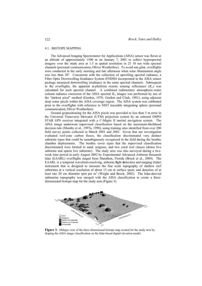
submarine topography was merged with the AISA classification to create a threedimensional biotope map for the study area (Figure 3).
Figure 3. Oblique view of the three dimensional biotope map created for the study area by
draping the AISA image classification on the lidar-based digital elevation model.
122
Brock, Yates and Halley
The Advanced Imaging Spectrometer for Applications (AISA) sensor was flown at
an altitude of approximately 1500 m on January 7, 2001 to collect hyperspectral
imagery over the study area at 1.5 m spatial resolution in 25 10 nm wide spectral
channels (personal communication, Oliver Weatherbee). To avoid sun glint, overflights
were conducted in the early morning and late afternoon when solar illumination angle
was less than 30
o . Concurrent with the collection of upwelling spectral radiance, a
Fiber Optic Downwelling Irradiance System (FODIS) incorporated in the AISA sensor
package measured downwelling irradiance in the same spectral channels. Subsequent
to the overflights, the apparent at-platform remote sensing reflectance (R rs ) was
calculated for each spectral channel. A combined rudimentary atmospheric-water
column radiance correction of the AISA spectral R rs images was performed by use of
the “darkest pixel” method (Gordon, 1978; Gordon and Clark, 1981), using adjacent
deep water pixels within the AISA coverage region. The AISA system was calibrated
prior to the overflights with reference to NIST traceable integrating sphere (personal
communication, Oliver Weatherbee).
Ground geopositioning for the AISA pixels was provided to less than 5 m error in
the Universal Transverse Mercator (UTM) projection system by an onboard OMNI
STAR GPS receiver integrated with a C-Migits II inertial navigation system. The
AISA image underwent supervised classification based on the maximum-likelihood
decision rule (Mumby et al., 1997a, 1998), using training sites identified from over 200
field survey points collected in March 2001 and 2002. Given that our investigation
evaluated reef-zone carbon fluxes, the classification discriminated very distinct
substrate types that could be unambiguously recognized in the field during the benthic
chamber deployments. The benthic cover types that the supervised classification
discriminated were limited to sand, seagrass, and two coral reef classes (dense live
substrate and sparse live substrate). The study area was also surveyed during a twoweek time period in early August 2002 by Experimental Advanced Airborne Research
lidar (EAARL) overflights staged from Marathon, Florida (Brock et al., 2004). The
EAARL is a temporal waveform-resolving, airborne light detection and ranging (lidar)
instrument that is designed to measure the fine scale topography of shallow reef
substrates at a vertical resolution of about 15 cm at surface spots, and densities of at
least one 20 cm diameter spot per m
2 (Wright and Brock, 2002). The lidar-derived
submarine topography was merged with the AISA classification to create a threedimensional biotope map for the study area (Figure 3).
Figure 3. Oblique view of the three dimensional biotope map created for the study area by
draping the AISA image classification on the lidar-based digital elevation model.
122
Brock, Yates and Halley