

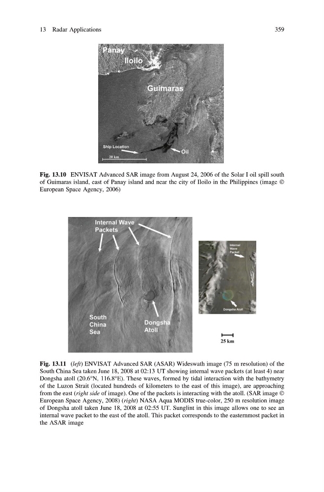
Fig. 13.10 ENVISAT Advanced SAR image from August 24, 2006 of the Solar I oil spill south
of Guimaras island, east of Panay island and near the city of Iloilo in the Philippines (image Ó
European Space Agency, 2006)
Fig. 13.11 (left) ENVISAT Advanced SAR (ASAR) Wideswath image (75 m resolution) of the
South China Sea taken June 18, 2008 at 02:13 UT showing internal wave packets (at least 4) near
Dongsha atoll (20.6°N, 116.8°E). These waves, formed by tidal interaction with the bathymetry
of the Luzon Strait (located hundreds of kilometers to the east of this image), are approaching
from the east (right side of image). One of the packets is interacting with the atoll. (SAR image Ó
European Space Agency, 2008) (right) NASA Aqua MODIS true-color, 250 m resolution image
of Dongsha atoll taken June 18, 2008 at 02:55 UT. Sunglint in this image allows one to see an
internal wave packet to the east of the atoll. This packet corresponds to the easternmost packet in
the ASAR image
13 Radar Applications
359
of Guimaras island, east of Panay island and near the city of Iloilo in the Philippines (image Ó
European Space Agency, 2006)
Fig. 13.11 (left) ENVISAT Advanced SAR (ASAR) Wideswath image (75 m resolution) of the
South China Sea taken June 18, 2008 at 02:13 UT showing internal wave packets (at least 4) near
Dongsha atoll (20.6°N, 116.8°E). These waves, formed by tidal interaction with the bathymetry
of the Luzon Strait (located hundreds of kilometers to the east of this image), are approaching
from the east (right side of image). One of the packets is interacting with the atoll. (SAR image Ó
European Space Agency, 2008) (right) NASA Aqua MODIS true-color, 250 m resolution image
of Dongsha atoll taken June 18, 2008 at 02:55 UT. Sunglint in this image allows one to see an
internal wave packet to the east of the atoll. This packet corresponds to the easternmost packet in
the ASAR image
13 Radar Applications
359