

Oil spill mapping Using SAR data to monitor oil releases in the vicinity of coral
reefs is a practical use of SAR imagery for coral reef monitoring and management.
For example, ship traffic can be monitored for intentional oil releases while
underway (i.e., bilge pumping or tank cleaning). This is a very common practice in
many parts of the world, particularly the South China Sea (Lu et al. 1999). Large
accidental spills can also be tracked to determine if booming is required to protect
reefs, wetlands, or other sensitive regions. Figure 13.10 shows oil leaking from a
ship, the Solar I, which sank in the Philippines, south of the island of Guimaras, on
August 11, 2006, carrying about 2 million liters of oil.
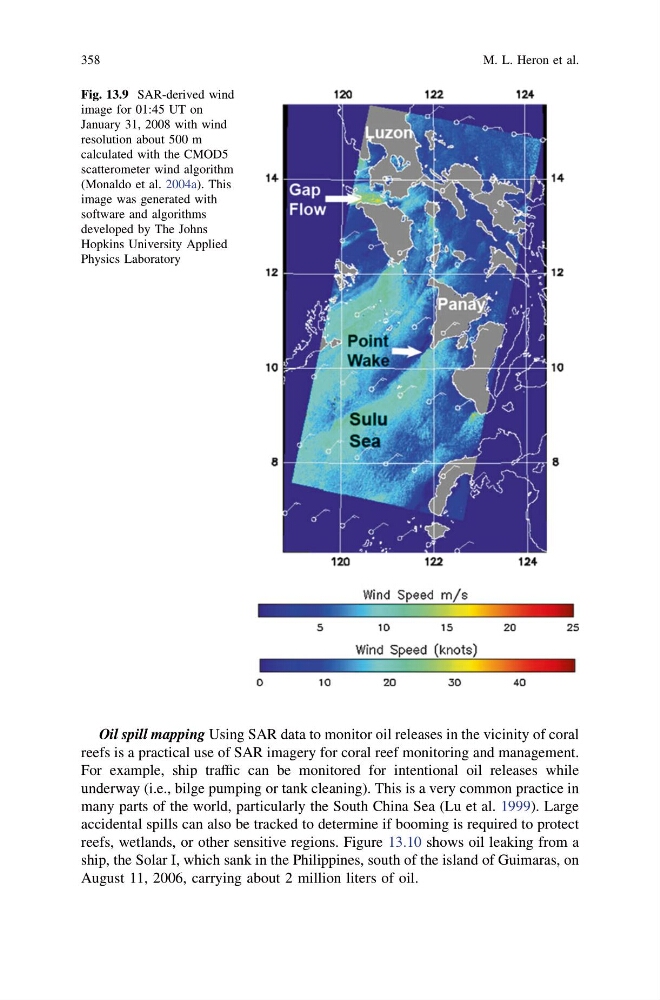
Fig. 13.9 SAR-derived wind
image for 01:45 UT on
January 31, 2008 with wind
resolution about 500 m
calculated with the CMOD5
scatterometer wind algorithm
(Monaldo et al. 2004a). This
image was generated with
software and algorithms
developed by The Johns
Hopkins University Applied
Physics Laboratory
358
M. L. Heron et al.
reefs is a practical use of SAR imagery for coral reef monitoring and management.
For example, ship traffic can be monitored for intentional oil releases while
underway (i.e., bilge pumping or tank cleaning). This is a very common practice in
many parts of the world, particularly the South China Sea (Lu et al. 1999). Large
accidental spills can also be tracked to determine if booming is required to protect
reefs, wetlands, or other sensitive regions. Figure 13.10 shows oil leaking from a
ship, the Solar I, which sank in the Philippines, south of the island of Guimaras, on
August 11, 2006, carrying about 2 million liters of oil.
Fig. 13.9 SAR-derived wind
image for 01:45 UT on
January 31, 2008 with wind
resolution about 500 m
calculated with the CMOD5
scatterometer wind algorithm
(Monaldo et al. 2004a). This
image was generated with
software and algorithms
developed by The Johns
Hopkins University Applied
Physics Laboratory
358
M. L. Heron et al.