

landcover classification. Although the analysis is based on land, the conceptual
approach can be extended to submerged ecosystems as bathymetric LiDAR and
hyperspectral data fusion becomes more prevalent. An advanced approach for
combining seafloor classifications generated from LiDAR data and hyperspectral
imagery is also presented.
7.3.1 Decision-Tree Classification
A relatively straightforward technique for integrating information derived from
LiDAR data and hyperspectral imagery is a decision-tree classifier. In the example
presented here, the height above ground, or surface height, was derived from
topographic LiDAR data, and combined with select hyperspectral bands for classification into basic landcover classes on a pixel-by-pixel basis (Reif et al. 2011).
The land-cover types and decision parameters are described in Table 7.2. The
schematic in Fig. 7.8 demonstrates the decision process from preprocessed imagery
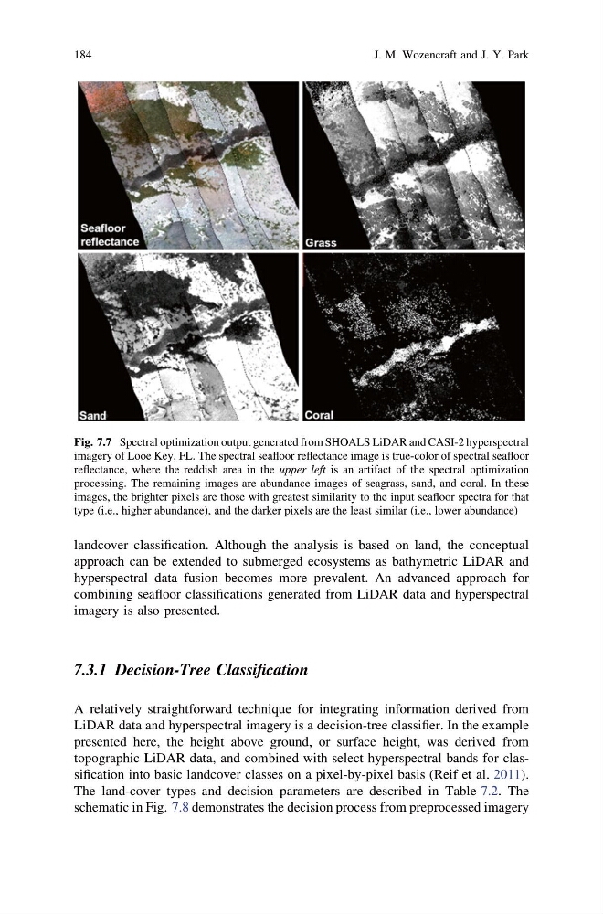
Fig. 7.7 Spectral optimization output generated from SHOALS LiDAR and CASI-2 hyperspectral
imagery of Looe Key, FL. The spectral seafloor reflectance image is true-color of spectral seafloor
reflectance, where the reddish area in the upper left is an artifact of the spectral optimization
processing. The remaining images are abundance images of seagrass, sand, and coral. In these
images, the brighter pixels are those with greatest similarity to the input seafloor spectra for that
type (i.e., higher abundance), and the darker pixels are the least similar (i.e., lower abundance)
184
J. M. Wozencraft and J. Y. Park
approach can be extended to submerged ecosystems as bathymetric LiDAR and
hyperspectral data fusion becomes more prevalent. An advanced approach for
combining seafloor classifications generated from LiDAR data and hyperspectral
imagery is also presented.
7.3.1 Decision-Tree Classification
A relatively straightforward technique for integrating information derived from
LiDAR data and hyperspectral imagery is a decision-tree classifier. In the example
presented here, the height above ground, or surface height, was derived from
topographic LiDAR data, and combined with select hyperspectral bands for classification into basic landcover classes on a pixel-by-pixel basis (Reif et al. 2011).
The land-cover types and decision parameters are described in Table 7.2. The
schematic in Fig. 7.8 demonstrates the decision process from preprocessed imagery
Fig. 7.7 Spectral optimization output generated from SHOALS LiDAR and CASI-2 hyperspectral
imagery of Looe Key, FL. The spectral seafloor reflectance image is true-color of spectral seafloor
reflectance, where the reddish area in the upper left is an artifact of the spectral optimization
processing. The remaining images are abundance images of seagrass, sand, and coral. In these
images, the brighter pixels are those with greatest similarity to the input seafloor spectra for that
type (i.e., higher abundance), and the darker pixels are the least similar (i.e., lower abundance)
184
J. M. Wozencraft and J. Y. Park