

this spectral optimization model follows similar inversion methods as described
above and in Chap. 4; however, in this coupled model, the atmospheric correction
is also performed as part of the inversion process. Using this method, the atmosphere, water column, and seafloor are decomposed into their component constituents, and incorporated into the radiative transfer equation inversion process
through a series of analytical and empirical relationships, all well-established in
the ocean optics community. The results of this approach are a series of output data
layers, including spectral water-leaving reflectance, water column attenuation, Chl
a and colored dissolved organic matter absorption, spectral seafloor reflectance,
and abundance images depicting the proportionate contributions of seafloor constituents in each pixel based on input bottom spectra (e.g., see spectral unmixing in
Chap. 4). Figure 7.7 shows examples of spectral seafloor reflectance and three
abundance images (sand, coral, and sea grass) generated from SHOALS LiDAR
data and CASI-2 hyperspectral imagery collected near Looe Key, FL.
7.3 Applications of LiDAR/Hyperspectral Fusion
The techniques introduced for integrating LiDAR data with hyperspectral imagery
have focused predominantly on improving the quality of spectral seafloor reflectance and spectral water column information. This section will demonstrate how
information extracted from the LiDAR data can be combined with spectral
information in a decision-tree classifier to improve a semi-automated pixel-level
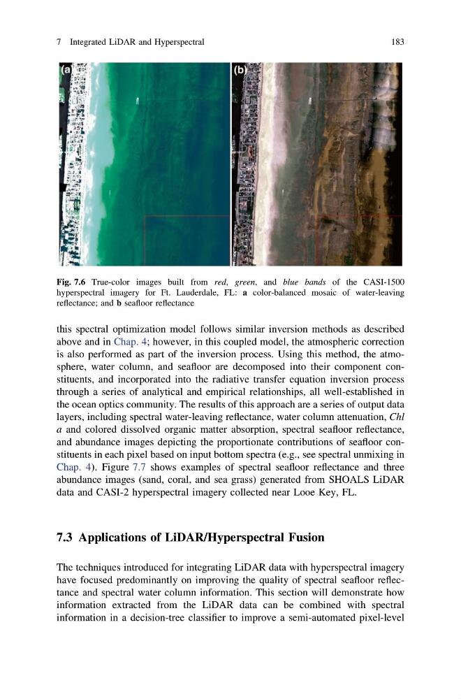
Fig. 7.6 True-color images built from red, green, and blue bands of the CASI-1500
hyperspectral imagery for Ft. Lauderdale, FL: a color-balanced mosaic of water-leaving
reflectance; and b seafloor reflectance
7 Integrated LiDAR and Hyperspectral
183
above and in Chap. 4; however, in this coupled model, the atmospheric correction
is also performed as part of the inversion process. Using this method, the atmosphere, water column, and seafloor are decomposed into their component constituents, and incorporated into the radiative transfer equation inversion process
through a series of analytical and empirical relationships, all well-established in
the ocean optics community. The results of this approach are a series of output data
layers, including spectral water-leaving reflectance, water column attenuation, Chl
a and colored dissolved organic matter absorption, spectral seafloor reflectance,
and abundance images depicting the proportionate contributions of seafloor constituents in each pixel based on input bottom spectra (e.g., see spectral unmixing in
Chap. 4). Figure 7.7 shows examples of spectral seafloor reflectance and three
abundance images (sand, coral, and sea grass) generated from SHOALS LiDAR
data and CASI-2 hyperspectral imagery collected near Looe Key, FL.
7.3 Applications of LiDAR/Hyperspectral Fusion
The techniques introduced for integrating LiDAR data with hyperspectral imagery
have focused predominantly on improving the quality of spectral seafloor reflectance and spectral water column information. This section will demonstrate how
information extracted from the LiDAR data can be combined with spectral
information in a decision-tree classifier to improve a semi-automated pixel-level
Fig. 7.6 True-color images built from red, green, and blue bands of the CASI-1500
hyperspectral imagery for Ft. Lauderdale, FL: a color-balanced mosaic of water-leaving
reflectance; and b seafloor reflectance
7 Integrated LiDAR and Hyperspectral
183