

2.2.3 Data Preparing and Model Setup
The meteorological data at Kyoto station is obtained from Japan Meteorological
Agency and the daily data from 1979 to 2008 is used as input data to the model. The
100 m DEM of KRB and 100 m mesh land use data sheet of 2006 are from the
Nation and Regional Planning Bureau of MLIT. The 1927 land use stems from the
research of Luo et al. (2014b) (Shown in Table 2.2). The soil map of the KRB (from
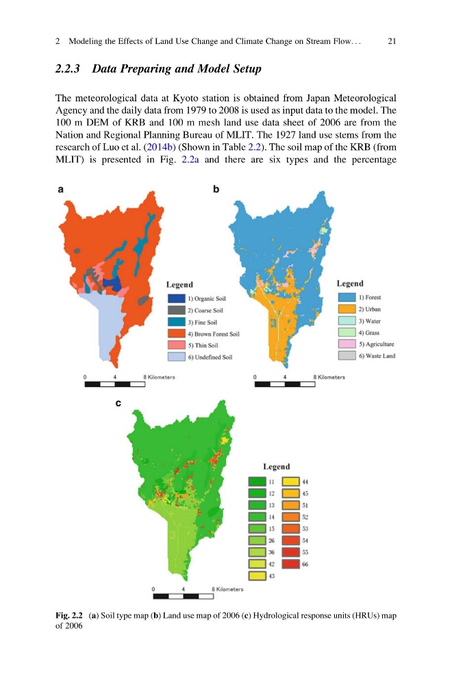
MLIT) is presented in Fig. 2.2a and there are six types and the percentage
Fig. 2.2 (a) Soil type map (b) Land use map of 2006 (c) Hydrological response units (HRUs) map
of 2006
2 Modeling the Effects of Land Use Change and Climate Change on Stream Flow. . .
21
The meteorological data at Kyoto station is obtained from Japan Meteorological
Agency and the daily data from 1979 to 2008 is used as input data to the model. The
100 m DEM of KRB and 100 m mesh land use data sheet of 2006 are from the
Nation and Regional Planning Bureau of MLIT. The 1927 land use stems from the
research of Luo et al. (2014b) (Shown in Table 2.2). The soil map of the KRB (from
MLIT) is presented in Fig. 2.2a and there are six types and the percentage
Fig. 2.2 (a) Soil type map (b) Land use map of 2006 (c) Hydrological response units (HRUs) map
of 2006
2 Modeling the Effects of Land Use Change and Climate Change on Stream Flow. . .
21