

13.3.4 Accuracy Assessment
The accuracy assessment was conducted by using visual comparison and the error
matrix approach. The visual comparison is qualitative by nature, while the error
matrix approach is a quantitative method that compares the classification map with
the ground reference information (Congalton 1991). A total of 498 reference
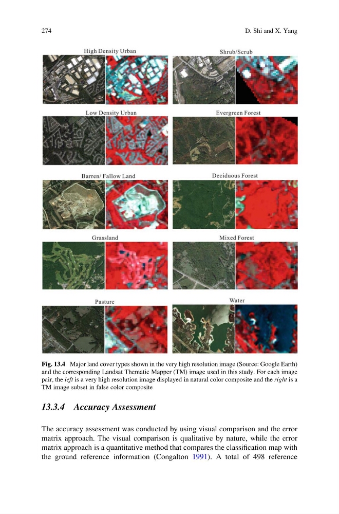
Fig. 13.4 Major land cover types shown in the very high resolution image (Source: Google Earth)
and the corresponding Landsat Thematic Mapper (TM) image used in this study. For each image
pair, the left is a very high resolution image displayed in natural color composite and the right is a
TM image subset in false color composite
274
D. Shi and X. Yang
The accuracy assessment was conducted by using visual comparison and the error
matrix approach. The visual comparison is qualitative by nature, while the error
matrix approach is a quantitative method that compares the classification map with
the ground reference information (Congalton 1991). A total of 498 reference
Fig. 13.4 Major land cover types shown in the very high resolution image (Source: Google Earth)
and the corresponding Landsat Thematic Mapper (TM) image used in this study. For each image
pair, the left is a very high resolution image displayed in natural color composite and the right is a
TM image subset in false color composite
274
D. Shi and X. Yang