

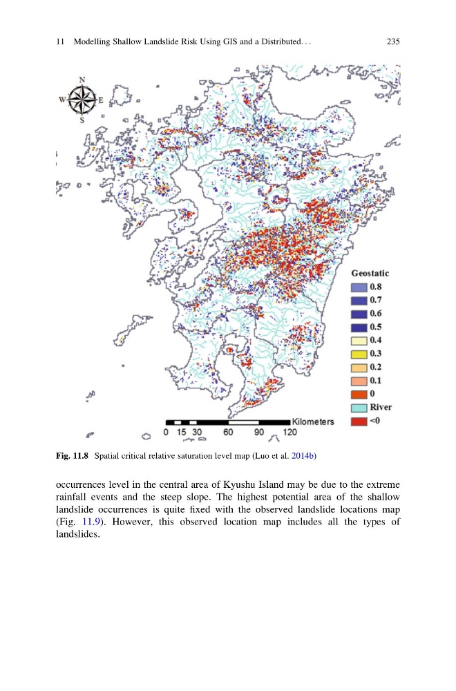
occurrences level in the central area of Kyushu Island may be due to the extreme
rainfall events and the steep slope. The highest potential area of the shallow
landslide occurrences is quite fixed with the observed landslide locations map
(Fig. 11.9). However, this observed location map includes all the types of
landslides.
Fig. 11.8 Spatial critical relative saturation level map (Luo et al. 2014b)
11 Modelling Shallow Landslide Risk Using GIS and a Distributed. . .
235
rainfall events and the steep slope. The highest potential area of the shallow
landslide occurrences is quite fixed with the observed landslide locations map
(Fig. 11.9). However, this observed location map includes all the types of
landslides.
Fig. 11.8 Spatial critical relative saturation level map (Luo et al. 2014b)
11 Modelling Shallow Landslide Risk Using GIS and a Distributed. . .
235