

using the method by Iwahashi and Pike (2007), such as slope degree (gentle, middle
and steep), convexity (convex and concave) and roughness (rough and smooth)
derived from the DEM. Figure 7.6 shows automated landform classification map
with 12 category (Koarai et al. 2010b).
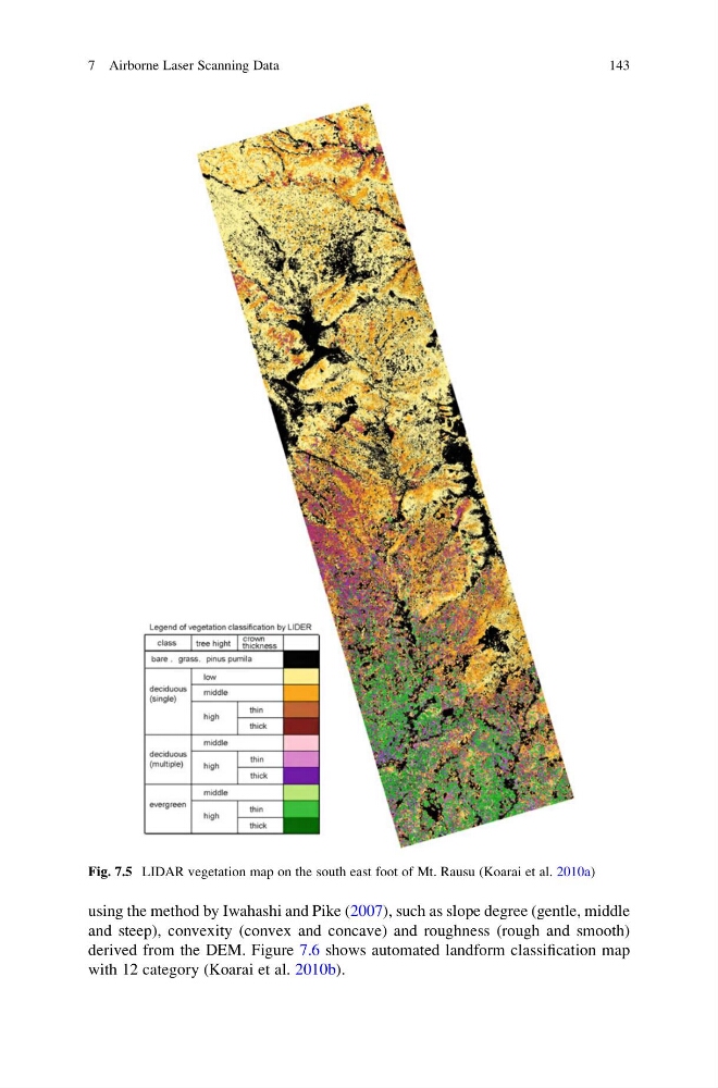
Fig. 7.5 LIDAR vegetation map on the south east foot of Mt. Rausu (Koarai et al. 2010a)
7 Airborne Laser Scanning Data
143
and steep), convexity (convex and concave) and roughness (rough and smooth)
derived from the DEM. Figure 7.6 shows automated landform classification map
with 12 category (Koarai et al. 2010b).
Fig. 7.5 LIDAR vegetation map on the south east foot of Mt. Rausu (Koarai et al. 2010a)
7 Airborne Laser Scanning Data
143