

To determine land use development in individual cities GIS tools were applied.
The latest GIS layer created from city maps and remote sensing data was used as the
first input data to determine the previous (¼ older) GIS land use layer. A copy of the
“younger” land use layer was edited using historical aerial photos to create
the “older” one. It is a method which allows to maintain topology among layers –
to avoid slivers of polygons of different years – and to make the interpretation
relatively easy and quick. This is because large areas, especially in city centres,
have not changed considerably within dozens of years. The mapping of these areas
by editing saves time. GIS tools are irreplaceable for this time series processing –
both for editing and multilayer vector data quality. Aerial photographs (20–50 pixel
size) offer a suitable scale for visual interpretation. Satellite data were applied only
in cases where no aerial photographs of a given city in a given year were available.
Orthophoto data were provided by COSMOC (colour orthophotos) and from the
military archives (black and white photographs). Satellite Landsat data of the
appropriate years were downloaded from http://glovis.usgs.gov. GIS vector data
of land use classes were a source of spatial data functional classes for indicators in
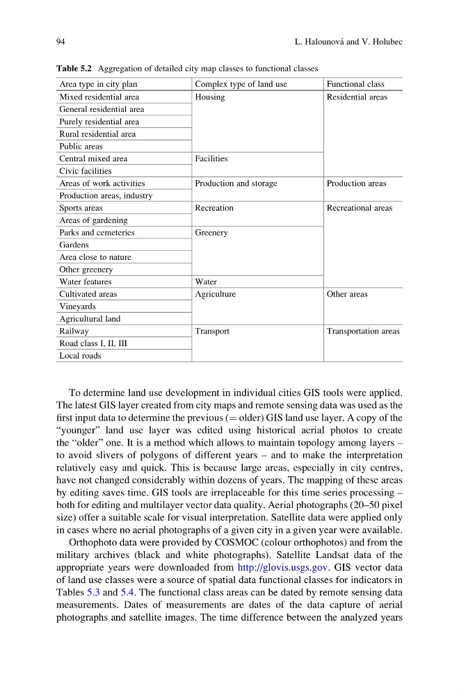
Tables 5.3 and 5.4. The functional class areas can be dated by remote sensing data
measurements. Dates of measurements are dates of the data capture of aerial
photographs and satellite images. The time difference between the analyzed years
Table 5.2 Aggregation of detailed city map classes to functional classes
Area type in city plan
Complex type of land use
Functional class
Mixed residential area
Housing
Residential areas
General residential area
Purely residential area
Rural residential area
Public areas
Central mixed area
Facilities
Civic facilities
Areas of work activities
Production and storage
Production areas
Production areas, industry
Sports areas
Recreation
Recreational areas
Areas of gardening
Parks and cemeteries
Greenery
Gardens
Area close to nature
Other greenery
Water features
Water
Cultivated areas
Agriculture
Other areas
Vineyards
Agricultural land
Railway
Transport
Transportation areas
Road class I, II, III
Local roads
94
L. Halounova ´ and V. Holubec
The latest GIS layer created from city maps and remote sensing data was used as the
first input data to determine the previous (¼ older) GIS land use layer. A copy of the
“younger” land use layer was edited using historical aerial photos to create
the “older” one. It is a method which allows to maintain topology among layers –
to avoid slivers of polygons of different years – and to make the interpretation
relatively easy and quick. This is because large areas, especially in city centres,
have not changed considerably within dozens of years. The mapping of these areas
by editing saves time. GIS tools are irreplaceable for this time series processing –
both for editing and multilayer vector data quality. Aerial photographs (20–50 pixel
size) offer a suitable scale for visual interpretation. Satellite data were applied only
in cases where no aerial photographs of a given city in a given year were available.
Orthophoto data were provided by COSMOC (colour orthophotos) and from the
military archives (black and white photographs). Satellite Landsat data of the
appropriate years were downloaded from http://glovis.usgs.gov. GIS vector data
of land use classes were a source of spatial data functional classes for indicators in
Tables 5.3 and 5.4. The functional class areas can be dated by remote sensing data
measurements. Dates of measurements are dates of the data capture of aerial
photographs and satellite images. The time difference between the analyzed years
Table 5.2 Aggregation of detailed city map classes to functional classes
Area type in city plan
Complex type of land use
Functional class
Mixed residential area
Housing
Residential areas
General residential area
Purely residential area
Rural residential area
Public areas
Central mixed area
Facilities
Civic facilities
Areas of work activities
Production and storage
Production areas
Production areas, industry
Sports areas
Recreation
Recreational areas
Areas of gardening
Parks and cemeteries
Greenery
Gardens
Area close to nature
Other greenery
Water features
Water
Cultivated areas
Agriculture
Other areas
Vineyards
Agricultural land
Railway
Transport
Transportation areas
Road class I, II, III
Local roads
94
L. Halounova ´ and V. Holubec