

59
moisture. Reference to datasets such as these is particularly important where a time
series is being constructed as scene(s) or parts of scenes might not be directly comparable in terms of vegetation change as the backscatter changes would correspond
with soil and/or surface vegetation moisture amounts.
Geometric Correction
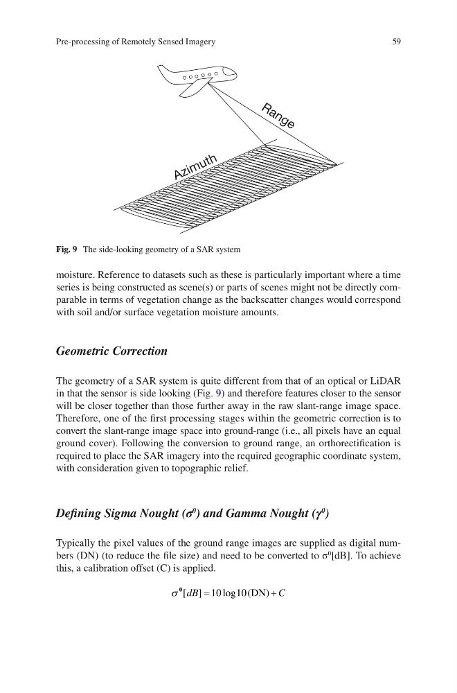
The geometry of a SAR system is quite different from that of an optical or LiDAR
in that the sensor is side looking (Fig. 9) and therefore features closer to the sensor
will be closer together than those further away in the raw slant- range image space.
Therefore, one of the first processing stages within the geometric correction is to
convert the slant-range image space into ground-range (i.e., all pixels have an equal
ground cover). Following the conversion to ground range, an orthorectification is
required to place the SAR imagery into the required geographic coordinate system,
with consideration given to topographic relief.
Defining Sigma Nought (σ
0
) and Gamma Nought (γ
0
)
Typically the pixel values of the ground range images are supplied as digital numbers (DN) (to reduce the file size) and need to be converted to σ
0
[dB]. To achieve
this, a calibration offset (C) is applied.
s
0 [ ]
log
dB
C
=
+
10
(DN)
10
Fig. 9 The side-looking geometry of a SAR system
Pre-processing of Remotely Sensed Imagery
moisture. Reference to datasets such as these is particularly important where a time
series is being constructed as scene(s) or parts of scenes might not be directly comparable in terms of vegetation change as the backscatter changes would correspond
with soil and/or surface vegetation moisture amounts.
Geometric Correction
The geometry of a SAR system is quite different from that of an optical or LiDAR
in that the sensor is side looking (Fig. 9) and therefore features closer to the sensor
will be closer together than those further away in the raw slant- range image space.
Therefore, one of the first processing stages within the geometric correction is to
convert the slant-range image space into ground-range (i.e., all pixels have an equal
ground cover). Following the conversion to ground range, an orthorectification is
required to place the SAR imagery into the required geographic coordinate system,
with consideration given to topographic relief.
Defining Sigma Nought (σ
0
) and Gamma Nought (γ
0
)
Typically the pixel values of the ground range images are supplied as digital numbers (DN) (to reduce the file size) and need to be converted to σ
0
[dB]. To achieve
this, a calibration offset (C) is applied.
s
0 [ ]
log
dB
C
=
+
10
(DN)
10
Fig. 9 The side-looking geometry of a SAR system
Pre-processing of Remotely Sensed Imagery