

302
products from EO data, with these including environmental variables but also other
ancillary spatial information such as cadastral and urban maps, process models
(e.g., hydrological) and knowledge. The EODESM system accepts 30 primary inputs
(e.g., relating to crop sequences, leaf type, cadastral information), with thematic
layers requiring specific class codes (e.g., 1 for woody, 2 for herbaceous vegetation). Continuous layers (e.g., canopy cover and hydro-period) are automatically
translated to pre-set thematic classes within the EODESM system. Once entered,
the system automatically translates each input to LCCS component codes, which
are then combined subsequently to generate a class description. Each class is then
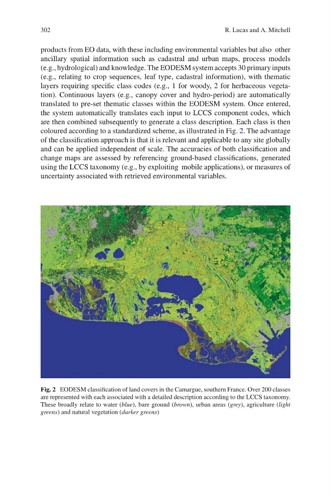
coloured according to a standardized scheme, as illustrated in Fig. 2. The advantage
of the classification approach is that it is relevant and applicable to any site globally
and can be applied independent of scale. The accuracies of both classification and
change maps are assessed by referencing ground-based classifications, generated
using the LCCS taxonomy (e.g., by exploiting mobile applications), or measures of
uncertainty associated with retrieved environmental variables.
Fig. 2 EODESM classification of land covers in the Camargue, southern France. Over 200 classes
are represented with each associated with a detailed description according to the LCCS taxonomy.
These broadly relate to water (blue), bare ground (brown), urban areas (grey), agriculture (light
greens) and natural vegetation (darker greens)
R. Lucas and A. Mitchell
products from EO data, with these including environmental variables but also other
ancillary spatial information such as cadastral and urban maps, process models
(e.g., hydrological) and knowledge. The EODESM system accepts 30 primary inputs
(e.g., relating to crop sequences, leaf type, cadastral information), with thematic
layers requiring specific class codes (e.g., 1 for woody, 2 for herbaceous vegetation). Continuous layers (e.g., canopy cover and hydro-period) are automatically
translated to pre-set thematic classes within the EODESM system. Once entered,
the system automatically translates each input to LCCS component codes, which
are then combined subsequently to generate a class description. Each class is then
coloured according to a standardized scheme, as illustrated in Fig. 2. The advantage
of the classification approach is that it is relevant and applicable to any site globally
and can be applied independent of scale. The accuracies of both classification and
change maps are assessed by referencing ground-based classifications, generated
using the LCCS taxonomy (e.g., by exploiting mobile applications), or measures of
uncertainty associated with retrieved environmental variables.
Fig. 2 EODESM classification of land covers in the Camargue, southern France. Over 200 classes
are represented with each associated with a detailed description according to the LCCS taxonomy.
These broadly relate to water (blue), bare ground (brown), urban areas (grey), agriculture (light
greens) and natural vegetation (darker greens)
R. Lucas and A. Mitchell