

283
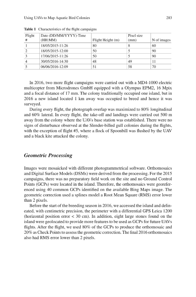
In 2016, two more flight campaigns were carried out with a MD4-1000 electric
multicopter from Microdrones GmbH equipped with a Olympus EPM2, 16 Mpix
and a focal distance of 17 mm. The colony traditionally occupied one island, but in
2016 a new island located 1 km away was occupied to breed and hence it was
surveyed.
During every flight, the photograph overlap was maximized to 80% longitudinal
and 60% lateral. In every flight, the take-off and landings were carried out 500 m
away from the colony where the UAVs base station was established. There were no
signs of disturbance observed at the Slender-billed gull colonies during the flights,
with the exception of flight #5, where a flock of Spoonbill was flushed by the UAV
and a black kite attacked the colony.
Geometric Processing
Images were mosaicked with different photogrammetrical software. Orthomosaics
and Digital Surface Models (DSMs) were derived from the processing. For the 2015
campaigns, there was no preparatory field work on the site and no Ground Control
Points (GCPs) were located in the island. Therefore, the orthomosaics were georeferenced using 40 common GCPs identified on the available Bing Maps image. The
geometric correction used a splines model a Root Mean Square (RMS) error lower
than 2 pixels.
Before the start of the breeding season in 2016, we accessed the island and delineated, with centimetric precision, the perimeter with a differential GPS Leica 1200
(horizontal position error < 30 cm). In addition, eight large stones found on the
island were geolocated to provide more features to be used as GCPs for future UAVs
flights. After the flight, we used 80% of the GCPs to produce the orthomosaic and
20% as Check Points to assess the geometric correction. The final 2016 orthomosaics
also had RMS error lower than 2 pixels.
Table 1 Characteristics of the flight campaigns
Flight
#
Date (DD/MM/YYYY)-Time
(HH:MM)
Flight Height (m)
Pixel size
(mm)
N of images
1
18/05/2015-11:26
80
8
60
2
18/05/2015-12:00
50
5
90
3
17/06/2015-11:26
50
5
90
4
30/05/2016-14:30
48
49
11
5
06/06/2016-12:09
51
58
70
Using UAVs to Map Aquatic Bird Colonies
In 2016, two more flight campaigns were carried out with a MD4-1000 electric
multicopter from Microdrones GmbH equipped with a Olympus EPM2, 16 Mpix
and a focal distance of 17 mm. The colony traditionally occupied one island, but in
2016 a new island located 1 km away was occupied to breed and hence it was
surveyed.
During every flight, the photograph overlap was maximized to 80% longitudinal
and 60% lateral. In every flight, the take-off and landings were carried out 500 m
away from the colony where the UAVs base station was established. There were no
signs of disturbance observed at the Slender-billed gull colonies during the flights,
with the exception of flight #5, where a flock of Spoonbill was flushed by the UAV
and a black kite attacked the colony.
Geometric Processing
Images were mosaicked with different photogrammetrical software. Orthomosaics
and Digital Surface Models (DSMs) were derived from the processing. For the 2015
campaigns, there was no preparatory field work on the site and no Ground Control
Points (GCPs) were located in the island. Therefore, the orthomosaics were georeferenced using 40 common GCPs identified on the available Bing Maps image. The
geometric correction used a splines model a Root Mean Square (RMS) error lower
than 2 pixels.
Before the start of the breeding season in 2016, we accessed the island and delineated, with centimetric precision, the perimeter with a differential GPS Leica 1200
(horizontal position error < 30 cm). In addition, eight large stones found on the
island were geolocated to provide more features to be used as GCPs for future UAVs
flights. After the flight, we used 80% of the GCPs to produce the orthomosaic and
20% as Check Points to assess the geometric correction. The final 2016 orthomosaics
also had RMS error lower than 2 pixels.
Table 1 Characteristics of the flight campaigns
Flight
#
Date (DD/MM/YYYY)-Time
(HH:MM)
Flight Height (m)
Pixel size
(mm)
N of images
1
18/05/2015-11:26
80
8
60
2
18/05/2015-12:00
50
5
90
3
17/06/2015-11:26
50
5
90
4
30/05/2016-14:30
48
49
11
5
06/06/2016-12:09
51
58
70
Using UAVs to Map Aquatic Bird Colonies