

134
before deciding on the imagery to use. On the Breckland heathland sites, grazing is
important in maintaining the condition of the sward, with patches of bare ground and
very short swards maintaining the biodiversity of these habitats. Whilst both regional
and site level maps showed large patches of bare ground, the UAV data revealed the
smaller patches which are most important for maintaining the communities.
At a site level the maps are suitable for understanding how a specific site or
species interacts in relation to its surroundings (e.g., on wetland bog complexes and
a Breckland heathland site). The features that could be identified are of value for:
• Planning scrub management
• Quantifying grazing pressure
• Understanding differences in wetness within sites
• Mapping bare ground and invasive species.
Examining the relationships between habitats at a site and within the surrounding
areas can indicate where there are risk factors to the habitat condition or conversely,
opportunities for habitat expansion (Breyer et al. 2016). This is especially informative for protected sites management (Fig. 9). In several areas of the Norfolk Broads,
protected sites (such as SSSIs) were mapped using UAVs. Measures of vegetation
productivity (NDVI) from lower resolution satellite data and the regional scale
mapping were produced rapidly and at low cost, as the regional map was complete.
Spectral measures, such as the NDVI, assisted site managers in identifying how
management of the land surrounding a protected site impacts upon its ecological
condition (e.g., through nutrient deposition from heavy use of fertiliser around the
site itself).
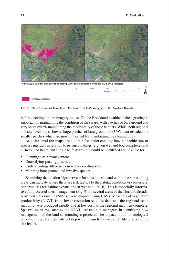
Fig. 8 Classification of Himalayan Balsam from UAV imagery in the Norfolk Broads
K. Medcalf et al.
before deciding on the imagery to use. On the Breckland heathland sites, grazing is
important in maintaining the condition of the sward, with patches of bare ground and
very short swards maintaining the biodiversity of these habitats. Whilst both regional
and site level maps showed large patches of bare ground, the UAV data revealed the
smaller patches which are most important for maintaining the communities.
At a site level the maps are suitable for understanding how a specific site or
species interacts in relation to its surroundings (e.g., on wetland bog complexes and
a Breckland heathland site). The features that could be identified are of value for:
• Planning scrub management
• Quantifying grazing pressure
• Understanding differences in wetness within sites
• Mapping bare ground and invasive species.
Examining the relationships between habitats at a site and within the surrounding
areas can indicate where there are risk factors to the habitat condition or conversely,
opportunities for habitat expansion (Breyer et al. 2016). This is especially informative for protected sites management (Fig. 9). In several areas of the Norfolk Broads,
protected sites (such as SSSIs) were mapped using UAVs. Measures of vegetation
productivity (NDVI) from lower resolution satellite data and the regional scale
mapping were produced rapidly and at low cost, as the regional map was complete.
Spectral measures, such as the NDVI, assisted site managers in identifying how
management of the land surrounding a protected site impacts upon its ecological
condition (e.g., through nutrient deposition from heavy use of fertiliser around the
site itself).
Fig. 8 Classification of Himalayan Balsam from UAV imagery in the Norfolk Broads
K. Medcalf et al.