

135
Towards a Living Map
The regional map of Norfolk produced by the project provided an overview of habitats in Norfolk at a field/part-field scale level and with knowledge that not all habitats could be identified fully, but areas of search could be delineated and a ‘parent
class’ assigned. Furthermore, there was variation in the accuracy of mapping across
the region that was quantifiable.
This knowledge allowed the NBIS to interact with the project team and arrive at
a potentially cost-effective way of improving the content of the map through ongoing targeted field work and a citizen science approach (Medcalf et al. 2015. A subsequent assessment and study (Newson et al. in press) enabled the NBIS volunteers
to validate and update the map and take forward the concept of a ‘living map’ in a
Defra funded project led by British Trust for Ornithology.
The project assessed the potential for volunteers to assist the process of groundtruthing or validating “Living Maps” using the maps and data produced for Norfolk.
It considered the potential sampling methodologies, the technological solutions and
the opinions of the volunteer sector, particularly with regards to their interest in
contributing to such an exercise, their capabilities and their attitudes towards technological options. A broad spectrum of group leaders spanning charities, councils,
leisure groups, recorder networks and conservation agencies were consulted by the
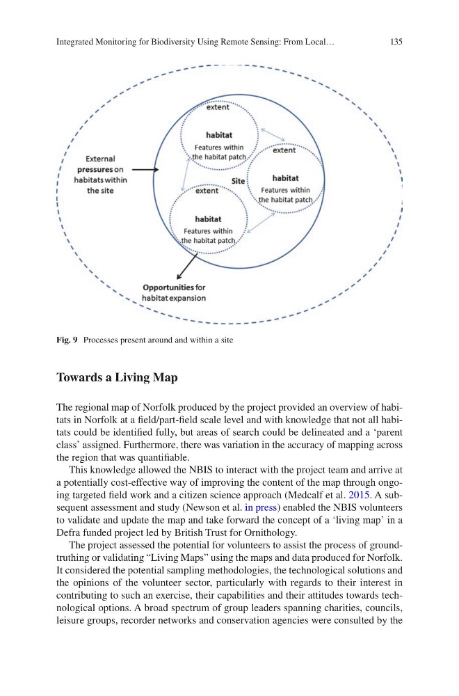
Fig. 9 Processes present around and within a site
Integrated Monitoring for Biodiversity Using Remote Sensing: From Local…
Towards a Living Map
The regional map of Norfolk produced by the project provided an overview of habitats in Norfolk at a field/part-field scale level and with knowledge that not all habitats could be identified fully, but areas of search could be delineated and a ‘parent
class’ assigned. Furthermore, there was variation in the accuracy of mapping across
the region that was quantifiable.
This knowledge allowed the NBIS to interact with the project team and arrive at
a potentially cost-effective way of improving the content of the map through ongoing targeted field work and a citizen science approach (Medcalf et al. 2015. A subsequent assessment and study (Newson et al. in press) enabled the NBIS volunteers
to validate and update the map and take forward the concept of a ‘living map’ in a
Defra funded project led by British Trust for Ornithology.
The project assessed the potential for volunteers to assist the process of groundtruthing or validating “Living Maps” using the maps and data produced for Norfolk.
It considered the potential sampling methodologies, the technological solutions and
the opinions of the volunteer sector, particularly with regards to their interest in
contributing to such an exercise, their capabilities and their attitudes towards technological options. A broad spectrum of group leaders spanning charities, councils,
leisure groups, recorder networks and conservation agencies were consulted by the
Fig. 9 Processes present around and within a site
Integrated Monitoring for Biodiversity Using Remote Sensing: From Local…