

15 Ship Surveillance with High Resolution TerraSAR-X Satellite in African Waters
303
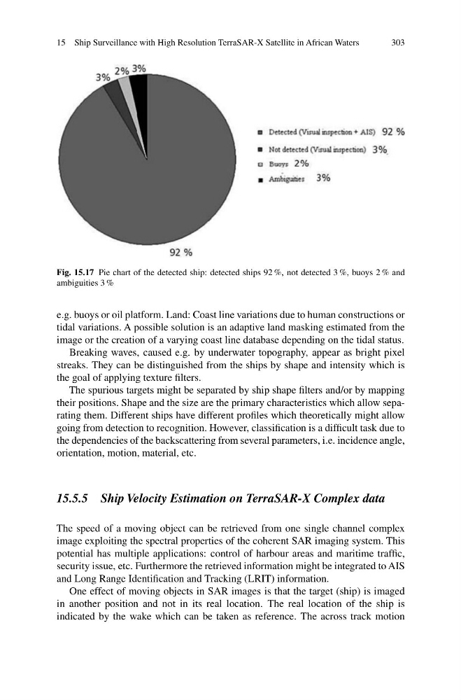
Fig. 15.17 Pie chart of the detected ship: detected ships 92 %, not detected 3 %, buoys 2 % and
ambiguities 3 %
e.g. buoys or oil platform. Land: Coast line variations due to human constructions or
tidal variations. A possible solution is an adaptive land masking estimated from the
image or the creation of a varying coast line database depending on the tidal status.
Breaking waves, caused e.g. by underwater topography, appear as bright pixel
streaks. They can be distinguished from the ships by shape and intensity which is
the goal of applying texture filters.
The spurious targets might be separated by ship shape filters and/or by mapping
their positions. Shape and the size are the primary characteristics which allow separating them. Different ships have different profiles which theoretically might allow
going from detection to recognition. However, classification is a difficult task due to
the dependencies of the backscattering from several parameters, i.e. incidence angle,
orientation, motion, material, etc.
15.5.5 Ship Velocity Estimation on TerraSAR-X Complex data
The speed of a moving object can be retrieved from one single channel complex
image exploiting the spectral properties of the coherent SAR imaging system. This
potential has multiple applications: control of harbour areas and maritime traffic,
security issue, etc. Furthermore the retrieved information might be integrated to AIS
and Long Range Identification and Tracking (LRIT) information.
One effect of moving objects in SAR images is that the target (ship) is imaged
in another position and not in its real location. The real location of the ship is
indicated by the wake which can be taken as reference. The across track motion
303
Fig. 15.17 Pie chart of the detected ship: detected ships 92 %, not detected 3 %, buoys 2 % and
ambiguities 3 %
e.g. buoys or oil platform. Land: Coast line variations due to human constructions or
tidal variations. A possible solution is an adaptive land masking estimated from the
image or the creation of a varying coast line database depending on the tidal status.
Breaking waves, caused e.g. by underwater topography, appear as bright pixel
streaks. They can be distinguished from the ships by shape and intensity which is
the goal of applying texture filters.
The spurious targets might be separated by ship shape filters and/or by mapping
their positions. Shape and the size are the primary characteristics which allow separating them. Different ships have different profiles which theoretically might allow
going from detection to recognition. However, classification is a difficult task due to
the dependencies of the backscattering from several parameters, i.e. incidence angle,
orientation, motion, material, etc.
15.5.5 Ship Velocity Estimation on TerraSAR-X Complex data
The speed of a moving object can be retrieved from one single channel complex
image exploiting the spectral properties of the coherent SAR imaging system. This
potential has multiple applications: control of harbour areas and maritime traffic,
security issue, etc. Furthermore the retrieved information might be integrated to AIS
and Long Range Identification and Tracking (LRIT) information.
One effect of moving objects in SAR images is that the target (ship) is imaged
in another position and not in its real location. The real location of the ship is
indicated by the wake which can be taken as reference. The across track motion