

15 Ship Surveillance with High Resolution TerraSAR-X Satellite in African Waters
287
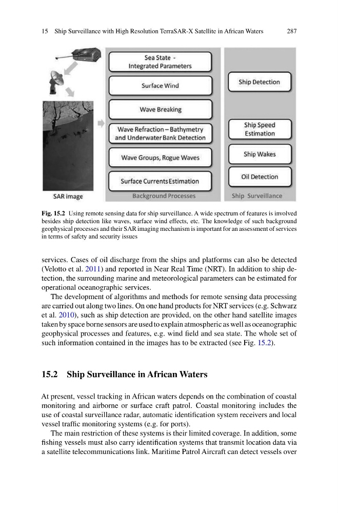
Fig. 15.2 Using remote sensing data for ship surveillance. A wide spectrum of features is involved
besides ship detection like waves, surface wind effects, etc. The knowledge of such background
geophysical processes and their SAR imaging mechanism is important for an assessment of services
in terms of safety and security issues
services. Cases of oil discharge from the ships and platforms can also be detected
(Velotto et al. 2011) and reported in Near Real Time (NRT). In addition to ship detection, the surrounding marine and meteorological parameters can be estimated for
operational oceanographic services.
The development of algorithms and methods for remote sensing data processing
are carried out along two lines. On one hand products for NRT services (e.g. Schwarz
et al. 2010), such as ship detection are provided, on the other hand satellite images
taken by space borne sensors are used to explain atmospheric as well as oceanographic
geophysical processes and features, e.g. wind field and sea state. The whole set of
such information contained in the images has to be extracted (see Fig. 15.2).
15.2 Ship Surveillance in African Waters
At present, vessel tracking in African waters depends on the combination of coastal
monitoring and airborne or surface craft patrol. Coastal monitoring includes the
use of coastal surveillance radar, automatic identification system receivers and local
vessel traffic monitoring systems (e.g. for ports).
The main restriction of these systems is their limited coverage. In addition, some
fishing vessels must also carry identification systems that transmit location data via
a satellite telecommunications link. Maritime Patrol Aircraft can detect vessels over
287
Fig. 15.2 Using remote sensing data for ship surveillance. A wide spectrum of features is involved
besides ship detection like waves, surface wind effects, etc. The knowledge of such background
geophysical processes and their SAR imaging mechanism is important for an assessment of services
in terms of safety and security issues
services. Cases of oil discharge from the ships and platforms can also be detected
(Velotto et al. 2011) and reported in Near Real Time (NRT). In addition to ship detection, the surrounding marine and meteorological parameters can be estimated for
operational oceanographic services.
The development of algorithms and methods for remote sensing data processing
are carried out along two lines. On one hand products for NRT services (e.g. Schwarz
et al. 2010), such as ship detection are provided, on the other hand satellite images
taken by space borne sensors are used to explain atmospheric as well as oceanographic
geophysical processes and features, e.g. wind field and sea state. The whole set of
such information contained in the images has to be extracted (see Fig. 15.2).
15.2 Ship Surveillance in African Waters
At present, vessel tracking in African waters depends on the combination of coastal
monitoring and airborne or surface craft patrol. Coastal monitoring includes the
use of coastal surveillance radar, automatic identification system receivers and local
vessel traffic monitoring systems (e.g. for ports).
The main restriction of these systems is their limited coverage. In addition, some
fishing vessels must also carry identification systems that transmit location data via
a satellite telecommunications link. Maritime Patrol Aircraft can detect vessels over