

part of the NLCD (mentioned in Sect. 2). This dataset is the most widely utilized in
the United States for impervious surfaces and was developed to identify “percent
developed imperviousness” [50]. The 2006 dataset was developed using regression
tree software from both leaf-on and leaf-off Landsat images and images from
National Oceanic and Atmospheric Administration’s (NOAA) Defense Meteorological Satellite Program [50]. The National Land Cover Database Impervious
Surfaces (NLCD IS) dataset is a continuous layer with a gradient of imperviousness
from 0 to 100 %, whereby the value of each 30 m
2 pixel is the percent of impervious
surfaces present within that pixel [21]. A new NLCD IS was released in April 2014
after a 2011 update and subsequent validation (for specifics on the update—see
[19]). Figure 9 shows the extent of impervious surfaces for northwest Roanoke,
Virginia (USA), in 2006 (a) and 2011 (b), and the areas of change between the two
datasets (c).
Individual researchers have developed different methods for extracting impervious surfaces from remotely sensed imagery. As previously mentioned, pixel size
varies from sensor to sensor, and within an urban environment, land use/land cover
is extremely variable and creates a fine-scale heterogeneity in spectral values due to
mixed pixels.
4 In most case studies, researchers are evaluating the extent or change
in impervious surfaces and the resultant impact on water quantity and quality.
For example, one study evaluated changes in impervious surface cover in three
sub-watersheds in Atlanta, Georgia (USA)—the Line, Flat, and Whitewater Creek
sub-watersheds—to determine if increasing urbanization was impacting the freshwater mussel population [51]. Investigators used three Landsat images (1979, 1987,
and 1997) to calculate changes in impervious surfaces. They also conducted four
mussel inventories in the 1990s and used pre-1992 historical records to determine if
any change occurred in mussel populations over time. They then used changes in
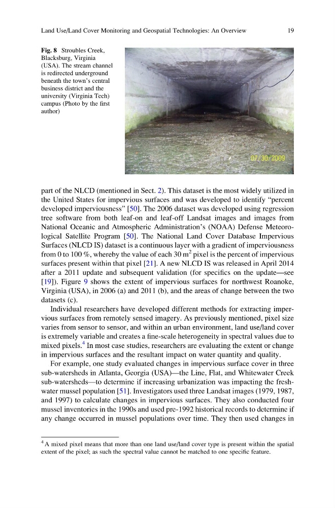
Fig. 8 Stroubles Creek,
Blacksburg, Virginia
(USA). The stream channel
is redirected underground
beneath the town’s central
business district and the
university (Virginia Tech)
campus (Photo by the first
author)
4 A mixed pixel means that more than one land use/land cover type is present within the spatial
extent of the pixel; as such the spectral value cannot be matched to one specific feature.
Land Use/Land Cover Monitoring and Geospatial Technologies: An Overview
19
the United States for impervious surfaces and was developed to identify “percent
developed imperviousness” [50]. The 2006 dataset was developed using regression
tree software from both leaf-on and leaf-off Landsat images and images from
National Oceanic and Atmospheric Administration’s (NOAA) Defense Meteorological Satellite Program [50]. The National Land Cover Database Impervious
Surfaces (NLCD IS) dataset is a continuous layer with a gradient of imperviousness
from 0 to 100 %, whereby the value of each 30 m
2 pixel is the percent of impervious
surfaces present within that pixel [21]. A new NLCD IS was released in April 2014
after a 2011 update and subsequent validation (for specifics on the update—see
[19]). Figure 9 shows the extent of impervious surfaces for northwest Roanoke,
Virginia (USA), in 2006 (a) and 2011 (b), and the areas of change between the two
datasets (c).
Individual researchers have developed different methods for extracting impervious surfaces from remotely sensed imagery. As previously mentioned, pixel size
varies from sensor to sensor, and within an urban environment, land use/land cover
is extremely variable and creates a fine-scale heterogeneity in spectral values due to
mixed pixels.
4 In most case studies, researchers are evaluating the extent or change
in impervious surfaces and the resultant impact on water quantity and quality.
For example, one study evaluated changes in impervious surface cover in three
sub-watersheds in Atlanta, Georgia (USA)—the Line, Flat, and Whitewater Creek
sub-watersheds—to determine if increasing urbanization was impacting the freshwater mussel population [51]. Investigators used three Landsat images (1979, 1987,
and 1997) to calculate changes in impervious surfaces. They also conducted four
mussel inventories in the 1990s and used pre-1992 historical records to determine if
any change occurred in mussel populations over time. They then used changes in
Fig. 8 Stroubles Creek,
Blacksburg, Virginia
(USA). The stream channel
is redirected underground
beneath the town’s central
business district and the
university (Virginia Tech)
campus (Photo by the first
author)
4 A mixed pixel means that more than one land use/land cover type is present within the spatial
extent of the pixel; as such the spectral value cannot be matched to one specific feature.
Land Use/Land Cover Monitoring and Geospatial Technologies: An Overview
19