

impervious surfaces as an ecological indicator to assess the impacts on water
quality and mussel populations. Their study of fourteen different sites determined
that the sub-watershed with the highest rate of change in impervious surfaces also
had the highest decline in mussel species diversity.
For the second example, researchers using Landsat 5 TM images from 1987,
1999, 2000, and 2007 analyzed impervious surface changes as an environmental
health indicator for Lake Kasumigaura Basin, Japan (Lake Kasumigaura is the
second largest lake in Japan) [52]. Their results showed that, by 1987, the watershed
had already been impacted by land use change (all sub-basins had at least 10 %
impervious surfaces). They also found that, by 2007, nine of the 22 sub-basins had
greater than 25 % imperviousness and qualified as a degraded watershed. They
concluded that if the trend continues, by 2017 more than 50 % of the Lake
Kasumigaura Basin will fall into the degraded category.
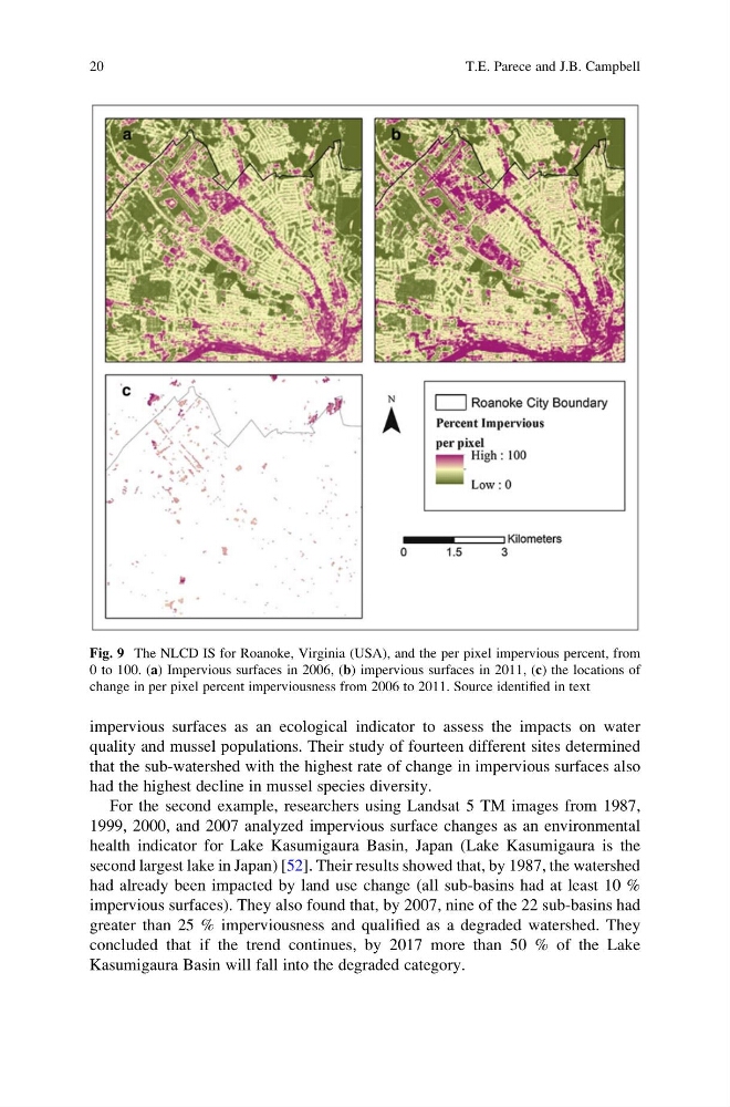
Fig. 9 The NLCD IS for Roanoke, Virginia (USA), and the per pixel impervious percent, from
0 to 100. (a) Impervious surfaces in 2006, (b) impervious surfaces in 2011, (c) the locations of
change in per pixel percent imperviousness from 2006 to 2011. Source identified in text
20
T.E. Parece and J.B. Campbell
quality and mussel populations. Their study of fourteen different sites determined
that the sub-watershed with the highest rate of change in impervious surfaces also
had the highest decline in mussel species diversity.
For the second example, researchers using Landsat 5 TM images from 1987,
1999, 2000, and 2007 analyzed impervious surface changes as an environmental
health indicator for Lake Kasumigaura Basin, Japan (Lake Kasumigaura is the
second largest lake in Japan) [52]. Their results showed that, by 1987, the watershed
had already been impacted by land use change (all sub-basins had at least 10 %
impervious surfaces). They also found that, by 2007, nine of the 22 sub-basins had
greater than 25 % imperviousness and qualified as a degraded watershed. They
concluded that if the trend continues, by 2017 more than 50 % of the Lake
Kasumigaura Basin will fall into the degraded category.
Fig. 9 The NLCD IS for Roanoke, Virginia (USA), and the per pixel impervious percent, from
0 to 100. (a) Impervious surfaces in 2006, (b) impervious surfaces in 2011, (c) the locations of
change in per pixel percent imperviousness from 2006 to 2011. Source identified in text
20
T.E. Parece and J.B. Campbell