

537
24.3.3 Threats
Parts of the wetlands are protected by fi ve forest
reserves and a wildlife sanctuary. But still, the
environment is degrading due to reduced water
accumulation and increasing population. Thus,
there is growing competition between man and
wildlife. In the process, the farmers use poison
to kill the crop-destroying Quelea quelea . In
this exercise, non-target species are also killed.
Marginal land is now coming under cultivation,
and tree cover in the forest reserves is being
depleted.
24.3.4 Economy
The area supports about 1.5 million farmers,
herders and fi shermen. Wet-season rice farming
is done in the wetlands. Also, fl ood-recession
agriculture and dry-season farming are done
using irrigation. Crops include peppers and
wheat. The wetlands support fi shermen, who
often also farm, and provide fuel wood and leaves
used for making mats and ropes. The lands are
also grazed by Fulani cattle.
24.3.5 Issues
The wetlands have suffered from increasingly
severe droughts in recent years. Also, dams have
threatened the viability of the wetlands.
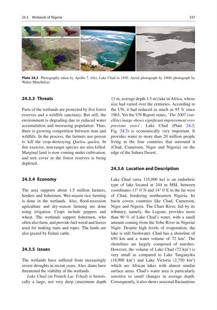
Lake Chad (in French Lac Tchad ) is historically a large, not very deep (maximum depth
11 m, average depth 1.5 m) lake in Africa, whose
size had varied over the centuries. According to
the UN, it had reduced as much as 95 % since
1963. Yet the UN Report states, ‘ The 2007 (satellite) image shows signifi cant improvement over
previous years ’. Lake Chad (Plate 24.3 ,
Fig. 24.2 ) is economically very important. It
provides water to more than 20 million people
living in the four countries that surround it
(Chad, Cameroon, Niger and Nigeria) on the
edge of the Sahara Desert.
24.3.6 Location and Description
Lake Chad (area 135,000 ha) is an endorheic
type of lake located at 244 m MSL between
coordinates 13° 0′ N and 14° 0′ E in the far west
of Chad, bordering northeastern Nigeria. Its
basin covers countries like Chad, Cameroon,
Niger and Nigeria. The Chari River, fed by its
tributary, namely , the Logone, provides more
than 90 % of Lake Chad’s water, with a small
amount coming from the Yobe River in Nigeria/
Niger. Despite high levels of evaporation, the
lake is still freshwater. Chad has a shoreline of
650 km and a water volume of 72 km
3 . The
shorelines are largely composed of marshes.
However, the volume of Lake Chad (72 km
3 ) is
very small as compared to Lake Tanganyika
(18,900 km
3 ) and Lake Victoria (2,750 km
3 )
which are African lakes with almost similar
surface areas. Chad’s water area is particularly
sensitive to small changes in average depth.
Consequently, it also shows seasonal fl uctuations
Plate 24.3 Photography taken by Apollo 7, (Oct, Lake Chad in 1930. Aerial photograph by 1968) photograph by
Walter Mittelhilzer
24.3 Wetlands of Nigeria