

484
part of a 1991 Ordinance of the Swiss Federal
Council implementing the Federal Law on the
Protection of Nature and Cultural Heritage.
22.9 Wetlands of Austria
There are quite a number of wetlands in Austria.
An account of some of the lentic bodies in Austria
is given below.
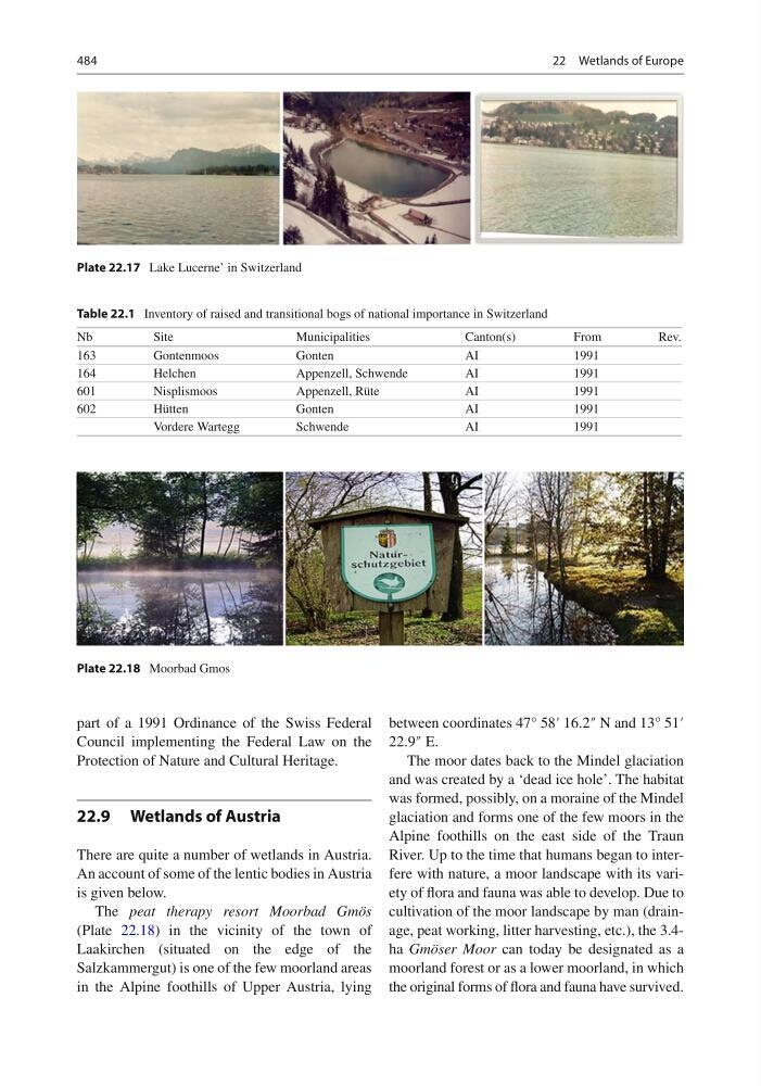
The peat therapy resort Moorbad Gmös
(Plate 22.18 ) in the vicinity of the town of
Laakirchen (situated on the edge of the
Salzkammergut) is one of the few moorland areas
in the Alpine foothills of Upper Austria, lying
between coordinates 47° 58′ 16.2″ N and 13° 51′
22.9″ E.
The moor dates back to the Mindel glaciation
and was created by a ‘dead ice hole’. The habitat
was formed, possibly, on a moraine of the Mindel
glaciation and forms one of the few moors in the
Alpine foothills on the east side of the Traun
River. Up to the time that humans began to interfere with nature, a moor landscape with its variety of fl ora and fauna was able to develop. Due to
cultivation of the moor landscape by man (drainage, peat working, litter harvesting, etc.), the 3.4ha Gmöser Moor can today be designated as a
moorland forest or as a lower moorland, in which
the original forms of fl ora and fauna have survived.
Plate 22.17 Lake Lucerne’ in Switzerland
Table 22.1 Inventory of raised and transitional bogs of national importance in Switzerland
Nb
Site
Municipalities
Canton(s)
From
Rev.
163
Gontenmoos
Gonten
AI
1991
164
Helchen
Appenzell, Schwende
AI
1991
601
Nisplismoos
Appenzell, Rüte
AI
1991
602
Hütten
Gonten
AI
1991
Vordere Wartegg
Schwende
AI
1991
Plate 22.18 Moorbad Gmos
22 Wetlands of Europe
part of a 1991 Ordinance of the Swiss Federal
Council implementing the Federal Law on the
Protection of Nature and Cultural Heritage.
22.9 Wetlands of Austria
There are quite a number of wetlands in Austria.
An account of some of the lentic bodies in Austria
is given below.
The peat therapy resort Moorbad Gmös
(Plate 22.18 ) in the vicinity of the town of
Laakirchen (situated on the edge of the
Salzkammergut) is one of the few moorland areas
in the Alpine foothills of Upper Austria, lying
between coordinates 47° 58′ 16.2″ N and 13° 51′
22.9″ E.
The moor dates back to the Mindel glaciation
and was created by a ‘dead ice hole’. The habitat
was formed, possibly, on a moraine of the Mindel
glaciation and forms one of the few moors in the
Alpine foothills on the east side of the Traun
River. Up to the time that humans began to interfere with nature, a moor landscape with its variety of fl ora and fauna was able to develop. Due to
cultivation of the moor landscape by man (drainage, peat working, litter harvesting, etc.), the 3.4ha Gmöser Moor can today be designated as a
moorland forest or as a lower moorland, in which
the original forms of fl ora and fauna have survived.
Plate 22.17 Lake Lucerne’ in Switzerland
Table 22.1 Inventory of raised and transitional bogs of national importance in Switzerland
Nb
Site
Municipalities
Canton(s)
From
Rev.
163
Gontenmoos
Gonten
AI
1991
164
Helchen
Appenzell, Schwende
AI
1991
601
Nisplismoos
Appenzell, Rüte
AI
1991
602
Hütten
Gonten
AI
1991
Vordere Wartegg
Schwende
AI
1991
Plate 22.18 Moorbad Gmos
22 Wetlands of Europe