

371
20.2.11.5 Gomati Anua
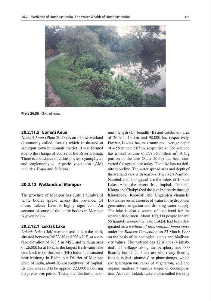
Gomati Anua (Plate 20.58 ) is an oxbow wetland
(commonly called ‘Anua’) which is situated at
Amarpur town in Gomati district. It was formed
due to the change of course of the River Gomati.
There is abundance of chlorophytes, cyanophytes
and euglenophytes. Aquatic vegetation (AM)
includes Trapa and Salvinia .
20.2.12 Wetlands of Manipur
The province of Manipur has quite a number of
lentic bodies spread across the province. Of
these, Loktak Lake is highly signifi cant. An
account of some of the lentic bodies in Manipur
is given below.
20.2.12.1 Loktak Lake
Loktak Lake (‘lok’ = stream and ‘tak’ = the end),
situated between 24°33′ N and 93° 47′ E, at a surface elevation of 768.5 m MSL and with an area
of 26,000 ha at FSL, is the largest freshwater lake
(wetland) in northeastern (NE) India. It is situated
near Moirang in Bishnupur District of Manipur
State of India, about 20 km southwest of Imphal.
Its area was said to be approx. 223,000 ha during
the prehistoric period. Today, the lake has a maximum length (L), breadth (B) and catchment area
of 26 km, 13 km and 98,000 ha, respectively.
Further, Loktak has maximum and average depth
of 4.58 m and 2.07 m, respectively. The wetland
has a total volume of 598.36 million m
3
. A big
portion of the lake (Plate 20.59 ) has been converted for agriculture today. The lake has no defi -
nite shoreline. The water spread area and depth of
the wetland vary with seasons. The rivers Nambol,
Nambul and Thongjarol are the inlets of Loktak
Lake. Also, the rivers Iril, Imphal, Thoubal,
Khuga and Chakpi feed the lake indirectly through
Khuordoak, Khordak and Ungamlen channels.
Loktak serves as a source of water for hydropower
generation, irrigation and drinking water supply.
The lake is also a source of livelihood for the
riparian fi shermen. About 100,000 people inhabit
55 hamlets around the lake. Loktak had been designated as a wetland of international importance
under the Ramsar Convention on 23 March 1990
on the basis of its ecological status and biodiversity values. The wetland has 12 islands (4 inhabited), 55 villages along the periphery and 600
fl oating hutments. There are also many fl oating
islands called ‘phumdis’ or phumshongs, which
are heterogeneous mass of vegetation, soil and
organic matters at various stages of decomposition. As such, Loktak Lake is also called the only
Plate 20.58 Gomati Anua
20.2 Wetlands of Northeast India (The Water Wealth of Northeast India)
20.2.11.5 Gomati Anua
Gomati Anua (Plate 20.58 ) is an oxbow wetland
(commonly called ‘Anua’) which is situated at
Amarpur town in Gomati district. It was formed
due to the change of course of the River Gomati.
There is abundance of chlorophytes, cyanophytes
and euglenophytes. Aquatic vegetation (AM)
includes Trapa and Salvinia .
20.2.12 Wetlands of Manipur
The province of Manipur has quite a number of
lentic bodies spread across the province. Of
these, Loktak Lake is highly signifi cant. An
account of some of the lentic bodies in Manipur
is given below.
20.2.12.1 Loktak Lake
Loktak Lake (‘lok’ = stream and ‘tak’ = the end),
situated between 24°33′ N and 93° 47′ E, at a surface elevation of 768.5 m MSL and with an area
of 26,000 ha at FSL, is the largest freshwater lake
(wetland) in northeastern (NE) India. It is situated
near Moirang in Bishnupur District of Manipur
State of India, about 20 km southwest of Imphal.
Its area was said to be approx. 223,000 ha during
the prehistoric period. Today, the lake has a maximum length (L), breadth (B) and catchment area
of 26 km, 13 km and 98,000 ha, respectively.
Further, Loktak has maximum and average depth
of 4.58 m and 2.07 m, respectively. The wetland
has a total volume of 598.36 million m
3
. A big
portion of the lake (Plate 20.59 ) has been converted for agriculture today. The lake has no defi -
nite shoreline. The water spread area and depth of
the wetland vary with seasons. The rivers Nambol,
Nambul and Thongjarol are the inlets of Loktak
Lake. Also, the rivers Iril, Imphal, Thoubal,
Khuga and Chakpi feed the lake indirectly through
Khuordoak, Khordak and Ungamlen channels.
Loktak serves as a source of water for hydropower
generation, irrigation and drinking water supply.
The lake is also a source of livelihood for the
riparian fi shermen. About 100,000 people inhabit
55 hamlets around the lake. Loktak had been designated as a wetland of international importance
under the Ramsar Convention on 23 March 1990
on the basis of its ecological status and biodiversity values. The wetland has 12 islands (4 inhabited), 55 villages along the periphery and 600
fl oating hutments. There are also many fl oating
islands called ‘phumdis’ or phumshongs, which
are heterogeneous mass of vegetation, soil and
organic matters at various stages of decomposition. As such, Loktak Lake is also called the only
Plate 20.58 Gomati Anua
20.2 Wetlands of Northeast India (The Water Wealth of Northeast India)