

306
Fish Yield
Of the 57 species, as revealed from our studies
(Kar and Barbhuiya 2000 ), Cypriniformes was
found to constitute 32.3 % of the total fi sh population followed by Channiformes (22.8 %),
Siluriformes (14.02 %), Clupeiformes (10.52 %)
and Osteoglossiformes (0.00029 %). Family
Notopteridae showed the least abundance
(0.00064 %). Interestingly, amongst the clupeids,
occurrence of Hilsa (Tenualosa) ilisha
(0.000041 %) in Chatla is a remarkable feature.
Further, occurrence of advanced fry stages of
Hilsa (45.5–128.0 mm) in Chatla is an exceptional feature in the zoogeography and biology of
the fi sh (Kar and Dey 2002 ; Kar 2007a ). On the
other hand, yield of Gudusia chapra revealed an
alarming trend of decline in this wetland.
Furthermore, occurrence of juveniles of Indian
major carps (IMC) in Chatla indicates the possibility of this wetland serving as a breeding ground
for these large growing fi shes (Kar and Dey 2002 ).
Satkarakandi Anua
Geography
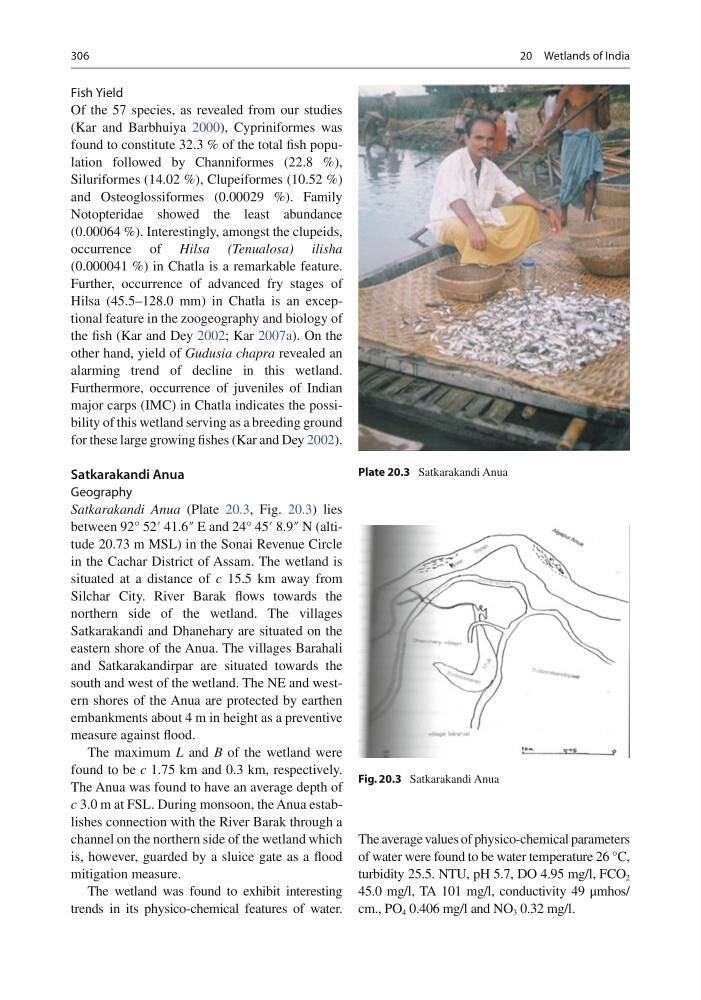
Satkarakandi Anua (Plate 20.3 , Fig. 20.3 ) lies
between 92° 52′ 41.6″ E and 24° 45′ 8.9″ N (altitude 20.73 m MSL) in the Sonai Revenue Circle
in the Cachar District of Assam. The wetland is
situated at a distance of c 15.5 km away from
Silchar City. River Barak fl ows towards the
northern side of the wetland. The villages
Satkarakandi and Dhanehary are situated on the
eastern shore of the Anua. The villages Barahali
and Satkarakandirpar are situated towards the
south and west of the wetland. The NE and western shores of the Anua are protected by earthen
embankments about 4 m in height as a preventive
measure against fl ood.
The maximum L and B of the wetland were
found to be c 1.75 km and 0.3 km, respectively.
The Anua was found to have an average depth of
c 3.0 m at FSL. During monsoon, the Anua establishes connection with the River Barak through a
channel on the northern side of the wetland which
is, however, guarded by a sluice gate as a fl ood
mitigation measure.
The wetland was found to exhibit interesting
trends in its physico-chemical features of water.
The average values of physico-chemical parameters
of water were found to be water temperature 26 °C,
turbidity 25.5. NTU, pH 5.7, DO 4.95 mg/l, FCO 2
45.0 mg/l, TA 101 mg/l, conductivity 49 μmhos/
cm., PO 4 0.406 mg/l and NO 3 0.32 mg/l.
Plate 20.3 Satkarakandi Anua
Fig. 20.3 Satkarakandi Anua
20 Wetlands of India
Fish Yield
Of the 57 species, as revealed from our studies
(Kar and Barbhuiya 2000 ), Cypriniformes was
found to constitute 32.3 % of the total fi sh population followed by Channiformes (22.8 %),
Siluriformes (14.02 %), Clupeiformes (10.52 %)
and Osteoglossiformes (0.00029 %). Family
Notopteridae showed the least abundance
(0.00064 %). Interestingly, amongst the clupeids,
occurrence of Hilsa (Tenualosa) ilisha
(0.000041 %) in Chatla is a remarkable feature.
Further, occurrence of advanced fry stages of
Hilsa (45.5–128.0 mm) in Chatla is an exceptional feature in the zoogeography and biology of
the fi sh (Kar and Dey 2002 ; Kar 2007a ). On the
other hand, yield of Gudusia chapra revealed an
alarming trend of decline in this wetland.
Furthermore, occurrence of juveniles of Indian
major carps (IMC) in Chatla indicates the possibility of this wetland serving as a breeding ground
for these large growing fi shes (Kar and Dey 2002 ).
Satkarakandi Anua
Geography
Satkarakandi Anua (Plate 20.3 , Fig. 20.3 ) lies
between 92° 52′ 41.6″ E and 24° 45′ 8.9″ N (altitude 20.73 m MSL) in the Sonai Revenue Circle
in the Cachar District of Assam. The wetland is
situated at a distance of c 15.5 km away from
Silchar City. River Barak fl ows towards the
northern side of the wetland. The villages
Satkarakandi and Dhanehary are situated on the
eastern shore of the Anua. The villages Barahali
and Satkarakandirpar are situated towards the
south and west of the wetland. The NE and western shores of the Anua are protected by earthen
embankments about 4 m in height as a preventive
measure against fl ood.
The maximum L and B of the wetland were
found to be c 1.75 km and 0.3 km, respectively.
The Anua was found to have an average depth of
c 3.0 m at FSL. During monsoon, the Anua establishes connection with the River Barak through a
channel on the northern side of the wetland which
is, however, guarded by a sluice gate as a fl ood
mitigation measure.
The wetland was found to exhibit interesting
trends in its physico-chemical features of water.
The average values of physico-chemical parameters
of water were found to be water temperature 26 °C,
turbidity 25.5. NTU, pH 5.7, DO 4.95 mg/l, FCO 2
45.0 mg/l, TA 101 mg/l, conductivity 49 μmhos/
cm., PO 4 0.406 mg/l and NO 3 0.32 mg/l.
Plate 20.3 Satkarakandi Anua
Fig. 20.3 Satkarakandi Anua
20 Wetlands of India